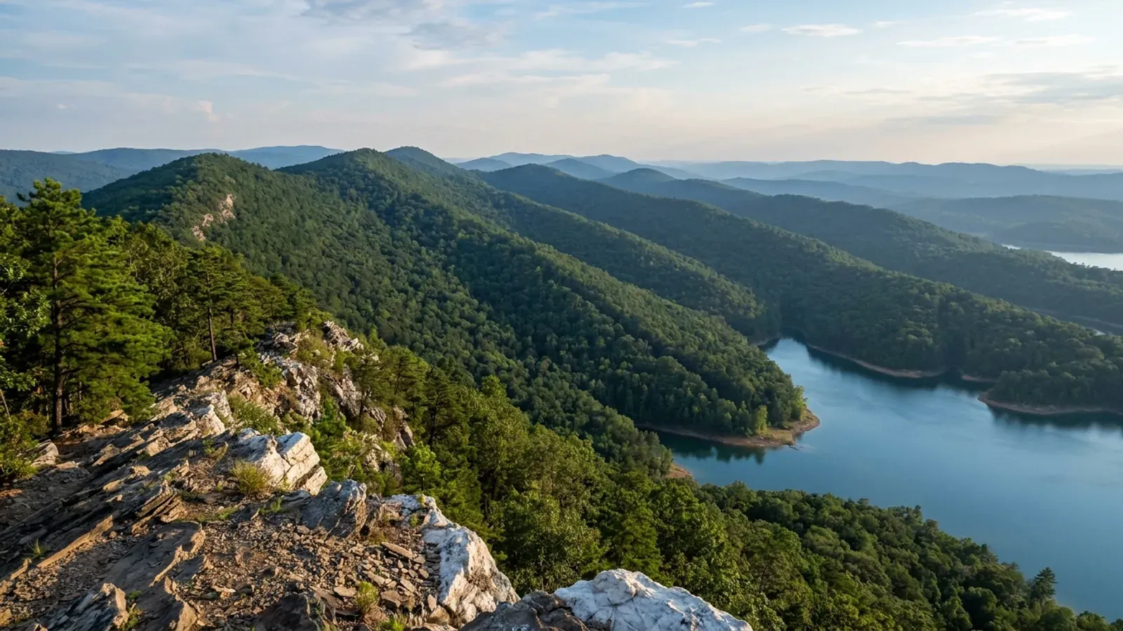
Parallel east-west Ouachita ridges in shortleaf pine and hardwood above an arm of a clear lake.
Garland County Statewide code, local enforcement optional

Barndominium Builders in Garland County, AR

Unincorporated Garland County has no planning board, no zoning and no building department, and the county says so in its own published material — including a line on its addressing page that it issues no certificate of occupancy of any kind. What it does issue is a floodplain permit, free of charge, and that permit has to be in hand before the county assigns an address and work begins. Everything difficult about building here is physical rather than procedural: Ouachita ridge slope across most of the county, rock within a spade's depth on a quarter of it, and three large lakes whose shorelines answer to a utility and to the Corps of Engineers instead of to the county.

Garland County at a glance

County
Garland County
Population
99,695
ZIP codes
71901, 71913, 71909, 71949, 71956, 71964, 71968, 72087, 71933
Site visits
Garland County sits inside our regular Ouachitas working area, so site walks on Jessieville, Royal, Pearcy, Mountain Pine and Lonsdale ground — and on the steep lots above Lake Hamilton — are ordinary scheduling rather than a special arrangement.

Building conditions in Garland County

The State's code reaches every parcel in Arkansas, including rural and unincorporated land. What is not everywhere is the office that checks it: a city or county is authorised to set up a building department, not required to, and a great deal of rural Arkansas never has. So the first question on any parcel is not what the code says — that part travels — but whether anyone here issues a permit, inspects the work, or publishes the design criteria your drawings still have to satisfy. Where nobody does, the obligation does not go away. It just moves to the appraiser, the insurer, your lender and whoever buys the place from you.

Build conditions for Garland County , Arkansas . BUILD CONDITIONS GARLAND COUNTY, ARGarland CountyONE STATEWIDE CODEADOPTED RESIDENTIAL CODEONE STATEWIDE CODEThis jurisdiction publishes no design wind speed. It is settled in writing with the authority overyour parcel before the frame is ordered.ZONING · NONE — GARLAND COUNTY HAS ADOPTED NO…The county judge's published memorandum states that Garland Countydoes not have a Planning Board or Commission, nor has the quorum…GARLAND COUNTY SWPPP STORMWATER PERMIT$75.00, $100.00 or $200.00 by distur…Garland County Code section 56-49 prices the county's stormwaterpermit at $75.00 for a site over one and under five disturbed acres…WHO ISSUES THE PERMITGarland County Department of Emergen…401 Mid-America Boulevard, Hot Springs, 501-767-3911,floodperm@garlandcounty.org. One department holds both counters a…
Build conditions for Garland County, drawn from the sourced facts on this page. Every figure above is cited in the quick-facts panel below, with its source and vintage.
The county says in writing that it issues no building permit and no certificate of occupancy
Garland County's addressing page states that the county has no planning board or commission, that the quorum court has not been elected to assume a planning board's powers, duties and functions, and that the county does not issue any type of certificate of occupancy. A memorandum on County Judge letterhead dated 28 December 2021 puts it plainly: Garland County generally does not have building codes and does not issue building permits, and it does not have a zoning program. That is both halves of Arkansas's county opt-in answered in the county's own documents.

https://www.garlandcounty.org/244/Garland-County-Addressing

The one permit every new house here does need is free
Garland County requires a floodplain permit for any new construction or significant remodeling in the county, and its published guidance states there is no charge for the permit. If the site is outside a mapped flood hazard area the Floodplain Administrator may issue an exemption certificate instead. The sequence is set out on the county's own addressing page: the floodplain department must permit a property to be developed before an address is issued and work commences. Both counters sit in the Department of Emergency Management at 401 Mid-America Boulevard.

https://www.garlandcounty.org/245/Floodplain

Entergy owns the shoreline of Lake Hamilton and Lake Catherine, not the county
Remmel Dam, completed in 1924 and creating Lake Catherine, and Carpenter Dam, completed in 1932 and creating Lake Hamilton, together form Federal Energy Regulatory Commission Project No. 271, relicensed on 30 December 2002 for fifty years. Entergy Arkansas states that it owns the dams, the shoreline and the land under the lakes — everything but the water, which is public. Where the federal project boundary runs above the natural shoreline, or where Entergy owns the land between a deeded parcel and that boundary, Entergy requires a permit for any activity in those areas before construction. Docks, seawalls, bulkheads, rip-rap, landings and fill are permitted by Entergy Shoreline, reachable at shoreline@entergy.com and 501-844-2148.

https://www.entergy.com/operations/hydro/lakes

Twelve percent is the number twice over in this county
The Arkansas onsite wastewater rule caps a capping-fill absorption area at 12 percent slope and requires a variance above it, and holds a surface-discharge area to the same line. Garland County's own Master Road Plan sets a maximum driveway grade of twelve percent between the street edge of pavement and the right-of-way line, and caps a new local street at 12 percent centreline grade — with a clause letting the county judge raise the road figure by 25 percent where steep natural topography affects access. On SSURGO survey area AR051, 57.2 percent of the county carries a representative slope of 12 percent or more. Two independent rules, one number, and most of the county on the wrong side of it.

https://library.municode.com/ar/garland_county/codes/code_of_ordinances

Also worth knowing before you build in Garland County

Chapter 14 of the county code is called Buildings and Building Regulations and contains no building permit
Its three articles are a uniform address and street-numbering ordinance administered by the Office of Emergency Management, a housing article covering Section 8 administration and a residential housing facilities board, and a nuisance article on unsanitary and unsightly conditions that exempts farmed agricultural land and any parcel over ten acres where the condition is not visible from a public road. There is no building official, no plan review, no inspection schedule and no adoption of the Arkansas Fire Prevention Code anywhere in the codified county code, whose chapters run from 1 to 74 with no zoning, planning or subdivision chapter among them.

https://library.municode.com/ar/garland_county/codes/code_of_ordinances

Two feet of freeboard, and basements prohibited in the flood hazard area
The Garland County Flood Damage Prevention Code requires the top surface of the lowest floor of a new residential structure in an AE or A1-30 risk zone to sit two feet or more above the published base flood elevation, documented on an Elevation Certificate completed by a professional engineer, surveyor or architect licensed in Arkansas. Its general standards prohibit construction of basement foundations in any Special Flood Hazard Area outright, and require flood openings on at least two separate walls totalling one square inch per square foot of enclosed area with the bottom of every opening no higher than one foot above grade. Non-residential structures must be two feet above base flood or floodproofed to three feet above it.

https://www.garlandcounty.org/DocumentCenter/View/3317

The county's published construction fee is a stormwater permit, not a building permit
Garland County Code section 56-49 sets SWPPP permit fees at $75.00 for a site over one and under five disturbed acres or one requiring special plan submittal, $100.00 for over five and under ten acres, and $200.00 above ten acres. Section 56-47 exempts land-disturbing activity under one acre only where it does not affect any lake or stream, which on a Lake Hamilton or Lake Catherine lot is exactly the situation. All commercial sites need one regardless of size, and the county's Environmental Inspections Division issues permits within seven business days of submittal under the county's general stormwater permit with the state.

https://library.municode.com/ar/garland_county/codes/code_of_ordinances

The quorum court handed lake permitting to a utility in 2003
Ordinance O-03-30, adopted 11 August 2003 and codified at Garland County Code sections 74-31 through 74-37, provides that the Sheriff's Office will no longer be responsible for the approval or permitting of future buoy placement on the lakes and that authority for approval and permitting vests with Entergy. The Sheriff still enforces and still removes unpermitted buoys. It is the county writing down what a lakefront owner discovers anyway: on and along the water, the permitting authority is a private licensee of a federal commission.

https://library.municode.com/ar/garland_county/codes/code_of_ordinances

The only Director of Planning and Inspections in unincorporated Garland County works for a private association
Chapter 27 of the county code adopts the Hot Springs Village Exterior Maintenance of Property Code under A.C.A. 14-14-814 and names the compliance officer as the Director of Planning and Inspections employed by the Hot Springs Village Property Owners' Association, with county-code penalties enforced by state-certified law enforcement officers. Its standards reach accessory structures including detached garages, fences, seawalls, docks and walls, and apply to the Garland County portions of the Village. Outside the Village gates the county employs no equivalent officer at all.

https://library.municode.com/ar/garland_county/codes/code_of_ordinances

Rock within a spade's depth across a quarter of the county
SSURGO survey area AR051 records a lithic or paralithic bedrock restriction within 50 centimetres on roughly 114,056 acres and within 102 centimetres on roughly 224,050 acres. The two largest shallow components are Bismarck, a loamy-skeletal Typic Dystrudept whose taxonomic class carries the word shallow and whose paralithic contact averages 41 centimetres, at about 78,750 acres; and Clebit, a Lithic Dystrudept with hard rock at an average of 30 centimetres, at about 34,757 acres. Carnasaw, the county's largest component at about 93,130 acres, is a clayey Hapludult over paralithic rock averaging 108 centimetres. Rock excavation, not soil bearing capacity, is the line item that moves a Garland County footing budget.

https://sdmdataaccess.sc.egov.usda.gov/

Garland's own slope numbers, which are not the Ozarks' numbers
Weighting mapped acres by component percentage across SSURGO survey area AR051, a representative slope of 12 percent or more covers about 268,693 acres — 57.2 percent of the mapped survey area, or 61.9 percent of the county's land once the 35,995 acres SSURGO maps as open water are set aside. Twenty percent or more covers about 222,226 acres, and 30 percent or more about 186,443 acres, roughly 43 percent of the land. Yanush averages 34 percent slope, Bigfork 34, Avant 30 and Pirum 25. This is folded east-west Ouachita ridge and sideslope, and it behaves nothing like the Delta or the plateau country north of the Arkansas River.

https://sdmdataaccess.sc.egov.usda.gov/

Three lakes, three different landlords
Garland County has 56.9 square miles of water — the second-largest water area of any Arkansas county after Desha, and 7.8 percent of its total area. Lake Hamilton and Lake Catherine belong to Entergy's federal hydro project. Lake Ouachita is a Corps of Engineers reservoir built between 1946 and 1954, with 40,000 acres of water, 20,000 acres of public land, over 200 islands and 975 miles of shoreline, and the Corps states that the land surrounding it is part of the Ouachita National Forest. Private lakefront in this county effectively means Hamilton or Catherine; Lake Ouachita is federal shoreline backed by federal timber and is not for sale.

https://www.mvk.usace.army.mil/Missions/Recreation/Lake-Ouachita/

One of only fourteen Arkansas counties in EPA's moderate radon zone, and one of only two outside the Ozarks
EPA's Map of Radon Zones places Garland in Zone 2, moderate potential, defined as a predicted average indoor screening level of 2 to 4 pCi/L. Arkansas has no Zone 1 county and only fourteen in Zone 2; twelve of those are Ozark carbonate country, and Garland and Montgomery are the Ouachita pair. Every neighbouring Ouachita county — Hot Spring, Saline, Perry, Polk, Pike, Clark and Yell — is Zone 3. USGS credits Arkansas's low indoor averages partly to a housing stock that is slab-on-grade or crawl space without basements, which is exactly what a pole barn house is. The map dates from 1993 and EPA states it should not be used to decide whether an individual home needs testing; test the finished house.

https://www.epa.gov/sites/default/files/2014-08/documents/arkansas.pdf

Fifty-six percent of the county's farms are under fifty acres
The 2022 Census of Agriculture counts 313 farms in Garland County on 29,001 acres — about 6.7 percent of the county's land, among the lowest shares in Arkansas — and sorts them by size: 40 under ten acres, 136 between ten and 49, 91 between 50 and 179, 38 between 180 and 499, seven between 500 and 999, and exactly one at 1,000 acres or more. Average farm size is 93 acres against a median of 39. Land in farms fell 15 percent and the number of farms fell 12 percent since 2017. This is the opposite of the Delta pattern, where median farm size runs into the hundreds of acres and nothing is purchasable at homesite scale.

https://www.nass.usda.gov/Publications/AgCensus/2022/Online_Resources/County_Profiles/Arkansas/cp05051.pdf

The addressing ordinance makes you number the lake side of the house too
Ordinance O-16-16 requires a building on a lake in Garland County to post reflective numbers and the full street name on the lake-facing side in addition to the street side — attached to the lake side of the dock if there is one, or on a seawall or in the yard near the water if there is not, at a height and with a view unobstructed enough to be read by law enforcement patrolling from the water. Numbers must be at least three inches and letters at least two. The same address application asks the owner to state whether the property will be used as a short-term or vacation rental, which is the closest thing to a land-use question the county asks.

https://www.garlandcounty.org/244/Garland-County-Addressing

The county's own 2021 guidance still describes a Hot Springs planning ring that no longer exists
The County Judge's memorandum tells readers that permits may be required by the City of Hot Springs if the property lies within the city limits or the one-mile extra-territorial jurisdiction area surrounding the city. Act 314 of 2025 repealed A.C.A. 14-56-413 outright and abolished municipal extraterritorial planning jurisdiction in Arkansas altogether, along with the provision that had let a city extend electrical permit and inspection jurisdiction into the same ring. Garland County's twenty-five ordinances of 2025 and its 2026 ordinances through O-26-08 are budgets, appropriations, tax levies, grants and interlocal agreements — the county adopted nothing to fill the gap the repeal left around Hot Springs.

https://www.garlandcounty.org/Archive.aspx?AMID=70

An excavator grading a compacted building pad on a cleared lot, with survey stakes and a drainage swale visible.
Below the slab

The expensive surprises are in the ground, not the building

What moves an Arkansas budget is usually below grade, and the state hands you a different problem depending on where you stand. In the Delta the issue is shrink-swell clay that moves with the season, and it is the reason a wide, light building with a big slab and a big door opening is the shape most at risk. Along the Fall Line there is a second, separate clay belt with nothing to do with the Delta at all. Up in the Ozarks the question inverts: what matters is not what the slab sits in but what is under it, because that limestone is full of solution cavities and the collapses arrive with no prior indication at the surface. And on Crowley's Ridge, where Jonesboro and Paragould sit, it is fine wind-blown loess that stands up in a vertical cut and then erodes out from under whatever you put on it. The same ground decides your wastewater system, which is the gate that most often moves a rural build's schedule — and it is soils that decide it, not the size of the house. So the site work, the foundation and the wastewater get resolved together rather than one at a time. We price the dirt before we price the building.

What a build looks like

Three stages every Garland County project passes through, from a raw parcel to a finished home. Site work first, because that is where the budget is decided.

Aerial view of an undeveloped rural lot with cleared grass, an oak and hickory treeline with shortleaf pines, and a pale gravel access track.
Stage one

The parcel

Zoning, setbacks, flood zone and utility access get checked before anything is drawn.

An excavator grading a compacted building pad on a cleared lot, with survey stakes and a drainage swale visible.
Stage two

Pad and permit

Clearing, grading and a compacted pad, while the submittal works through whichever office issues the permit where you are building.

A finished barndominium at dusk with warm interior lighting glowing through its large windows.
Stage three

Frame to finish

Shell erected and dried in, then systems, insulation and interior finish through to CO.

Those are the rules where you are building in Garland County. Tell us what you want to build and we will draw it to them.

Where we build around Garland County

Garland County and the rural land around it. The buildable acreage for a project this size usually sits outside the city limits, which is frequently what changes who issues your permit.

The Garland County service area, including the rural acreage outside the built-up edge, which is where the parcels big enough for a build like this usually sit. The map marks the territory we build in. It is not a branch location, and there is no office at this pin.

Nearby areas we build in

Others we cover nearby. One may be a county, another a city inside it — and since March 2025 the soft edge between them is gone, because the cities' extraterritorial jurisdiction was abolished outright and that land reverted to the counties. So the office that issues the permit, the fees it charges, the zoning and whether anyone publishes design criteria at all can differ from one card to the next, and the boundary that decides it may have moved recently.

Building in Garland County: common questions

9 questions we get asked most often about building in Garland County. If yours is not on the list, ask it directly.

Does Garland County require a building permit for a barndominium?
No. Garland County issues no residential building permit, and it says so in its own published material rather than leaving it to be inferred. The county's addressing page states that Garland County does not have a planning board or commission, that the quorum court has not assumed a planning board's powers, duties and functions, and that the county does not issue any type of certificate of occupancy. A memorandum on County Judge letterhead dated 28 December 2021 adds that the county generally does not have building codes and does not issue building permits. Arkansas builds county land-use power as a two-step opt-in: A.C.A. 14-17-203(a) lets a county judge, with quorum court approval, create a county planning board, and only after that may the quorum court adopt a zoning ordinance, which A.C.A. 14-17-209(c) says is observed through denial of the issuance of building permits. With no board there is no zoning, no county building permit and nobody to deny one. That is not the same as saying nothing applies. The Arkansas Department of Labor and Licensing states on its Contractors Licensing Board's building codes page that the Arkansas Building Code, part of the Fire Prevention Code, applies statewide, even in rural and unincorporated areas. The code follows the land; the counter does not. What is missing in Garland County is the plan review, the inspections and the certificate of occupancy — not the standard the work should be built to.
So what do I actually have to get before I can build in unincorporated Garland County?
Four things, in a specific order, and none of them is a building permit. First, a floodplain permit from the Garland County Department of Emergency Management at 401 Mid-America Boulevard. The county requires one for any new construction or significant remodeling anywhere in the county, its published guidance says there is no charge for it, and where the site is outside a mapped flood hazard area the Floodplain Administrator may issue an exemption certificate instead. Second, an address from the 911 Administrative Office in the same department — and the county's own page is explicit that the floodplain department must permit the property before the address is issued and work commences, so the two are sequential rather than parallel. Third, an onsite wastewater permit from the Arkansas Department of Health through the Garland County Health Unit at 1425 Malvern Avenue, which on a sloping Ouachita lot is the real gate on the project. Fourth, a stormwater permit from the county's Environmental Inspections Division if you will disturb more than an acre, or any amount that affects a lake or stream, at $75 to $200 depending on acreage. Add a driveway or culvert permit from the Road Department if you are connecting to a county road, and a road-cut permit at a $25 minimum per cut if you are trenching across one. If you are building on Lake Hamilton or Lake Catherine, add an Entergy shoreline permit for anything inside the federal project boundary.
What does Ouachita ground do to a barndominium foundation and budget?
It moves the money from soil engineering to rock excavation and earthwork. SSURGO survey area AR051 records a lithic or paralithic bedrock restriction within 50 centimetres on roughly 114,056 acres of the county and within 102 centimetres on roughly 224,050 acres. Bismarck, one of the two largest soils here at about 78,750 acres, is classified with the word shallow in its own taxonomic name and averages paralithic contact at 41 centimetres; Clebit, at about 34,757 acres, hits hard rock at an average of 30 centimetres. Both are loamy-skeletal, meaning more than a third of the profile by volume is rock fragment. Carnasaw, the largest component at about 93,130 acres, is the clayey exception, with a fine-textured subsoil over rock at about 108 centimetres. Slope is the other half. A representative slope of 12 percent or more covers 57.2 percent of the mapped survey area and 61.9 percent of the county's land once open water is set aside; 30 percent or more covers about 43 percent of the land. In practice that means a pad that is cut-and-fill rather than scraped, a footing that may be trenched into rock rather than dug in soil, and a real decision between a stepped monolithic slab and a pier-and-beam frame. The Arkansas Geological Survey also notes that landslides in this state often occur where excavation into hillsides has over-steepened and reduced natural slope stability, and singles out Hot Springs, where nineteenth-century crews blasted back the toes of the mountains. Cut slopes here deserve an engineer, not a rule of thumb.
Can I get a septic system approved on a steep lot here?
Often yes, but 12 percent slope is the line where it stops being routine. The Arkansas State Board of Health's Rules Pertaining to Onsite Wastewater Systems, effective 5 September 2024, use that figure repeatedly: the absorption area of a capping-fill system cannot exceed 12 percent slope and needs a variance above it, the discharge area of a surface-discharging system cannot exceed 12 percent with a variance possible at the Department's sole discretion, and the relaxed soil-depth pathway for lots under three acres applies only where slope is 12 percent or less. On slopes over 6 percent, fill must extend one foot uphill, ten feet to the sides and twenty feet downhill before grading, and a berm or drainage ditch is required upslope. Since 57.2 percent of Garland County carries a representative slope of 12 percent or more, the slope question is not exceptional here — it is the normal case. Three acres is not a minimum lot size for a conventional system, but it is the size at which the required depths to seasonal water table get shallower, and it is the hard floor for a surface-discharging system, which also needs secondary treatment, disinfection, a coverage permit from the state's water programme and setbacks of 300 feet from any adjacent dwelling. Get a licensed Designated Representative or Professional Soil Classifier onto the ground before you commit to a house position. In a county with no building department, the septic permit is very often the only construction permit anyone reviews on the merits.
I want to build on Lake Hamilton or Lake Catherine. Who do I actually deal with?
Entergy Arkansas, before and alongside the county. Remmel Dam, completed in 1924 and impounding Lake Catherine, and Carpenter Dam, completed in 1932 and impounding Lake Hamilton, form Federal Energy Regulatory Commission Project No. 271, relicensed on 30 December 2002 for a further fifty years. Entergy states that it owns the dams, the shoreline and the land under the lakes; only the water is public. Where the federal project boundary runs above the natural shoreline, or where Entergy owns the land between your deeded property and that boundary, Entergy requires a permit for any activity in those areas before construction. That covers docks, walkways, swim platforms, landings, bulkheads, seawalls, rip-rap, dredging and fill. Entergy's Shoreline Management Plan, prepared under the licence, assigns each stretch of shoreline a Shoreline Management Classification and runs proposals against an allowable-use matrix that returns allowed, case-by-case or not allowed. Applications go to Entergy Shoreline at shoreline@entergy.com or 501-844-2148, and the company notes that applications received after 30 November are not guaranteed to be issued in time to build during that year's drawdown. The county code confirms the arrangement from its own side: Ordinance O-03-30 removed buoy permitting from the Sheriff's Office and vested it in Entergy. Two more Entergy licence terms are worth knowing when you are setting a floor elevation and a dock: daily lake level fluctuation is limited to 12 inches on Lake Hamilton and 24 inches on Lake Catherine.
There is no zoning — so is there anything at all that can stop me building what I want?
Yes, and it is private rather than public. The County Judge's own memorandum makes the point directly: Garland County does not have a zoning program and does not restrict the placement of manufactured housing on any unplatted parcel, but there may be a bill of assurance or restrictive covenants in place that could affect how land is used and what may be constructed, and the county is not responsible for any restrictive covenants placed upon the land. It sends readers to the Circuit Clerk's office to search for land restrictions. That matters more in Garland County than in most of Arkansas because so much of the buildable land here is inside a recorded plat: lake subdivisions around Hamilton and Catherine, resort and retirement developments, and Hot Springs Village, a 57-square-mile covenant-governed property owners' association straddling the Garland and Saline county line. The county code even reaches into the Village — Chapter 27 adopts the Hot Springs Village Exterior Maintenance of Property Code and names the association's own Director of Planning and Inspections as the compliance officer. A metal-clad or post-frame exterior, a shop door on the street elevation, minimum square footage, roof pitch and siding material are all things a bill of assurance can and does control. Pull the deed and the recorded restrictions before you buy, not after. On unrestricted acreage outside a plat, the practical limits are the septic rule, the floodplain ordinance, the driveway grade and the slope.
Arkansas abolished city extraterritorial jurisdiction in 2025. What changed around Hot Springs?
The one-mile planning ring around the city is gone, and Garland County did not replace it. Act 314 of 2025, approved 18 March 2025, repealed A.C.A. 14-56-413 in its entirety, abolishing municipal extraterritorial planning jurisdiction in Arkansas. It also repealed A.C.A. 17-28-305(b)(3), the provision that had allowed a city to extend electrical permit and inspection jurisdiction into that same ring by agreement with the county, and repealed the subdivision provision that gave a municipal planning authority jurisdiction over unincorporated land adjoining its limits. Garland County's own 2021 guidance still tells readers that permits may be required by the City of Hot Springs if the property lies within the city limits or the one-mile extra-territorial jurisdiction area surrounding the city, and it still refers cell-site work in that ring to the Hot Springs planning department. That description of the ring is now historical. Land that used to answer to Hot Springs planning within a mile of the city limits now answers to Garland County, and Garland County has adopted no zoning and issues no building permit. The county's twenty-five ordinances of 2025 and its 2026 ordinances through O-26-08 are budget amendments, appropriations, tax levies, grant authorisations and interlocal agreements. Nothing in either year creates a planning board or picks up the vacated jurisdiction. Inside the actual Hot Springs city limits nothing changed: the city still runs its own planning department and its own permits.
Where in Garland County can I actually buy land to build on?
The honest answer starts with what is not available. Roughly 88 percent of the county is forest, only about 6.7 percent of its land is in farms, and the biggest lake in the county is federal: the Corps of Engineers holds Lake Ouachita with 20,000 acres of public land and 975 miles of shoreline, and the Corps says the land around it is Ouachita National Forest. Add 56.9 square miles of water and 5,550 gross acres of Hot Springs National Park inside the county, and a large share of the map is simply not on the market. What is left is fine-grained rather than coarse, which is the good news. The 2022 Census of Agriculture counts 313 farms in the county, of which 176 — 56 percent — are under 50 acres, and only eight are 500 acres or larger. Average farm size is 93 acres against a median of 39, so a handful of larger timber tracts pull the average up while most holdings are homesite-scale. Practically, buildable acreage is in the unincorporated belts: Jessieville and the 71949 area north toward the forest boundary, Royal and Pearcy west and southwest toward Lake Ouachita, Mountain Pine, and Lonsdale and the Fountain Lake corridor east toward Saline County. Expect to pay for scarcity rather than for soil — the county's agricultural land carries the third-highest per-acre asset value in Arkansas in the 2022 census despite almost no farming, which is lakefront and resort proximity showing up in a farm statistic.
With no inspector, how do I know a pole barn house here is built right?
By making the checks contractual and by using the credentials the state does enforce, because several of them reach rural Garland County whether or not anyone permits the build. The Arkansas Contractors Licensing Board's own rules list detached structures and metal buildings, new home construction, steel and metal fabrication and storm shelters inside the residential building contractor classification, so a steel-frame or post-frame dwelling is named work under that licence — there is no argument in Arkansas that a metal building is not a house. The residential exemption floor is $2,000 per project under A.C.A. 17-25-513(3)(A), with an anti-splitting clause; the $50,000 figure that dominates search results belongs to the commercial statute, which expressly excludes single-family residences. Separately, electricians, plumbers and HVACR mechanics are licensed by the State everywhere in Arkansas, and the plumbing statute says the state plumbing code has the force of law as minimum standards statewide, applying to all types of buildings, private or public, rural or urban. On rural land with no permit counter, those trade licences reach further than the building code does. Then build the review in yourself: an engineer-sealed frame and truss package with the wind speed, exposure and topographic factor stated for your ridge; a geotechnical or soils opinion before the pad on shallow-rock ground; third-party framing and insulation inspections written into the contract; and an Elevation Certificate if any part of the site is near mapped flood hazard, which the county's own floodplain code requires anyway.

Building in Garland County?

Start with the plan. Tell us what you want to build and we will draw it, then confirm which office issues the permit for your parcel, what it will let you put there, and what wind load it has to meet. That conversation costs nothing.