Barndominium Builders in Grant County, AR
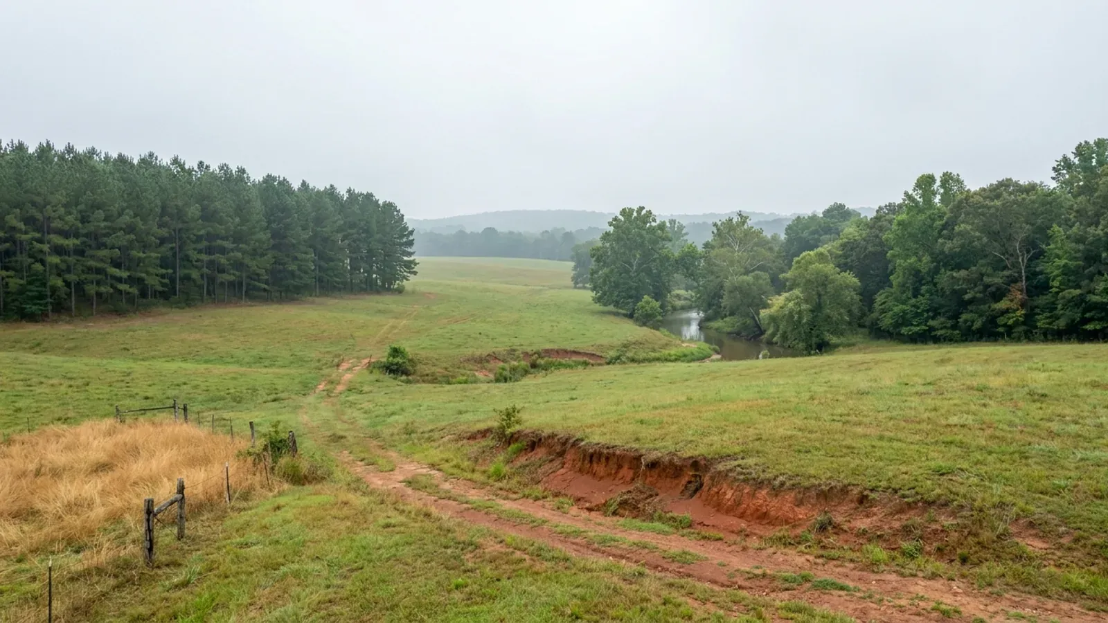
Grant County is 97 percent forest and not one acre of that forest is federal, which is why the land here is genuinely for sale in a way that Perry County's is not: 11,806 of its 18,756 residents already live outside every city limit. It sits on the West Gulf Coastal Plain rather than in the Ouachitas, so the ground is sandy and gentle and only 9.3 percent of it reaches twelve percent slope. The problem in Grant County is water. Half the county carries a seasonal water table within two feet of the surface, better than a quarter of it is mapped as frequently flooded, and since the county issues no building permit and has adopted no zoning, the drainfield and the flood map are the two things that decide where a barndominium can actually go.
Grant County at a glance
- County
- Grant County
- Population
- 18,756
- ZIP codes
- 72150, 72057, 72129, 72084, 72128
- Site visits
- Unincorporated Grant County is inside our regular central Arkansas working area, from the Poyen and Prattsville side across Sheridan to Leola, Grapevine and the Saline River bottoms, so walking a tract for drainfield ground and checking a flood panel before anyone talks about a slab is ordinary scheduling here.
Building conditions in Grant County
The State's code reaches every parcel in Arkansas, including rural and unincorporated land. What is not everywhere is the office that checks it: a city or county is authorised to set up a building department, not required to, and a great deal of rural Arkansas never has. So the first question on any parcel is not what the code says — that part travels — but whether anyone here issues a permit, inspects the work, or publishes the design criteria your drawings still have to satisfy. Where nobody does, the obligation does not go away. It just moves to the appraiser, the insurer, your lender and whoever buys the place from you.
https://www.fs.usda.gov/managing-land/lands-minerals-geology/land-area-reports
https://mcclibrary.blob.core.usgovcloudapi.net/codecontent/50044/413912/Title%20Page.pdf
Also worth knowing before you build in Grant County
- Guyton silt loam covers 43,276 acres and its water table sits at or above the surface for six months
- The NRCS Official Series Description for Guyton, a fine-silty siliceous active thermic Typic Glossaqualf, records a seasonal high water table 0 to 46 cm, that is 0 to 1.5 feet, below the surface from December through May, except where ponded, and where ponded, it is from 1 foot above the surface to 0.5 foot below the surface most of the time. Permeability is slow, drainage is poorly drained, and flooding frequency is rare, occasional, or frequent. SSURGO maps 43,276 acres of Guyton silt loam, 0 to 1 percent slopes, frequently flooded, in Grant County: it is the third largest map unit in the county and it sits along every drainageway. Guyton land is cheap, level, wooded and superficially attractive. It is also the ground on which a conventional septic system is not going to be approved and a slab will need engineered fill.
- The biggest single map unit in the county is a fragipan soil with water 12 to 18 inches down
- SSURGO's largest Grant County map unit is 49,191 acres of Stough fine sandy loam, 1 to 3 percent slopes. Stough is a coarse-loamy siliceous semiactive thermic Fragiaquic Paleudult, and the NRCS description puts depth to seasonal high water table at 30 to 46 centimetres, 1 to 1.5 feet, below the surface during the wet season late in winter and early in spring, with a fragic layer in the particle-size control section from 36 to 87 centimetres. A fragipan is what creates that perched water: it is dense, roots and water do not readily pass it, and Arkansas's onsite wastewater rule treats it as a Restrictive Soil Layer. Ten point three percent of Grant County carries a mapped fragipan. The series was established on the Lower East Saline soil conservation district in Drew County, Arkansas in 1939, which is to say this is the classic coastal-plain flatwoods soil and it behaves the same way here as it does across south Arkansas.
- The buildable ground in Grant County has three names: Warnock, Pikeville and Saffell
- The county's best homesite soils are the well and moderately well drained uplands. Warnock fine sandy loam, 1 to 7 percent slopes, covers 48,153 acres and its NRCS description puts a perched seasonal water table within 4 and 6 feet of the soil surface from December to April with moderate permeability, which is the deepest water table of any large unit in the county. Pikeville fine sandy loam, 1 to 8 percent slopes, adds 15,593 well drained acres with no water table recorded at all, and Saffell gravelly fine sandy loam another 8,531 across three slope classes. Rosalie loamy fine sand adds 8,606. Together that is about 80,000 acres, one fifth of Grant County, and it is where a standard trench drainfield and an ordinary slab both work. On a parcel walk here the soil map is worth more than the aerial photograph, because the wet ground and the dry ground look identical under pine.
- Sacul soils cover 72,091 acres and they are the reason a perc test here can fail on a hill
- Six Grant County map units are named for the Sacul series and together they cover 72,091 acres, from 1 to 8 percent slopes up to 15 to 35 percent. Sacul is a fine, mixed, active, thermic Aquic Hapludult formed in acid, loamy and clayey sediments of Tertiary Age, mainly in the Claiborne, Jackson and Wilcox formations. The NRCS description records slow permeability and a seasonally high water table that is within 2 to 4 feet of the soil surface in late winter and spring most years, even though the series is classed moderately well drained. That combination catches people out: the site drains at the surface, it looks dry in August, and it perches water in February at exactly the depth a drainfield trench sits. Sacul is also the county's steep soil, carrying the 15 to 35 percent units that make up most of Grant County's limited slope.
- Grant County's flood maps were completely redrawn on 18 July 2017
- FEMA's NFIP Community Status Book records unincorporated Grant County, community 050434, in the regular programme since 1 February 1991 with a currently effective map date of 18 July 2017. Every other community in the county carries the identical date: Sheridan, Poyen, Prattsville, Leola and Tull. Tull entered the NFIP on that same day and Leola in 2009. The county's own floodplain page says the same thing in its own words, that Federal Emergency Management Agency (FEMA) flood maps for Grant County and all Cities will be effective July 18th, 2017, and adds that if you are clearly not in a flood zone, a Determination Letter is available from the County's Floodplain Administrator. For comparison, Perry County to the north-west is still working from panels effective 20 June 2000, and two of its towns are not in the NFIP at all. In Grant County everyone is in, and everyone is on the same recent map.
- The county's flood ordinance still cites a statute numbering system Arkansas abandoned
- Grant County's flood law lives at Section 290.00 of Chapter 2. It adopts by reference a flood damage prevention regulatory code for Grant County, Arkansas, such flood damage prevention regulatory code having been delegated by the legislature of the State of Arkansas and set forth in Arkansas Statutes Sections 21-1901 through 21-1904 (Act 629 of 1969), in five articles, filed with the County Clerk. It was passed as Ordinance 1989-004 on 21 August 1989 and carries a penalty of not more than one hundred dollars for each offence, each day a separate offence. Two things follow. The citation is to the pre-1987 Arkansas Statutes numbering, superseded by the Arkansas Code Annotated, so the ordinance has not been rewritten in nearly forty years. And the enforcement teeth are a hundred dollars a day, against Perry County's two hundred and fifty. What keeps Grant County's floodplain administration current is not the ordinance; it is the 2017 map and a staffed Floodplain Administrator.
- Forty-five ordinances published since 2024 and not one of them touches building, planning or zoning
- The Grant County Circuit and County Clerk publishes the Quorum Court's ordinances as downloadable PDFs. The list runs from Ordinance 2024-01 through Ordinance 2026-07, uploaded 14 July 2026, and it is 45 documents long. They are appropriations and budget amendments, millage levies, new county funds, quorum court meeting rules, transfer station fees, an immoderate driving ordinance, a travel reimbursement policy, a pay-per-call programme for rescue first responders, and a property exchange for the Memorial Building. There is no planning board ordinance, no zoning ordinance, no subdivision ordinance and no building code among them. That is a current, dated and independently checkable answer to the question a codified code last reposted in October 2022 can only answer as of its own date.
- In Grant County you buy the culvert from the County Judge's office, and nobody inspects the driveway
- The Grant County Road Department's own page says the county has approximately 455 miles of county road, that the department has 19 employees and is supervised by Foreman Jeff Vance from 410 South Oklahoma Street in Sheridan, and then asks: Want to purchase a culvert? Please contact the Grant County Judge's Office. That is the whole of the county's driveway process. Section 1200.01 of the code, Ordinance 1998-002, does set specifications, but by its own words they apply to all roads to be brought into the Grant County road system as a county road: a fifty-foot right-of-way, 24 feet of gravel base, 20 feet of asphalt or double chip seal, drainage pipes a minimum of 24 inches and side or driveway culverts a minimum of eighteen inches, plans approved by the County Judge, and 72 hours' notice to the Road Department before each phase so it can be inspected. Perry County, by contrast, requires a free Culvert Permit and an inspection for any private driveway that meets a county road at all.
- Grant County requires a house number on the mailbox, and nothing at all before the power is connected
- Section 1200.00 of the county code, passed as Ordinance 1997-003 on 21 April 1997 with an emergency clause, requires every person who resides in Grant County to place a house number in three inch or larger letters on their dwelling or at their driveway, visible from the roadway, and the complete address in two inch letters or larger on the mailbox. Chapter 2 Section 280.00 records the 1993 election that funded the 9-1-1 system in the first place. That is the entirety of Grant County's addressing law. There is no provision requiring a 911 address before electric service is extended, and no ordinance restricting utility companies from serving an unaddressed site. Perry County has both, at Section 1200.02(8)(a) and Section 1120.00; Carroll County requires certification before electric service; Sebastian County vests the same power in its County Judge. In Grant County the utility connection is between you and the co-op.
- 62.9 percent of Grant County lives outside any city, second only to Perry in the Little Rock metro
- Sheridan, Poyen, Prattsville, Leola and Tull hold 6,950 people between them. The other 11,806 of Grant County's 18,756 residents live outside all five, on Census Bureau Vintage 2025 estimates, up from 11,444 at the 2020 base. That is 62.9 percent unincorporated, thirteenth of Arkansas's 75 counties and second among the six counties of the Little Rock-North Little Rock-Conway metro behind Perry's 75.5 percent, well ahead of Saline at 43.1, Lonoke at 37.0, Faulkner at 33.0 and Pulaski at 11.8. Grant County grew 4.4 percent between 2020 and 2025, faster than any other Little Rock metro county except Faulkner and Saline, and it did it at 29.7 people per square mile. Growth, space and no permit counter is an unusual combination, and it describes exactly two counties in this metro.
- Only 9.3 percent of Grant County is steep enough to matter, and that is the opposite of its northern neighbours
- Weighting every SSURGO component by its representative slope, 37,581 of Grant County's 405,401 mapped acres, 9.3 percent, sit at twelve percent slope or steeper, and 21,111 acres, 5.2 percent, at twenty percent or steeper. Shallow bedrock is rarer still: only the Wilcox series records a restriction at all, at 147 centimetres, and the county's shallow-bedrock share is 1.4 percent. Set that beside Perry County at 57.6 percent over twelve percent slope and 70.3 percent shallow bedrock, or Saline County directly north with 46 percent of its area in Carnasaw-Townley associations mapped at 12 to 40 percent slopes. Grant County is where the Ouachita Mountains stop and the West Gulf Coastal Plain begins. Excavation is cheap here, rock is not the enemy, and a long, wide, single-level barndominium footprint that would need benching and blasting in Perry County can usually sit on natural grade in Grant County. The saving goes into the drainfield instead.
- The county's bridge ordinance designs for a 25-year flood and cites Arkansas's earthquake statute
- Section 1200.03 of the Grant County Code sets minimum standards for the upgrading of existing bridges and the construction and erection of replacement and new bridges on county roads. The hydraulic design for bridges shall provide for the twenty-five (25) year flood frequency, with freeboard based on site-specific hydrology, and the standards table is graded by current average daily traffic from over 6,000 down to under 400 with separate design loadings for flat, rolling and mountainous terrain. Railings are required on all bridges. The ordinance then provides that new and replacement bridges shall meet A.C.A. Sections 12-80-101 to 12-80-106, Act 1100 of 1991, requiring earthquake resistant design for public structures. Exceptions are written for bridges providing limited access to agricultural fields, pasturelands, oil fields, timberlands, and similar. If your site is across a creek from a county road, that ordinance and its exceptions are the document to read.
https://www2.census.gov/programs-surveys/popest/datasets/2020-2025/cities/totals/sub-est2025.csv

The expensive surprises are in the ground, not the building
What moves an Arkansas budget is usually below grade, and the state hands you a different problem depending on where you stand. In the Delta the issue is shrink-swell clay that moves with the season, and it is the reason a wide, light building with a big slab and a big door opening is the shape most at risk. Along the Fall Line there is a second, separate clay belt with nothing to do with the Delta at all. Up in the Ozarks the question inverts: what matters is not what the slab sits in but what is under it, because that limestone is full of solution cavities and the collapses arrive with no prior indication at the surface. And on Crowley's Ridge, where Jonesboro and Paragould sit, it is fine wind-blown loess that stands up in a vertical cut and then erodes out from under whatever you put on it. The same ground decides your wastewater system, which is the gate that most often moves a rural build's schedule — and it is soils that decide it, not the size of the house. So the site work, the foundation and the wastewater get resolved together rather than one at a time. We price the dirt before we price the building.
What we build in Grant County
All nine services are available in Grant County. What a build costs depends far more on the parcel than on square footage, so we price against your land rather than publishing a rate card.
Custom Barndominium Plans
Barndominium floor plans, elevations and engineered documents drawn to your parcel — and to the design numbers your Arkansas jurisdiction publishes.
Barndominium Kits
Engineered barndominium shell packages for Arkansas land, drawn to a named jurisdiction's criteria rather than to a national vendor's generic spec.
Turnkey Barndominium Builds
Land through handover under one contract, and a straight answer on what actually gates a barndominium build on rural Arkansas land.
What a build looks like
Three stages every Grant County project passes through, from a raw parcel to a finished home. Site work first, because that is where the budget is decided.

The parcel
Zoning, setbacks, flood zone and utility access get checked before anything is drawn.
Pad and permit
Clearing, grading and a compacted pad, while the submittal works through whichever office issues the permit where you are building.

Frame to finish
Shell erected and dried in, then systems, insulation and interior finish through to CO.
Those are the rules where you are building in Grant County. Tell us what you want to build and we will draw it to them.
Where we build around Grant County
Grant County and the rural land around it. The buildable acreage for a project this size usually sits outside the city limits, which is frequently what changes who issues your permit.
Keep reading
The questions that usually come next once you know what Grant County allows.
Barndominium Cost Guide
Sourced per-square-foot ranges by tier and by size, with a calculator built on the same figures.
Read itThe Arkansas Building Code
The code applies statewide, including unincorporated land — but a jurisdiction is only authorized to establish a building department, so on rural residential land there is often no counter at all.
Read itBuying Land in Arkansas
Where acreage is actually purchasable in homesite sizes, and what percolation, slope and the onsite wastewater rule do to a parcel before anything is designed.
Read itNearby areas we build in
Others we cover nearby. One may be a county, another a city inside it — and since March 2025 the soft edge between them is gone, because the cities' extraterritorial jurisdiction was abolished outright and that land reverted to the counties. So the office that issues the permit, the fees it charges, the zoning and whether anyone publishes design criteria at all can differ from one card to the next, and the boundary that decides it may have moved recently.
Building in Grant County: common questions
9 questions we get asked most often about building in Grant County. If yours is not on the list, ask it directly.
Does anyone issue a building permit for a barndominium in unincorporated Grant County?
If the county has no code of ordinances on Municode, how do you know what it has adopted?
What actually decides whether a Grant County site will take a barndominium?
Grant County is 97 percent forest. Is any of it actually for sale?
Is Grant County zoned, and how does it compare with the counties around it?
How serious is the flood risk, and are the maps current?
What will the county make me do about the driveway and the road?
Do I need a 911 address before the electric co-op will connect me?
What design wind speed and snow load should a Grant County barndominium be built to?
Building in Grant County?
Start with the plan. Tell us what you want to build and we will draw it, then confirm which office issues the permit for your parcel, what it will let you put there, and what wind load it has to meet. That conversation costs nothing.