Barndominium Builders in Perry County, AR
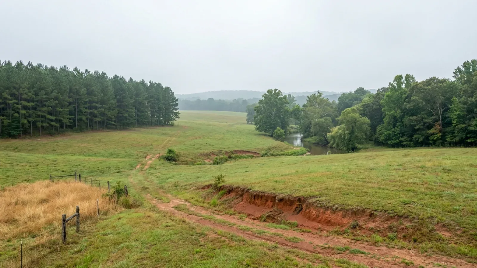
Perry County is the emptiest county in any Arkansas metropolitan area: 10,309 people across 551 square miles inside the Little Rock metro, and 7,788 of them live outside every city limit. It is also the county where the ground argues back. Two thirds of it is mapped in the Carnasaw-Pirum-Clebit associations of the Ouachita Mountains, 57.6 percent of it sits at twelve percent slope or steeper, and 98,970 acres of it belong to the Ouachita National Forest and will never be for sale. There is no county building department, no county zoning and no residential building permit here, so what decides a barndominium site in Perry County is where the rock is, how steep the approach runs, and whether the 911 office has given you an address before the power company will set a meter.
Perry County at a glance
- County
- Perry County
- Population
- 10,309
- ZIP codes
- 72126, 72125, 72070, 72016, 72001, 72025, 72857
- Site visits
- Unincorporated Perry County is inside our regular central Arkansas working area, from the Bigelow and Houston end on the Arkansas River side west through Perryville to the Fourche La Fave and the national forest boundary, so a site walk on steep ground with shallow sandstone under it is ordinary scheduling here rather than a special trip.
Building conditions in Perry County
The State's code reaches every parcel in Arkansas, including rural and unincorporated land. What is not everywhere is the office that checks it: a city or county is authorised to set up a building department, not required to, and a great deal of rural Arkansas never has. So the first question on any parcel is not what the code says — that part travels — but whether anyone here issues a permit, inspects the work, or publishes the design criteria your drawings still have to satisfy. Where nobody does, the obligation does not go away. It just moves to the appraiser, the insurer, your lender and whoever buys the place from you.
https://www.fs.usda.gov/managing-land/lands-minerals-geology/land-area-reports
Also worth knowing before you build in Perry County
- Clebit soils put hard sandstone 10 to 20 inches down, and the depth changes within a few feet
- The NRCS Official Series Description for Clebit, a loamy-skeletal siliceous semiactive thermic Lithic Dystrudept, states that solum thickness and depth to hard sandstone bedrock ranges from 10 to 20 inches and may be extremely variable within short distances, with sandstone fragments making up 35 to 80 percent of the soil by volume. Clebit is a named component of every steep and very steep association in Perry County and SSURGO records its bedrock restriction at 36 centimetres. Its partners are gentler by degrees: Pirum at 91 centimetres and Carnasaw at 122. The Carnasaw description adds the other half of the problem, that permeability is slow and that the gray colors are inherited from the parent material and are not indicative of wetness, which is exactly the reading a soil scientist has to make on a Perry County perc test.
- The one permit a barndominium here actually needs is for the culvert, and it costs nothing
- Section 1200.03 of the county code, adopted by Ordinance 2010-002 on 15 February 2010 and effective 1 September 2010, applies to the construction, modification, replacement or repair of any private driveway or private road of any kind that connects with a Perry County Road. The owner applies to the Perry County Judge's Office for a Culvert Permit, and there shall be no cost for making such an application. After the work the applicant asks the County Judge or his designee to inspect it. The minimum standard is a culvert at the ditch line, at least eighteen inches in diameter and thirty feet long, of materials with sufficient strength to support the use of emergency vehicles. The County Judge may grant a variance after conferring with the Road Department. Building a driveway inconsistently with the ordinance draws a fine of not less than $50.00 and not greater than $250.00, enforceable by the Sheriff.
- Split a Perry County tract into lots of five acres or less and the County Judge becomes your reviewer
- Section 1200.01(3) provides that a person or entity subdividing land into lots of five acres or less is required to file a subdivision plat with the County Judge, showing the right-of-way to be dedicated to the public and the location of waterline and fire hydrants, which shall be a minimum of six inches in diameter or the largest line available every two thousand feet throughout the subdivision. Street signs must be erected for 9-1-1 response, and before construction or a permit the filer must contact the County 9-1-1 Coordinator to receive acceptance and approval of all proposed roadway or street names. Roads offered for county maintenance must be double chipped and sealed or asphalted to Arkansas Highway and Transportation Department design standards, and a new county road needs a 60-foot right-of-way, 26 feet shoulder to shoulder, a three-and-a-half inch crown and 90 tons of SB2 gravel per 100 feet. None of that applies to a single house on an existing parcel; all of it applies the moment you carve small lots.
- 75.5 percent of Perry County's population lives outside any city, the highest share in the Little Rock metro
- The Census Bureau's Vintage 2025 subcounty estimates put the Balance of Perry County, meaning everything outside Perryville, Perry, Houston, Bigelow, Adona, Casa and Fourche, at 7,788 people out of the county's 10,309, up from 7,563 at the 2020 base. That is 75.5 percent, and it is the highest unincorporated share of the six counties in the Little Rock-North Little Rock-Conway metro: Grant is 62.9 percent, Saline 43.1, Lonoke 37.0, Faulkner 33.0 and Pulaski 11.8. Statewide it ranks seventh of 75 counties. Put plainly, three quarters of the people who live in Perry County already live where no city government reaches and no building permit is issued.
- Perry County's flood maps are twenty-six years old, and two of its towns are not in the flood insurance program at all
- FEMA's NFIP Community Status Book records Perry County unincorporated, community 050165, as entering the regular program on 17 November 1999 with an initial Flood Insurance Rate Map of 6 July 1998 and a currently effective map date of 20 June 2000. Perryville and the Town of Perry share that 2000 date; Houston, Bigelow and Casa are still on the 6 July 1998 panels. Adona and Fourche are listed with no regular program date and are recorded as not participating, which means a federally backed mortgage on a flood-zone parcel inside those two town limits cannot be written against an NFIP policy. Against that, neighbouring Grant County was completely remapped on 18 July 2017. A Perry County lender or insurer is reading a quarter-century-old panel, so an elevation certificate does more work here than it would across the county line.
- The county does enforce a floodplain code, and it is the only construction rule here with a citation power behind it
- Section 280.00 of Chapter 2, headed Flood Damage Prevention Program, adopts by reference a Flood Damage Prevention Code for Perry County, Arkansas, dated January 5, 2009, in three articles, a copy of which is filed in the Office of the Perry County Judge. It rests on FEMA's Flood Insurance Study for Perry County, Arkansas, and Incorporated Areas dated June 20, 2000. The ordinance names a Floodplain Administrator who must enforce it and who is authorized to issue cease and desist orders on non-compliant floodplain development projects, issue citations for non-compliance, and request that FEMA file a 1316 Action, a denial of flood insurance, against non-compliant properties. Violation is a misdemeanor carrying fines of not more than $250 per day for each violation plus costs. The ordinance chain runs from Ordinance 1999-014 through five amendments to Ordinance 2009-001.
- Part of Little Rock's drinking water is made in Perry County, and the water utility is buying land here
- Central Arkansas Water states on its own watershed page that Lake Maumelle's watershed lies within Pulaski, Perry, and Saline counties, that even though about 80 percent forested, it is vulnerable to development and other land-use changes, and that current land uses include small residential sites, limited agriculture, and forestry activities. Its Board of Commissioners adopted the Lake Maumelle Watershed Management Plan in February 2007 and the utility has been acquiring watershed tracts and conservation easements since. This matters at the county line in a specific way: Pulaski County used A.C.A. Section 14-17-206 to zone its share of the Lake Maumelle watershed, and that ordinance stops where Pulaski County stops. On the Perry County side of the same watershed there is no overlay, no watershed district and no permit. The constraint on the Perry side is a willing seller with deep pockets, not a zoning map.
- The county says it in its own words: 70 percent forest service or timber company, 685 miles of county road
- Perry County's own About page states that Perry County has 685 miles of county roads, and 70% of the county is either U.S. Forestry Service or private timber companies, and that the local economy is based on timber companies and small business owners. It puts total area at 561.0 square miles, land 550.9 and inland water 10.1. That water figure is unusual for a county this size and it is Nimrod Lake, Harris Brake Lake, the Fourche La Fave River and the Arkansas River along the eastern boundary. Read the two halves together and the buying picture is clear: a 551-square-mile county with 685 miles of maintained county road, a quarter of it federal, and most of the rest in the hands of people who grow trees on it.
- Fire protection here is described by section, township and range, not by street address
- Section 920.00 of the county code establishes the Harris Brake Fire Protection District under Act 35 of 1979 and defines it by legal description: all of Sections 1, 2, 3, 4, 5, 8, 9, 10, 11 and 12 of T3N, R17W; all of Sections 23 through 28 and 32 through 36 and those portions south of the Fourche La Fave River of Sections 13, 14, 15, 21 and 22 of T4N, R17W; and all of Sections 18 through 21 and 28 through 33 plus the portion of Section 7 south of the Fourche La Fave River in T4N, R16W. Section 920.01, by Ordinance 2004-002, separately establishes the Perry County Tactical Rescue Squad as a countywide fire protection district for search and rescue, responding to the unincorporated areas of Perry County where no search and rescue services are provided. On an insurance quote for a rural barndominium the distance to a responding department is a real rating factor, and in Perry County the boundary is a survey description with a river in it.
- Perry County's septic problem is rock, not water, and that inverts the usual central Arkansas advice
- SSURGO for AR105 puts a seasonal water table within 24 inches of the surface on only 51,948 of 358,841 mapped acres, 14.5 percent, and records 24,320 acres as hydric, 6.8 percent, with just 7,860 acres in frequently flooded map units. Compare the same three measures for Grant County directly south: 49.9 percent, 35.9 percent and 27.7 percent. Perry is dry ground on a steep hill; Grant is flat ground with the water table in it. The wet exceptions in Perry are the bottoms and flats and they are worth knowing by name: Guthrie silt loam, 12,920 acres, poorly drained with water at 23 centimetres; Wrightsville silt loam and Perry clay at 15 centimetres; Taft and Moreland at 32; Barling at 76. Everywhere else the question at the perc test is how much soil sits above the sandstone, not how far down the water is.
- 339 farms, a median of 80 acres, and only 19.4 percent of the county in farms at all
- The 2022 Census of Agriculture counts 339 farms in Perry County holding 68,311 acres, which is 19.4 percent of the county's land, at a median farm size of 80 acres and an average agricultural land value of $3,212 an acre. Set that against the Delta counties an hour east, where Lonoke's median farm is 122 acres, Poinsett's 500 and Mississippi County's 1,170. Perry County's 80-acre median is the point: land here changes hands in pieces a family can actually buy and build on, because it was never row-cropped at scale. Forest cover is 267,100 acres, 76 percent of the county, and between the national forest and the timber companies most of that forest is held in large blocks, so the homesite market is the farm-and-pasture strip along the Fourche La Fave and the Highway 60 and Highway 10 corridors.
- Twelve county offices, nine justices of the peace, and not a building official among them
- The Perry County government's own department directory lists County Judge, Quorum Court, Road and Bridge, Solid Waste, Treasurer, Veterans, Coroner, County and Circuit Clerk, Collector, Assessor, Sheriff and Office of Emergency Management. There is no building department, no planning department, no zoning office and no board of adjustment on the list. The Quorum Court's nine justices of the peace meet the second Monday of each month at 6 p.m. at the Perry County Courts Building; the Road and Bridge Department is at 1711 Aplin Avenue in Perryville, open Monday to Thursday, 7 a.m. to 5.30 p.m., closed Friday; the County Judge's office is at 310 West Main Street. That is the complete list of counters a barndominium owner can walk up to in this county, and none of them will look at a set of house plans.
https://www2.census.gov/programs-surveys/popest/datasets/2020-2025/cities/totals/sub-est2025.csv
https://www.fema.gov/api/open/v1/NfipCommunityStatusBook?%24filter=state%20eq%20%27AR%27
https://www.nass.usda.gov/Publications/AgCensus/2022/Full_Report/Volume_1,_Chapter_2_County_Level/Arkansas/

The expensive surprises are in the ground, not the building
What moves an Arkansas budget is usually below grade, and the state hands you a different problem depending on where you stand. In the Delta the issue is shrink-swell clay that moves with the season, and it is the reason a wide, light building with a big slab and a big door opening is the shape most at risk. Along the Fall Line there is a second, separate clay belt with nothing to do with the Delta at all. Up in the Ozarks the question inverts: what matters is not what the slab sits in but what is under it, because that limestone is full of solution cavities and the collapses arrive with no prior indication at the surface. And on Crowley's Ridge, where Jonesboro and Paragould sit, it is fine wind-blown loess that stands up in a vertical cut and then erodes out from under whatever you put on it. The same ground decides your wastewater system, which is the gate that most often moves a rural build's schedule — and it is soils that decide it, not the size of the house. So the site work, the foundation and the wastewater get resolved together rather than one at a time. We price the dirt before we price the building.
What we build in Perry County
All nine services are available in Perry County. What a build costs depends far more on the parcel than on square footage, so we price against your land rather than publishing a rate card.
Custom Barndominium Plans
Barndominium floor plans, elevations and engineered documents drawn to your parcel — and to the design numbers your Arkansas jurisdiction publishes.
Barndominium Kits
Engineered barndominium shell packages for Arkansas land, drawn to a named jurisdiction's criteria rather than to a national vendor's generic spec.
Turnkey Barndominium Builds
Land through handover under one contract, and a straight answer on what actually gates a barndominium build on rural Arkansas land.
What a build looks like
Three stages every Perry County project passes through, from a raw parcel to a finished home. Site work first, because that is where the budget is decided.

The parcel
Zoning, setbacks, flood zone and utility access get checked before anything is drawn.
Pad and permit
Clearing, grading and a compacted pad, while the submittal works through whichever office issues the permit where you are building.

Frame to finish
Shell erected and dried in, then systems, insulation and interior finish through to CO.
Those are the rules where you are building in Perry County. Tell us what you want to build and we will draw it to them.
Where we build around Perry County
Perry County and the rural land around it. The buildable acreage for a project this size usually sits outside the city limits, which is frequently what changes who issues your permit.
Keep reading
The questions that usually come next once you know what Perry County allows.
Barndominium Cost Guide
Sourced per-square-foot ranges by tier and by size, with a calculator built on the same figures.
Read itThe Arkansas Building Code
The code applies statewide, including unincorporated land — but a jurisdiction is only authorized to establish a building department, so on rural residential land there is often no counter at all.
Read itBuying Land in Arkansas
Where acreage is actually purchasable in homesite sizes, and what percolation, slope and the onsite wastewater rule do to a parcel before anything is designed.
Read itNearby areas we build in
Others we cover nearby. One may be a county, another a city inside it — and since March 2025 the soft edge between them is gone, because the cities' extraterritorial jurisdiction was abolished outright and that land reverted to the counties. So the office that issues the permit, the fees it charges, the zoning and whether anyone publishes design criteria at all can differ from one card to the next, and the boundary that decides it may have moved recently.
Building in Perry County: common questions
9 questions we get asked most often about building in Perry County. If yours is not on the list, ask it directly.
Does anyone issue a building permit for a barndominium in unincorporated Perry County?
If nobody issues a building permit, what does Perry County actually make me do?
Is any of Perry County zoned, and did Act 314 of 2025 change anything here?
What does Perry County ground do to a barndominium foundation?
Will a septic system work on a Perry County site?
Where in Perry County can I actually buy a homesite?
How much of a problem is flooding, and are the flood maps current?
Does the Lake Maumelle watershed reach into Perry County, and does it restrict what I can build?
What wind speed, snow load and frost depth should a Perry County barndominium be designed to?
Building in Perry County?
Start with the plan. Tell us what you want to build and we will draw it, then confirm which office issues the permit for your parcel, what it will let you put there, and what wind load it has to meet. That conversation costs nothing.