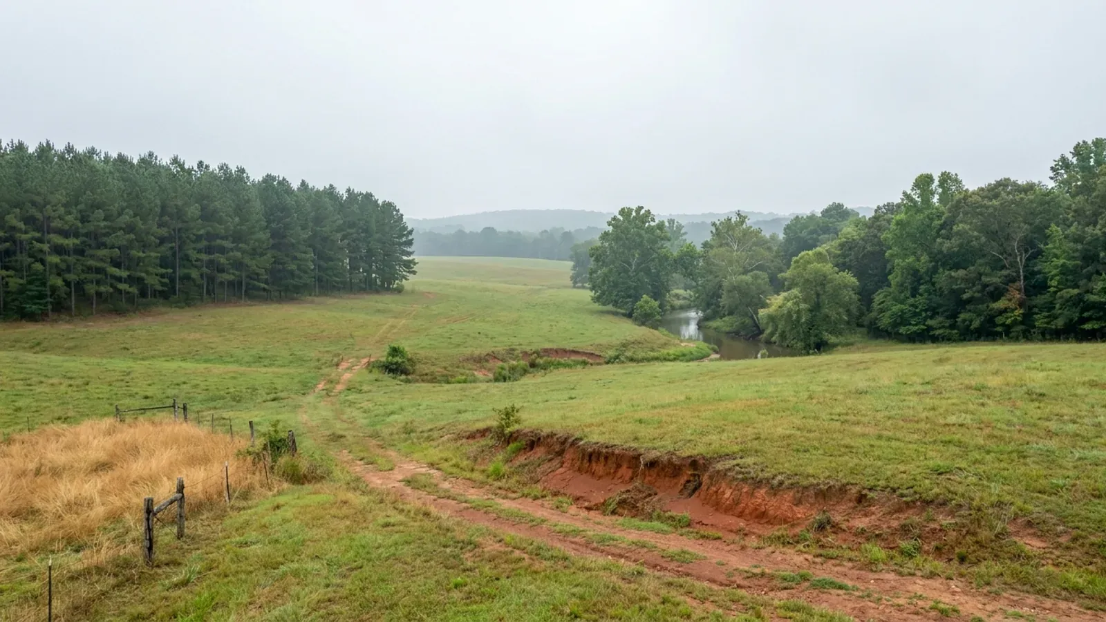
Rolling central Arkansas pasture with loblolly pine, red-brown clay in a cut bank and a wooded creek bottom.
Saline County Statewide code, local enforcement optional

Barndominium Builders in Saline County, AR

Saline County is Little Rock's south-west exurb and the place in central Arkansas where the metro's septic-dependent acreage actually is: 57,473 of its 133,288 people live outside every city limit, and that unincorporated population grew faster between 2020 and 2025 than any other county's in the state. It is also a county with no building department, no building permit and no general zoning — the Quorum Court has taken one of the two steps Arkansas law puts in front of county zoning and stopped there. What decides a barndominium site here is not a permit counter; it is slope, bedrock, flooding and whether a drainfield will work, on ground that changes character halfway across the county.

Saline County at a glance

County
Saline County
Population
133,288
ZIP codes
72122, 72002, 72011, 72065, 72087, 72167, 72019, 71909
Site visits
Unincorporated Saline County is inside our regular central Arkansas working area, from the East End and Alexander side across to Paron and the Ouachita foothills, so site walks, slope and septic questions and Planning Board timing are ordinary scheduling here rather than a special arrangement.

Building conditions in Saline County

The State's code reaches every parcel in Arkansas, including rural and unincorporated land. What is not everywhere is the office that checks it: a city or county is authorised to set up a building department, not required to, and a great deal of rural Arkansas never has. So the first question on any parcel is not what the code says — that part travels — but whether anyone here issues a permit, inspects the work, or publishes the design criteria your drawings still have to satisfy. Where nobody does, the obligation does not go away. It just moves to the appraiser, the insurer, your lender and whoever buys the place from you.

Build conditions for Saline County , Arkansas . BUILD CONDITIONS SALINE COUNTY, ARSaline CountyONE STATEWIDE CODEADOPTED RESIDENTIAL CODEONE STATEWIDE CODEThis jurisdiction publishes no design wind speed. It is settled in writing with the authority overyour parcel before the frame is ordered.ZONING · NONE COUNTYWIDE. THE ONLY ZONING ORD…None outside a recorded subdivisionArkansas gives a county a two-step opt-in: the county judge withquorum court approval may create a planning board, and only then ma…COUNTY ROAD RIGHT-OF-WAY CONSTRUCTION PERMIT$20.00, plus a $10,000 surety bondSection 1200.02 of the Saline County Code of Ordinances requiresanyone installing or repairing utility lines, or doing any other…WHO ISSUES THE PERMITSaline County Planning Board — subdi…The Planning Board's office is not at the courthouse but at theSaline County Road Department, 5555 Cynamide Road, Benton, and it…
Build conditions for Saline County, drawn from the sourced facts on this page. Every figure above is cited in the quick-facts panel below, with its source and vintage.
57,473 people live in unincorporated Saline County — and that number is growing faster than any other Arkansas county's
The Census Bureau's Vintage 2025 subcounty estimates put the Balance of Saline County — everything outside Benton, Bryant, Alexander, Bauxite, Haskell, Shannon Hills and Traskwood — at 57,473 people, up from 54,967 at the 2020 census base. That gain of 2,506 is the largest increase in unincorporated population of any county in Arkansas over the same period, ahead of Benton County's 2,401 and against outright declines in Pulaski and Garland. Forty-three percent of Saline County's 133,288 residents live where no city government reaches, and the share is rising.

https://www2.census.gov/programs-surveys/popest/datasets/2020-2025/cities/totals/sub-est2025_5.csv

The only zoning ordinance Saline County has ever adopted is about aircraft, not houses
Section 1200.06 of the Saline County Code of Ordinances is the Saline County Airport Height Zoning Ordinance, adopted by Ordinance 2002-077 on 17 December 2002. It sets the airport elevation at 390 feet above mean sea level, a horizontal surface at 540 feet, a conical surface sloping 20 to 1 outward to 740 feet, and a general allowance that nothing in the ordinance prohibits a structure or tree up to 50 feet above the surface of the land. It creates a five-member Board of Adjustment appointed by the County Judge and confirmed by the Quorum Court, requires a public hearing and written findings on every permit and variance, and requires an FAA determination to accompany a variance application. That is the whole of Saline County zoning: it regulates how tall a thing may be near one runway, and says nothing about what any building on unincorporated land may be used for.

https://mcclibrary.blob.core.usgovcloudapi.net/codecontent/50073/327682/Chapter%2012%20-%20Roads%20and%20Transportation.pdf

Two soil map units cover 46% of the county — and both are mapped at 12 to 40 percent slopes
SSURGO for survey area AR125, Saline County, data version 22 dated 10 September 2025, maps 148,341 acres as 'Carnasaw-Townley association, steep' and a further 65,669 acres as 'Carnasaw-Townley-Pirum association, steep'. Both carry a slope range of 12 to 40 percent. Together they are 214,010 acres — about 46 percent of the county's 463,000 acres — and 12 percent is precisely the slope at which Arkansas's onsite wastewater rule stops treating a system as routine. A third association, 'Carnasaw-Townley association, undulating', covers 39,944 more acres at 3 to 12 percent. The gentler ground is on the Coastal Plain side: Savannah fine sandy loam and Smithdale loamy sand, both mapped at 3 to 8 percent.

https://websoilsurvey.sc.egov.usda.gov/App/HomePage.htm

The county's subdivision rules still carve out city planning rings that state law abolished in 2025
Section 2.2.33 of the Saline County Subdivision Rules and Regulations, approved 15 April 2019 and last revised by Ordinance 2023-11, defines the county's own Territorial Jurisdiction as all land outside incorporated areas 'and which is not within the extraterritorial planning jurisdiction of an incorporated area'. Section 4.1.1 adds that if a proposed subdivision is within the jurisdiction of a city planning commission, the city's process is to be followed. Act 314 of 2025 repealed A.C.A. § 14-56-413 outright and abolished municipal extraterritorial jurisdiction in Arkansas, and struck the identical carve-out out of the county plat-recording statute at § 14-17-208(l)(1). The county's live plat application still carries a tick box reading 'CITY ETJ — If so, which City'. There is no longer such a thing, and the land in those former rings answers to Saline County alone.

https://cms2.revize.com/revize/salinecountyar/Documents/Government/Boards%20%26%20Commissions/Planning%20Board/Various%20Documents/Saline%20County%20Planning%20Board%20Rules.pdf

Also worth knowing before you build in Saline County

Almost none of Saline County's soil is rated better than 'very limited' for a drainfield
Running the NRCS engineering interpretation 'ENG - Septic Tank Absorption Fields' across the major soil components of survey area AR125 returns about 391,300 acres rated Very limited and about 16,800 rated Somewhat limited — and not one acre rated Not limited. The leading reasons, by acreage, are restricted percolation between 24 and 72 inches (about 303,700 acres), slope of 8 percent or more (about 202,500 acres), a water table near the surface (about 106,800 acres) and shallow bedrock (about 99,300 acres). Two of the county's more extensive Coastal Plain soils, Savannah and Leadvale, carry a fragipan starting at roughly 24 and 27 inches, which perches water above itself in winter and spring.

https://websoilsurvey.sc.egov.usda.gov/App/HomePage.htm

The Quorum Court passed 38 ordinances in 2025 and 2026 and not one of them was about building
The Saline County Clerk's published ordinance index lists Ordinances 2025-1 through 2025-20 and 2026-1 through 2026-18, the last of them on 17 August 2026. They are budget amendments, appropriations, personnel and salary items, fund creations, millage questions and two transfers of a used Sheriff's vehicle to other counties. None adopts a building code, creates a building department, adopts zoning, or responds to the abolition of municipal extraterritorial jurisdiction. The most recent ordinance touching unincorporated land at all is 2026-14, an animal control ordinance for the unincorporated boundaries of Saline County, adopted 17 August 2026.

https://documents.cisarkansas.com/?C=Saline&S=ORD

51,475 acres of Saline County are mapped as frequently flooded
Three soil map units in survey area AR125 carry a 'frequently flooded' phase: Amy silt loam, 0 to 1 percent slopes, frequently flooded (25,382 acres), Ouachita silt loam, 0 to 1 percent slopes, frequently flooded (23,106 acres) and Ouachita-Amy complex, frequently flooded (2,987 acres). That is 51,475 acres, about 11 percent of the county, and it is the flat, easy-looking bottomland along the Saline River and its tributaries. Amy is poorly drained and sits in hydrologic group C/D. Unincorporated Saline County participates in the National Flood Insurance Program as community 050191, on a currently effective map dated 5 June 2020; its first Flood Hazard Boundary Map was issued 9 August 1977 and its first Flood Insurance Rate Map on 17 November 1982.

https://www.fema.gov/flood-insurance/work-with-nfip/community-status-book

The county's own road plan says where the buildable land is, and what is wrong with it
The Saline County Master Road Plan, prepared with Metroplan and approved 21 November 2016 by Ordinance 2016-36, opens with a description of the county nobody else publishes: Saline County is divided primarily into two physiographic regions, the Ouachita Mountains in the western portion and the Gulf Coastal Plain in the eastern part; development constraints in the Ouachita Mountain region include steep slopes and flood plains, while several large flood plains constrain development in the Gulf Coastal Plain area; and the area west of State Highway 9 and north of State Highway 5 is primarily timber land and sparsely populated, apart from Hot Springs Village on the Garland County line. That is the county telling a buyer, in its own adopted document, that the cheap acreage is timbered mountain ground.

https://cms2.revize.com/revize/salinecountyar/Documents/Government/Boards%20%26%20Commissions/Planning%20Board/Various%20Documents/Master%20Road%20Plan_2017.pdf

A new county road in Saline County needs a 60-foot right of way and cannot exceed a 12 percent grade
The Master Road Plan's minimum requirements for Class VI local roads run to sixteen numbered clauses. A minimum 60-foot right of way measured from the centre of the road in all instances, plus a 10-foot utility and road-work easement, five feet each side; a 55-foot radius for a cul-de-sac right of way; a road bed 31 feet wide with 18-inch ditch lines, sub base compacted to 95 percent modified proctor to a depth of 18 inches and proof-rolled with a loaded tandem or tri-axle dump truck; a base of at least eight inches of class 7 crushed stone compacted to 98 percent; at least two and a half inches of asphalt at least 20 feet wide with four-foot gravel shoulders; a maximum grade of 12 percent; and a preconstruction meeting with the owner, resident engineer, contractor, the Planning Board Code Enforcement Officer and the County Road Superintendent before any work starts. Cross drains under the roadway must be reinforced concrete no smaller than 18 inches.

https://cms2.revize.com/revize/salinecountyar/Documents/Government/Boards%20%26%20Commissions/Planning%20Board/Various%20Documents/Master%20Road%20Plan_2017.pdf

Saline County names your private driveway and tells you how big the numerals have to be
Section 1200.01 of the county code establishes a uniform building-numbering system built on seven separate basing systems — Benton, Bryant, Haskell, Traskwood, Little Rock, Hot Springs Village and Interstate 30 — each with its own point of reference, extended out of the cities into the unincorporated county on a grid of sixteen blocks to the mile with a number assigned for every 25 feet of road frontage. The county, through the County Court, is responsible for naming county roads, public access private roads and private driveways in the unincorporated parts of the county. Numbers must be posted within 30 days of notification, at least three inches high for a residential structure and six inches for a non-residential one, in durable reflective material on a contrasting background. The Addressing Office is at the Road Department on Cynamide Road, and the ordinance warns that a private-road or driveway address is for emergency-services location only and does not oblige the Postal Service to deliver there.

https://mcclibrary.blob.core.usgovcloudapi.net/codecontent/50073/327682/Chapter%2012%20-%20Roads%20and%20Transportation.pdf

The county maintains more than 800 miles of road and more than 1,100 separate county roads
The Saline County Road Department states that it oversees the improvement and maintenance of over 800 miles of county roads and over 1,100 individual county roads, and that it also manages 911 addressing for the county. Its office is at 5555 Cynamide Road in Benton, and it is the same address as the Planning Board. That road count matters to a buyer because in unincorporated Saline County the road, not a building department, is the thing the county actually controls: whether a parcel has fee-title access to a public road decides whether a split needs a plat at all, and the Master Road Plan decides what any new road serving it has to be built to.

https://www.salinecounty.org/government/road_department/index.php

Thirty-three bauxite mine sites in Saline and Pulaski counties are recorded as reclaimed or abandoned
The Arkansas Geological Survey's critical minerals summary records that bauxite was mined in Saline and Pulaski counties from 1898 to 1990, that peak production exceeded six million tons in 1943, that the majority of mining was by surface techniques but there was also underground production during the Second World War, and that in the two counties 33 bauxite mine sites are listed as reclaimed or abandoned. The Saline County deposit centre is given as 34.567413 N / 92.482908 W. Independently, SSURGO maps 6,398 acres of Udorthents in Saline County — soils formed in earth-moved material — with a slope range of 3 to 60 percent and a hydrologic group of C. On the Bryant-to-Bauxite side of the county, knowing whether a parcel is on mined and backfilled ground is a real question, not a historical one.

https://www.geology.arkansas.gov/minerals/critical-minerals.html

There is still an operating nepheline syenite quarry in Saline County
The Arkansas Geological Survey states that nepheline syenite and its associated igneous rocks are exposed in only four areas of the state — south-central Pulaski County, Saline County in the vicinity of Bauxite, Garland County at Potash Sulphur Springs and Hot Spring County at Magnet Cove — and that the total surface exposure of syenite in Arkansas is about 13 square miles. It records that nepheline syenite has been quarried near Bauxite, and that one quarry is presently actively producing nepheline syenite near Bryant in Saline County. This is hard, weather-resistant intrusive rock in a county whose dominant soils are clay over weathered shale, and it is the reason the bauxite formed here at all.

https://www.geology.arkansas.gov/minerals/industrial/nepheline-syenite.html

What the Planning Board actually argues about is septic and access, not buildings
The board's published minutes are the clearest picture available of how rural Saline County land is regulated. At the meeting of 11 June 2026 the board approved five plats and conditioned a sixth, a preliminary plat, on a list that names the real constraints: access off Congo Road tested and dedicated to the county as a public road, a Designated Representative's opinion on density for septic, clarification of whether septic could be installed inside hatched greenspace, ingress and egress across greenspace, an extensive bill of assurance, and a property owners' association or improvement district to maintain the greenspace. The board recorded that the project was not ready to start construction and required engineering drawings to be approved first. Another item that evening was a replat prompted by a shop that had been built across a property line.

https://www.salinecounty.org/government/planning_board/meeting_agendas.php

The buildable acreage is the timbered western third, and the county says so on the map
The Master Road Plan identifies the area west of State Highway 9 and north of State Highway 5 as primarily timber land and currently sparsely populated, apart from Hot Springs Village on the Garland County line — the Paron and Owensville side of the county, running toward the Ouachita National Forest. That is where household-sized acreage in Saline County actually is. The same document warns what comes with it: development constraints in the Ouachita Mountain region are steep slopes and flood plains. Statewide data agree with the description — 311,500 acres of the county, about 67 percent, are forested, while only 12.9 percent of its land is in farms, the lowest farm share of any county in the Little Rock metropolitan area.

https://cms2.revize.com/revize/salinecountyar/Documents/Government/Boards%20%26%20Commissions/Planning%20Board/Various%20Documents/Master%20Road%20Plan_2017.pdf

Every Saline County city was in the smallest extraterritorial band before Act 314 removed it
Under the repealed A.C.A. § 14-56-413, the size of a city's planning ring was set by its population at the most recent decennial census. At the 2020 census Benton stood at 35,026 and Bryant at 20,671 — both in the 8,000 to 60,000 band, which carried a one-mile ring — while Shannon Hills (4,495), Haskell (3,974), Alexander (3,380), Bauxite (631) and Traskwood (500) were all in the 8,000-or-under band, which allowed a planning area of up to one mile but expressly barred the city from exercising any zoning authority outside its corporate limits. Act 314 of 2025 repealed the whole scheme, along with the provision that had let a city extend electrical permit and inspection jurisdiction into the same ring. No Saline County city now reaches past its own limit for any purpose.

https://www2.census.gov/programs-surveys/popest/datasets/2020-2025/cities/totals/sub-est2025_5.csv

An excavator grading a compacted building pad on a cleared lot, with survey stakes and a drainage swale visible.
Below the slab

The expensive surprises are in the ground, not the building

What moves an Arkansas budget is usually below grade, and the state hands you a different problem depending on where you stand. In the Delta the issue is shrink-swell clay that moves with the season, and it is the reason a wide, light building with a big slab and a big door opening is the shape most at risk. Along the Fall Line there is a second, separate clay belt with nothing to do with the Delta at all. Up in the Ozarks the question inverts: what matters is not what the slab sits in but what is under it, because that limestone is full of solution cavities and the collapses arrive with no prior indication at the surface. And on Crowley's Ridge, where Jonesboro and Paragould sit, it is fine wind-blown loess that stands up in a vertical cut and then erodes out from under whatever you put on it. The same ground decides your wastewater system, which is the gate that most often moves a rural build's schedule — and it is soils that decide it, not the size of the house. So the site work, the foundation and the wastewater get resolved together rather than one at a time. We price the dirt before we price the building.

What a build looks like

Three stages every Saline County project passes through, from a raw parcel to a finished home. Site work first, because that is where the budget is decided.

Aerial view of an undeveloped rural lot with cleared grass, an oak and hickory treeline with shortleaf pines, and a pale gravel access track.
Stage one

The parcel

Zoning, setbacks, flood zone and utility access get checked before anything is drawn.

An excavator grading a compacted building pad on a cleared lot, with survey stakes and a drainage swale visible.
Stage two

Pad and permit

Clearing, grading and a compacted pad, while the submittal works through whichever office issues the permit where you are building.

A finished barndominium at dusk with warm interior lighting glowing through its large windows.
Stage three

Frame to finish

Shell erected and dried in, then systems, insulation and interior finish through to CO.

Those are the rules where you are building in Saline County. Tell us what you want to build and we will draw it to them.

Where we build around Saline County

Saline County and the rural land around it. The buildable acreage for a project this size usually sits outside the city limits, which is frequently what changes who issues your permit.

The Saline County service area, including the rural acreage outside the built-up edge, which is where the parcels big enough for a build like this usually sit. The map marks the territory we build in. It is not a branch location, and there is no office at this pin.

Nearby areas we build in

Others we cover nearby. One may be a county, another a city inside it — and since March 2025 the soft edge between them is gone, because the cities' extraterritorial jurisdiction was abolished outright and that land reverted to the counties. So the office that issues the permit, the fees it charges, the zoning and whether anyone publishes design criteria at all can differ from one card to the next, and the boundary that decides it may have moved recently.

Building in Saline County: common questions

9 questions we get asked most often about building in Saline County. If yours is not on the list, ask it directly.

Does anyone issue a building permit for a barndominium in unincorporated Saline County?
No. Arkansas puts a two-step opt-in in front of county zoning: with the approval of a majority of the quorum court, a county judge may create a county planning board, and only then may the court adopt a zoning ordinance — which the statute says is observed through denial of the issuance of building permits and use permits. Saline County took the first step decades ago and has never taken the second. The Planning Board exists and meets monthly, but it administers subdivision plats, not zoning, and the county has no building department to deny a permit even if it wanted to. Three of the county's own published lists say the same thing from three directions. The government directory runs Airport, Assessor, Boards and Commissions, Circuit Clerk, Court, Collector, Coroner, County Clerk, County Judge, Emergency Management, Finance and HR, Prosecuting Attorney, Public Defender, Quorum Court, Road Department, Sheriff, Surveyor, Treasurer and Veterans Service — nineteen offices, none of them a building department. The Boards and Commissions page lists a 911 Board, Airport Commission, Conservation District, Economic Development Corporation, Election Commission, Equalization Board, Fair Board, Intergovernmental Council, Library Board, Planning Board, Recycle Saline Board, Saline Regional Public Water Authority and 250 Commission — no board of zoning adjustment, no building board of appeals. And the county's 'Apply For' page offers exactly two things: a Saline County job and a US passport. There is no plan review, no inspection sequence and no certificate of occupancy on unincorporated land here. That is a finding you can plan around, not a gap in the research.
What happened to the planning rings around Benton, Bryant, Alexander, Haskell, Shannon Hills and Bauxite?
They no longer exist. Act 314 of 2025, approved 18 March 2025, repealed A.C.A. § 14-56-413 in its entirety and abolished municipal extraterritorial jurisdiction in Arkansas. It also repealed § 14-17-208(i), which had given a city subdivision jurisdiction in adjoining unincorporated areas, repealed § 17-28-305(b)(3), which had let a city extend electrical permit and inspection jurisdiction into the same ring by agreement with the county, and amended § 14-17-208(l)(1) to strike the phrase 'not within the exercised extraterritorial jurisdiction of a municipality' from the county plat-recording rule. Before that, ring size followed population at the last decennial census: Benton at 35,026 and Bryant at 20,671 sat in the 8,000-to-60,000 band with a one-mile ring, and Shannon Hills, Haskell, Alexander, Bauxite and Traskwood all sat in the 8,000-or-under band, which permitted a planning area of up to a mile but forbade any zoning outside the corporate limits. Saline County has not amended its own documents to match. Section 2.2.33 of the county's Subdivision Rules still defines its Territorial Jurisdiction as land outside incorporated areas that is 'not within the extraterritorial planning jurisdiction of an incorporated area', section 4.1.1 still tells a subdivider inside a city planning commission's jurisdiction to follow the city process, and the county's plat application still has a tick box reading 'CITY ETJ — If so, which City'. In practice, land in those former bands is now regulated by Saline County alone — and Saline County has subdivision rules but no zoning and no building permit.
If there is no permit, what does the county actually make me do before I build?
Four things, and each of them has a named office. First, the division of land. The Planning Board reviews plats under rules approved 15 April 2019 and revised by Ordinances 2019-11, 2022-12 and 2023-11; nothing may be conveyed and no plat recorded before a Certificate of Final Plat Approval, and a bill of assurance must accompany every plat. Second, the road. If the site takes access from a new road, that road is built to the Master Road Plan's Class VI standard — a 60-foot right of way plus a 10-foot utility easement, a 31-foot road bed with 18-inch ditches, sub base compacted to 95 percent to 18 inches, eight inches of class 7 crushed stone at 98 percent, at least two and a half inches of asphalt at least 20 feet wide, and a maximum grade of 12 percent — after a preconstruction meeting with the Planning Board Code Enforcement Officer and the County Road Superintendent. Anyone working inside an existing county right of way needs a $20.00 permit from the County Judge and a $10,000 surety bond under section 1200.02 of the county code. Third, the address. The Road Department's Addressing Office assigns the 911 address and names the private road or driveway, and the numerals go up within 30 days at three inches minimum for a dwelling. Fourth, water and stormwater. The county's stormwater ordinance is adopted by reference at section 1340.00 of the code, and the county participates in the National Flood Insurance Program as community 050191, so floodplain development requirements are real on a mapped Special Flood Hazard Area.
What are the design numbers for a barndominium out here — wind, snow, frost, seismic?
Saline County publishes none of them, and it is important to be honest about that rather than fill the gaps. The Arkansas residential code prints its climatic and geographic criteria table blank and instructs the local jurisdiction to fill it in; the state supplies no wind speed, no ground snow load, no frost line depth, no weathering class and no termite class. In a county with no building department there is nobody whose job it is to fill that table in, so the numbers for a Saline County site do not exist in any published local form and the designer has to derive them from the code's own figures and from ASCE 7. Two things about that are worth knowing here specifically. The code's own topographic speed-up table multiplies the wind speed on a hill, ridge or escarpment, and where the modified speed reaches 140 mph the building is treated as 'wind design required' and leaves the prescriptive path — on the Ouachita foothill ridges that make up the western half of Saline County that is a live question, not a theoretical one. And the seismic side is mild: the USGS ASCE 7-16 service returns S_DS of 0.309 g at the county's own internal point on Site Class D-default, which puts a detached dwelling in Seismic Design Category B under the residential code's own table, well below the D-sub-categories that reshape a building in north-east Arkansas. One statewide floor does apply everywhere: exterior footings must be placed not less than 12 inches below the undisturbed ground surface.
What does the ground do to a foundation in Saline County?
It changes halfway across the county, which is the single most useful thing to know before choosing a site. The county's own Master Road Plan puts it plainly: Saline County is divided primarily into two physiographic regions, the Ouachita Mountains in the west and the Gulf Coastal Plain in the east, with steep slopes and flood plains constraining the mountain side and large flood plains constraining the Coastal Plain side. The soil survey shows the same split in acres. Two steep associations — Carnasaw-Townley and Carnasaw-Townley-Pirum — cover 214,010 acres at slopes of 12 to 40 percent, which is 46 percent of the county, and behind that clay is weathered shale: Townley meets paralithic bedrock at about 30 inches, Pirum hits lithic bedrock at about 36 inches, Zafra at about 42 and Carnasaw at about 50. Statewide comparison puts 52.1 percent of the Saline County survey area over a restriction within 152 centimetres, the eleventh-highest share of any Arkansas county. On that ground rock excavation, not soil bearing, is the budget line, and cut-and-fill on a 12-to-40-percent slope is the other one. East and south the Coastal Plain takes over with Savannah, Smithdale and Tiak, gentler at 3 to 8 percent, sandier, and carrying a fragipan under the Savannah at about 24 inches. Between them, along the Saline River and its tributaries, are 51,475 acres of frequently flooded Amy and Ouachita silt loams. And on the Bryant-to-Bauxite side, 6,398 acres are mapped as Udorthents — soils in earth-moved material — in a county where 33 bauxite mine sites are recorded as reclaimed or abandoned. A soils report is not a formality on any of it.
Will a septic system work on rural Saline County acreage?
Sometimes, and the county is one of the harder places in central Arkansas to make it work cheaply. Run the NRCS engineering interpretation for septic tank absorption fields across the major soil components of the Saline County survey area and about 391,300 acres come back Very limited, about 16,800 Somewhat limited, and nothing at all comes back Not limited. The four leading reasons, by acreage, are restricted percolation between 24 and 72 inches on roughly 303,700 acres, slope of 8 percent or more on roughly 202,500 acres, a water table near the surface on roughly 106,800 acres, and shallow bedrock on roughly 99,300 acres. Slope is the one that bites hardest here because of what the state rule says: Arkansas's onsite wastewater rules set 12 percent as the ceiling for the standard lot-size pathway and for a capping-fill absorption area, and a capping fill on a slope steeper than 12 percent needs a variance — and 46 percent of Saline County is mapped in associations whose slope range starts at 12 percent. On the Coastal Plain side the constraint changes character rather than disappearing: the fragipan under Savannah and Leadvale perches water above itself through winter and spring. None of this is administered by the county. The system is designed and installed under the Arkansas Department of Health's rules by a licensed Designated Representative the landowner hires, and the Planning Board's own minutes show it routinely conditioning plat approval on a Designated Representative's opinion about septic density before it will let a development proceed.
Where in Saline County can I actually buy homesite acreage?
Real acreage exists here, which is not true of every place in this metro, and the county's own documents point at it. Saline County is 723.5 square miles at 184 people per square mile, with 311,500 acres — about 67 percent — under forest and only 59,794 acres, about 12.9 percent, in farms; that farm share is the lowest of any county in the Little Rock metropolitan area. The Master Road Plan says the area west of State Highway 9 and north of State Highway 5 is primarily timber land and sparsely populated. That is the western third of the county: Paron, Owensville and the ground running toward the Ouachita National Forest, largely in the 72122 and 72019 postal areas. It is genuinely buyable in household-sized tracts, and it is also the steepest, rockiest and most septic-constrained part of the county, so the parcel that is cheapest per acre is often the one that costs most to sit a building on. Closer in, the East End side south-east of Bryant and the Alexander corridor toward Pulaski County give up some acreage in exchange for gentler Coastal Plain ground and shorter utility runs. Two cautions. Hot Springs Village, which straddles the Garland County line in the north-west, is a platted property-owners' association with its own architectural covenants and its own Director of Planning and Inspections, and Saline County has adopted a separate property code for the Saline County portion of the Village — the governing documents there, not the county, will decide whether a metal-clad or post-frame house is allowed. And Traskwood, alone among the county's municipalities, does not participate in the National Flood Insurance Program.
Are there any setback, height or appearance rules on unincorporated Saline County land?
Almost none, with two real exceptions and one that depends on where you are. The county has adopted no zoning districts, no use table and no countywide setback, so on an ordinary rural parcel outside a platted subdivision there is no county rule about how close to the line the building sits, how tall it is, what it is clad in, or whether a shop and a dwelling can share a roof. The first exception is the Saline County Airport Height Zoning Ordinance at section 1200.06 of the county code. Around the airport south-east of Bryant it establishes approach, transitional, horizontal and conical zones, sets the horizontal surface at 540 feet above sea level and the conical surface out to 740 feet, and provides that nothing in the ordinance prohibits a structure or tree up to 50 feet above the surface of the land. Above those limits a permit from the Saline County Airport Commission is required, a variance needs an FAA determination of effect, and appeals go to a five-member Board of Adjustment appointed by the County Judge and confirmed by the Quorum Court. The second exception is the plat itself: a recorded subdivision carries building setback lines with dimensions on the face of the plat and a bill of assurance, and both bind you as private covenants whatever the county does or does not enforce. The third is Hot Springs Village, where the property owners' association's covenants and the county's separately adopted property code for the Saline County portion of the Village both apply.
With no county inspections, how do I make a barndominium here financeable and insurable?
By building the record the county will not build for you. On unincorporated Saline County land the appraiser, the lender and the insurer become the effective inspection regime, and none of them will find a permit file, a plan-review stamp or a certificate of occupancy, because none exists. What does exist, and what still binds regardless of any county counter, is worth assembling into a file. Arkansas's plumbing statute makes the state plumbing code binding as minimum standards statewide, on all types of buildings, private or public, rural or urban. Electricians, plumbers and HVACR mechanics are licensed by the State of Arkansas everywhere in the county, and the agricultural carve-outs in those statutes are drafted to stop at a dwelling — the electrical exemption reaches a 'nonresidential farm building', which a barndominium used as a house is not, and the plumbing exemption reaches buildings whose primary use is agricultural and which are not connected to a public water, sewer or gas system. The onsite wastewater permit is issued under Department of Health rules by a licensed Designated Representative and produces a real document. The Planning Board's plat approval, the 911 address assignment and, where applicable, the floodplain development record are all county paper you can point to. Add the engineer's or truss supplier's sealed drawings, the concrete test results, the septic design and the electrical and plumbing licence numbers, and you have a documented build. In a county with no inspector, that documentation is worth more, not less.

Building in Saline County?

Start with the plan. Tell us what you want to build and we will draw it, then confirm which office issues the permit for your parcel, what it will let you put there, and what wind load it has to meet. That conversation costs nothing.