Barndominium Builders in White County, AR
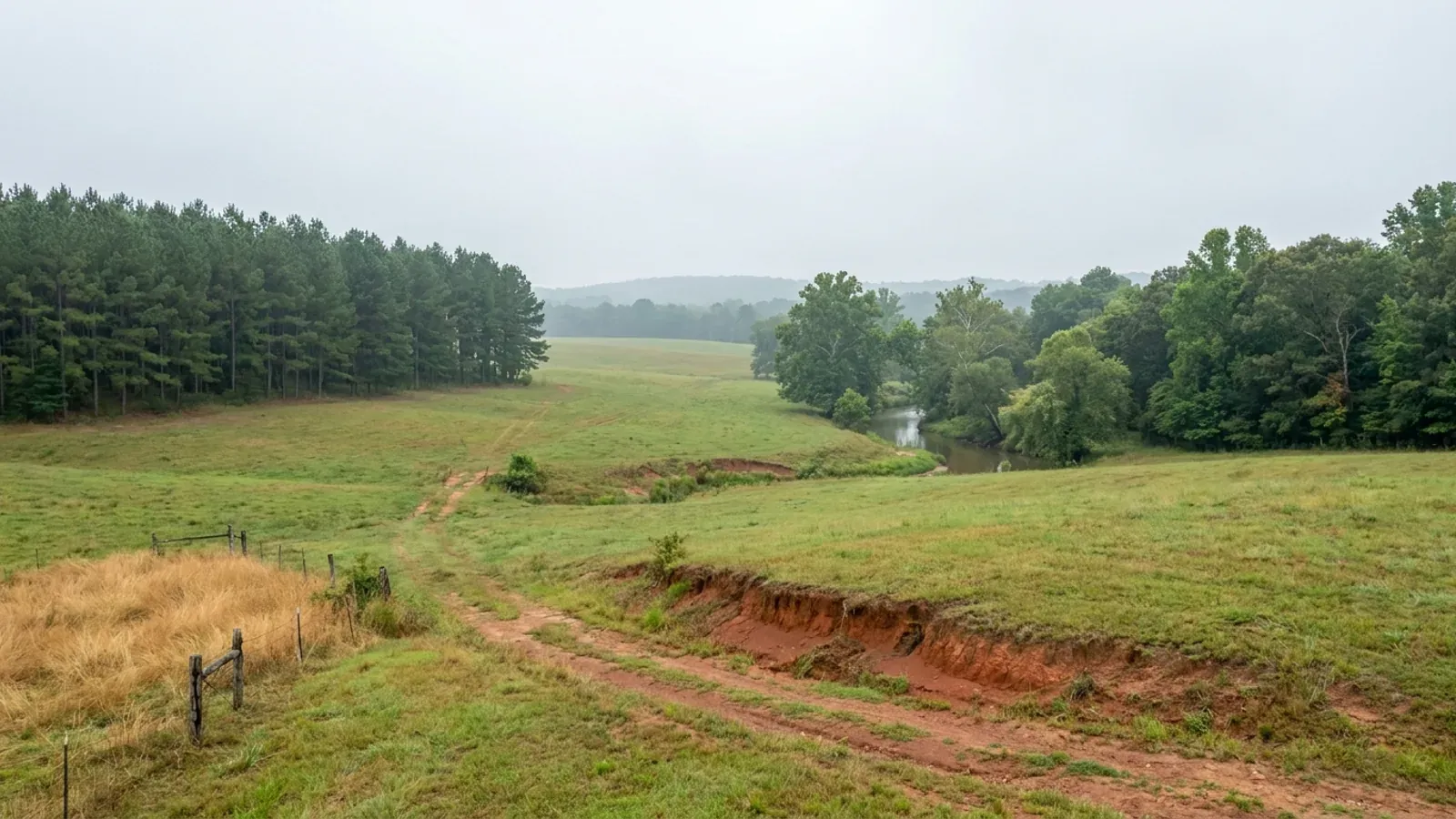
White County covers 1,033.97 square miles — second only to Union among Arkansas counties — and holds 80,085 people at about 78 per square mile, so almost all of it is open country. The Encyclopedia of Arkansas calls it "a microcosm of the state as a whole," and it earns that: the Ozark Escarpment ends in the north-west, the Ouachitas' last east–west ridges rise in the south-west, the Grand Prairie begins south of the Little Red River, and the eastern edge is White River alluvium. That is four different sets of ground in one county, and it changes the foundation, the septic field and the flood answer as you move across it.
White County at a glance
- County
- White County
- Population
- 80,085
- ZIP codes
- 72143, 72010, 72012, 72081, 72121, 72137, 72020, 72136, 72102, 72060, 72045, 72082, 72068, 72085
- Site visits
- White County sits inside our regular central Arkansas coverage, from Beebe and McRae up the US-67/167 corridor through Searcy, Judsonia and Bald Knob and out to Pangburn, Rose Bud and El Paso, so site walks, soil-pit visits and trips to the Searcy inspection counter are ordinary scheduling here rather than a special trip.
Building conditions in White County
The State's code reaches every parcel in Arkansas, including rural and unincorporated land. What is not everywhere is the office that checks it: a city or county is authorised to set up a building department, not required to, and a great deal of rural Arkansas never has. So the first question on any parcel is not what the code says — that part travels — but whether anyone here issues a permit, inspects the work, or publishes the design criteria your drawings still have to satisfy. Where nobody does, the obligation does not go away. It just moves to the appraiser, the insurer, your lender and whoever buys the place from you.
https://www.cityofsearcy.org/s/2025-27-ORDINANCE-Subdivision-Code-Amendments-ETJ.pdf
Also worth knowing before you build in White County
- Four White County towns are outside the flood insurance programme and under sanction
- FEMA's community status data for White County lists sixteen communities. Twelve participate in the National Flood Insurance Program, including unincorporated White County, community 050467, which entered the Regular Program on 1 March 2000 after a flood hazard boundary map dated 7 June 1977 and a first flood insurance rate map dated 1 March 2000. Four do not participate and are recorded as sanctioned: Griffithville, Russell, Rose Bud and West Point. Inside those four town limits federal flood insurance is not written, which reaches the mortgage before it reaches the building. The countywide map in force for every community in White County took effect on 2 May 2012.
- One acre in eight is mapped as frequently flooded
- SSURGO puts 80,339 acres of White County — 12.0% of the county's 666,777 mapped acres — on components rated "Frequent" for flooding, with another 27,772 acres "Occasional" and 5,384 "Rare." The frequently flooded ground is the eastern and central bottoms: Kobel silty clay, frequently flooded, is a single 40,800-acre map unit, Tichnor silt loam adds 24,379 acres and Oaklimeter and Commerce another 23,656 between them. Separately, 163,173 acres of the county — 24.5% — carry a hydric rating. This is the practical shape of the Little Red and White River floodplains, and it is why the eastern third of the county reads as cheap on a per-acre screen and expensive once a finished-floor elevation is priced.
- Bedrock is within reach of a footing on two fifths of the county, and within 17 inches on the Mountainburg soils
- SSURGO records a lithic bedrock restriction on 168,231 acres of White County and a paralithic restriction on a further 112,833 — together 42.2% of the county. The depths matter more than the share. The Mountainburg components, roughly 35,000 acres of the western hills, hit hard sandstone at 30 to 43 centimetres, twelve to seventeen inches down. Linker, the county's most extensive soil, meets rock at 79 to 94 centimetres. Steprock's paralithic contact sits at 69 centimetres. Against the Arkansas Department of Health's requirement of 18 to 36 inches of separation between a trench bottom and bedrock, the Mountainburg ground simply cannot take a conventional field, and a pier or a stepped footing is often cheaper than the rock excavation a full-perimeter footing would need.
- A fragipan sits under 167,682 acres at exactly trench depth
- A quarter of White County — 167,682 acres, 25.1% — has a fragipan, a dense brittle pan that roots and water will not pass. It is not deep. Leadvale's pan begins at 64 centimetres, Calloway's at 64, Sidon's at 64, Taft's at 58 to 61, Guthrie's at 56 and Immanuel's at 84. That is roughly 22 to 33 inches, which is the depth an absorption trench is dug to. A fragipan perches water above itself through winter and spring, which is what the Arkansas Department of Health's rule reads as a seasonal water table in the soil pit, and its sizing charts respond by making the field bigger. On a Leadvale or Calloway site the field is a design problem before it is a cost problem — budget the soil pits early and site the house around the answer, not the other way round.
- The only county sign-off on splitting land here is a 9-1-1 address approval
- White County Ordinance 2012-005, passed 29 March 2012 and amended by Ordinance 2015-018 on 24 February 2015, is codified at § 1120.01 of the county code: "The White County Circuit Clerk will not accept any plat map from a person, firm, corporation, partnership, or other entity until the White County 9-1-1 Office has approved the addresses and/or street name." There is no planning board to approve a plat, no subdivision ordinance and no setback rule — the one county office that has to sign is the 9-1-1 addressing office, and the ordinance carries an emergency clause reciting that the system "would assist emergency services in locating roads and addresses." New address requests go through the Office of Emergency Management at 2301 Eastline Road in Searcy.
- The county judge's published job description is roads, property, veterans, 911 and the budget
- White County's own page for the county judge lists the office's duties: authorising disbursement of appropriated funds, operating the county road system, administering ordinances passed by the quorum court, custody of county property, accepting grants, hiring county employees, and presiding over the quorum court with a veto but no vote. It then adds, in the county's words, that "White County is the second largest land mass in Arkansas with the largest County road system," and lists the rest as "taking care of all county property and facilities, Veterans affairs, 911 dispatch, Department of emergency management and maintaining the County's budget." Building permits, inspections and zoning appear nowhere on that list, and no department on the county's site performs them.
- The county's floodplain role sits inside emergency management, not a building office
- The White County Office of Emergency Management, at 2301 Eastline Road in Searcy, lists "Certified Floodplain Manager" twice on its own page — once under Response and once in its list of Emergency Management Responsibilities, alongside 911 addressing, the hazard mitigation plan, Tier II hazards, fire coordination for thirty White County fire departments and reporting to FEMA and ADEM. That is the shape of floodplain administration in a county with no building department: the National Flood Insurance Program obliges the county to manage development in the mapped floodplain, and the office that does it is emergency management, reachable at 501-279-6277. If a site touches the mapped floodplain, this is the county phone call — and it is the only one a build here generates.
- Four physiographic regions inside one county line
- The Encyclopedia of Arkansas entry for White County states that "Geographically, it is a microcosm of the state as a whole," and then names the parts: "Southwestern White County contains the northeastern-most extension of the Ouachita Mountains and is characterized by east-west trending ridges characteristic of the Ouachitas. The north-central and northwestern parts of the county contain the eastern terminus of the Ozark Escarpment. The southeastern half of the county can be further divided into two regions: in general, the land north of the Little Red River is lowland forests and farmland, and the area south of the Little Red River is the northern terminus of the Grand Prairie." The county's own About page puts it more plainly: "From hill country to plains."
- 1,552 farms, a median of 80 acres, and 538 of them under 50 acres
- The 2022 Census of Agriculture counts 1,552 farms in White County on 376,803 acres — 56.9% of the county — with an average size of 243 acres. The distribution is what matters to somebody looking for a homesite: 78 farms of 1 to 9 acres, 460 of 10 to 49, 573 of 50 to 179, 281 of 180 to 499, 90 of 500 to 999 and 70 at 1,000 acres or more. More than a third of the county's farms are under 50 acres, and 630 of them — 41% — sold less than $2,500 of product in 2022. This is fine-grained ownership by Arkansas standards, and the opposite of the Delta counties east of here where the median farm runs into the hundreds of acres and nothing sells in a homesite size.
- Hay is the biggest crop and poultry is the biggest cheque
- White County's land in farms splits 159,308 acres of cropland, 99,398 of woodland and 94,374 of pastureland, with 56,117 acres irrigated. The top crop by acreage is forage — hay and haylage — at 58,447 acres, with soybeans second at 42,902. But 73% of the county's $236.3 million of 2022 agricultural sales is livestock and poultry, and poultry and eggs alone account for $153.3 million, fourth among all 75 Arkansas counties. That combination — hay ground and poultry houses in the west, row crop in the east — is why the pole barn is the native building type here and why the trades that put up a post-frame shell are already local.
- Searcy publishes the codes it enforces; the county publishes none
- The City of Searcy's Building Codes page lists what its inspectors enforce: the Arkansas Fire Prevention Code, 2021 Edition; NFPA 101 Life Safety Code, 2003 Edition, as adopted by the State of Arkansas; the Arkansas State Plumbing Code, 2018 Edition; the Arkansas State Gas Code, 2018 Edition; the International Mechanical Code, 2021 Edition; the National Electric Code, 2020 Edition, "as currently adopted by the State of Arkansas"; and the city's own zoning code, updated June 2024, and land development and subdivision regulations. Chapter 7 of the city code adopts the state code by reference "as may be adopted by the State of Arkansas and as may be amended from time to time" — a rolling adoption running back to Ordinance No. 336 of 5 February 1952.
- The county code is maintained by an insurance fund and was last updated online in 2018
- White County's code of ordinances carries a publisher's note on its own landing page: "The White County code is updated by the Association of Arkansas Counties Risk Management Fund and hosted online in PDF format by Municode," with online content updated on 29 August 2018. That is worth knowing for two reasons. It explains the shape of the code — it follows the Association's model chapter structure, which is why the planning and zoning article exists as a heading with the state statute under it and nothing else. And it means the codified volume is not a live register: a floodplain management ordinance the county must hold to stay in the National Flood Insurance Program does not appear in it, so ordinance questions here go to the county clerk rather than to the online code.
https://encyclopediaofarkansas.net/entries/white-county-814/
https://www.cityofsearcy.org/cityservices/building-codes-enforced
https://library.municode.com/ar/white_county/codes/code_of_ordinances

The expensive surprises are in the ground, not the building
What moves an Arkansas budget is usually below grade, and the state hands you a different problem depending on where you stand. In the Delta the issue is shrink-swell clay that moves with the season, and it is the reason a wide, light building with a big slab and a big door opening is the shape most at risk. Along the Fall Line there is a second, separate clay belt with nothing to do with the Delta at all. Up in the Ozarks the question inverts: what matters is not what the slab sits in but what is under it, because that limestone is full of solution cavities and the collapses arrive with no prior indication at the surface. And on Crowley's Ridge, where Jonesboro and Paragould sit, it is fine wind-blown loess that stands up in a vertical cut and then erodes out from under whatever you put on it. The same ground decides your wastewater system, which is the gate that most often moves a rural build's schedule — and it is soils that decide it, not the size of the house. So the site work, the foundation and the wastewater get resolved together rather than one at a time. We price the dirt before we price the building.
What we build in White County
All nine services are available in White County. What a build costs depends far more on the parcel than on square footage, so we price against your land rather than publishing a rate card.
Custom Barndominium Plans
Barndominium floor plans, elevations and engineered documents drawn to your parcel — and to the design numbers your Arkansas jurisdiction publishes.
Barndominium Kits
Engineered barndominium shell packages for Arkansas land, drawn to a named jurisdiction's criteria rather than to a national vendor's generic spec.
Turnkey Barndominium Builds
Land through handover under one contract, and a straight answer on what actually gates a barndominium build on rural Arkansas land.
What a build looks like
Three stages every White County project passes through, from a raw parcel to a finished home. Site work first, because that is where the budget is decided.

The parcel
Zoning, setbacks, flood zone and utility access get checked before anything is drawn.
Pad and permit
Clearing, grading and a compacted pad, while the submittal works through whichever office issues the permit where you are building.

Frame to finish
Shell erected and dried in, then systems, insulation and interior finish through to CO.
Those are the rules where you are building in White County. Tell us what you want to build and we will draw it to them.
Where we build around White County
White County and the rural land around it. The buildable acreage for a project this size usually sits outside the city limits, which is frequently what changes who issues your permit.
Keep reading
The questions that usually come next once you know what White County allows.
Barndominium Cost Guide
Sourced per-square-foot ranges by tier and by size, with a calculator built on the same figures.
Read itThe Arkansas Building Code
The code applies statewide, including unincorporated land — but a jurisdiction is only authorized to establish a building department, so on rural residential land there is often no counter at all.
Read itBuying Land in Arkansas
Where acreage is actually purchasable in homesite sizes, and what percolation, slope and the onsite wastewater rule do to a parcel before anything is designed.
Read itNearby areas we build in
Others we cover nearby. One may be a county, another a city inside it — and since March 2025 the soft edge between them is gone, because the cities' extraterritorial jurisdiction was abolished outright and that land reverted to the counties. So the office that issues the permit, the fees it charges, the zoning and whether anyone publishes design criteria at all can differ from one card to the next, and the boundary that decides it may have moved recently.
Building in White County: common questions
9 questions we get asked most often about building in White County. If yours is not on the list, ask it directly.
Do I need a building permit for a barndominium in unincorporated White County?
So what does it cost to permit a barndominium inside Searcy, and how does that compare?
Searcy used to plan a mile outside its limits. What happened to that land?
Is there anything the county does regulate?
What does the ground actually do here — this county seems to change as you cross it?
What will the septic system be like on a rural White County tract?
How much of a flood problem is this, and which parts of the county should I check first?
Can I actually buy a homesite-sized piece of White County, and where?
If nobody inspects the build, what actually protects me?
Building in White County?
Start with the plan. Tell us what you want to build and we will draw it, then confirm which office issues the permit for your parcel, what it will let you put there, and what wind load it has to meet. That conversation costs nothing.