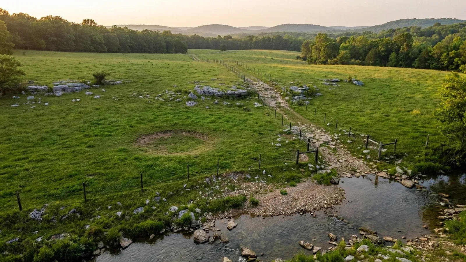
Rolling Ozark upland pasture with limestone ledges, a chert gravel track and a clear spring-fed creek.
Washington County Statewide code, local enforcement optional

Barndominium Builders in Springdale, AR

Springdale is Arkansas's fourth-largest city at about 90,700 people, and it is the only large place in the state that lies in two counties at once: roughly 78,200 residents are in Washington County and about 12,500 are in Benton County. Inside the city limits one Building Department at 201 Spring Street issues the permit either way, prices it on construction valuation rather than square footage, and publishes the whole fee table. Cross the city limit and the answer changes twice over — Washington County zones every unincorporated parcel it has and inspects none of them, Benton County runs its own separate planning board, and since 2025 Springdale itself reaches no further than its own boundary.

Springdale at a glance

County
Washington County
Population
90,685
ZIP codes
72762, 72764, 72766
Site visits
Springdale and the Northwest Arkansas corridor around it sit inside our regular working range, so site walks, soil questions and trips to a permit counter here are routine rather than a special arrangement.

Building conditions in Springdale

The State's code reaches every parcel in Arkansas, including rural and unincorporated land. What is not everywhere is the office that checks it: a city or county is authorised to set up a building department, not required to, and a great deal of rural Arkansas never has. So the first question on any parcel is not what the code says — that part travels — but whether anyone here issues a permit, inspects the work, or publishes the design criteria your drawings still have to satisfy. Where nobody does, the obligation does not go away. It just moves to the appraiser, the insurer, your lender and whoever buys the place from you.

Build conditions for Springdale , Washington County, Arkansas . BUILD CONDITIONS SPRINGDALE, ARWashington CountyONE STATEWIDE CODEADOPTED RESIDENTIAL CODEONE STATEWIDE CODEThis jurisdiction publishes no design wind speed. It is settled in writing with the authority overyour parcel before the frame is ordered.ZONING · A-1 AGRICULTURAL, R-E RESIDENTIAL ES…2 acres in A-1; 1 acre in R-E; 10,00…Chapter 130 of the Springdale Code of Ordinances, the ZoningOrdinance, originally Ordinance No. 3307 of 25 March 2003 and…PLASTIC PERMIT BOX CHARGE ON EVERY BUILDING P…$5.00The city's published permit pages add $5.00 to every building permitfor the plastic permit box, on top of the valuation-based fee —…WHO ISSUES THE PERMITCity of Springdale Building Departme…201 Spring Street, Springdale, Monday to Friday 8:00 a.m. to 5:00p.m., 479-750-8154, Chief Building Official Mike Chamlee; the…
Build conditions for Springdale, drawn from the sourced facts on this page. Every figure above is cited in the quick-facts panel below, with its source and vintage.
Springdale's own building code names two different counties' flood maps
Section 22-32(a) of the Springdale Code of Ordinances fills in the blank the model building code leaves for the flood hazard reference, and it has to name two jurisdictions to do it: 'Sec. 1612.3. insert Benton County, Arkansas and Incorporated Areas, September 18, 1991 and Washington County, Arkansas and Incorporated Areas, December 20, 2000.' One city, one building department, two countywide flood insurance studies with dates nine years apart. No other Arkansas city of any size has to write that sentence.

https://library.municode.com/ar/springdale/codes/code_of_ordinances?nodeId=COOR_CH22BUBURE

86% of Springdale is in Washington County and 14% is in Benton County
The Census Bureau's Vintage 2025 place estimates split Springdale's 90,685 residents between Washington County (FIPS 143) at 78,235 and Benton County (FIPS 007) at 12,450. Nineteen Arkansas places straddle a county line and Springdale is by far the largest; the next biggest, Cherokee Village, is under 5,000. For a north-side parcel that means a different assessor, a different circuit clerk to record the deed, a different county planning board and — the moment the site falls outside the city limit — a different set of county rules entirely.

https://www.census.gov/programs-surveys/popest.html

Springdale prices the building permit on valuation and publishes the whole table
Section 22-32(b) of the city code revises building code Section 109.2 into a five-band schedule: no fee at $1,000 and less unless an inspection is required, then $15 per inspection; $15 for the first $1,000 plus $5 for each additional thousand to $50,000; $260 for the first $50,000 plus $4 per additional thousand to $100,000; $460 for the first $100,000 plus $3 per additional thousand to $500,000; and $1,660 for the first $500,000 plus $2 for each additional thousand above that — a band the city's own web page leaves blank. The same section authorises the department to use the International Code Council's average construction costs per square foot, updated yearly, to set the valuation. Where work starts before the permit is obtained 'the fees herein specified shall be doubled', and a plan-checking fee equal to one-half the building permit fee is payable in addition when the valuation exceeds $1,000.

https://library.municode.com/ar/springdale/codes/code_of_ordinances?nodeId=COOR_CH22BUBURE

Washington County zones every unincorporated parcel it has and inspects none of them
The county's Planning page states that the designated zoning for the entirety of the county's parcels is 'Agricultural/Single-Family Residential, one (1) unit per acre', and in the same breath that the county 'does not enforce building codes for agricultural buildings, single-family homes, or residential accessory structures (such as swimming pools or personal-use storage sheds) in unincorporated areas. As a result, no building permits or inspections are required, and no certificates of occupancy will be issued unless specifically requested.' The current instrument is the Washington County Planning and Zoning Ordinance, Ord. No. 2025-044, which replaced the 2006 zoning ordinance, Ord. No. 2006-66. That is a county which took the planning-board and zoning steps Arkansas law makes optional, and deliberately declined the building-permit step.

https://www.washingtoncountyar.gov/government/departments-f-z/planning

Also worth knowing before you build in Springdale

Springdale sets its own footing depth at 18 inches, in ordinance
Among the amendments in Section 22-32 is a single line that is worth more to a slab designer than anything else the city publishes: 'That Section 1809.4 be revised to set the minimum depth of footings below the undisturbed ground surface to 18 inches.' The statewide residential code floor is 12 inches, so Springdale has gone six inches deeper by local ordinance — the one-way ratchet the Arkansas Fire Prevention Code permits, used. The city publishes no frost-line figure separately; this is the number the ordinance actually states.

https://library.municode.com/ar/springdale/codes/code_of_ordinances?nodeId=COOR_CH22BUBURE

Springdale publishes heating and cooling design temperatures of 0 and 95 degrees
Section 22-67 of the city code, under the energy article, requires insulation to be installed 'in a workmanlike manner to provide a reasonably uniform insulating value over the entire face of the insulated area' and then states: 'For the purpose of calculating heat loss and gain at design condition, the following design temperatures shall be used: Winter 0 degrees F, Summer 95 degrees F.' Section 22-68 adds an attic moisture-control minimum of five-tenths of a cubic foot per minute of net free area per square foot of ceiling, with soffit vents every eight feet on all hip roofs. Those are the Manual J half of the design table filled in by a named Arkansas jurisdiction — something almost no city in the state does.

https://library.municode.com/ar/springdale/codes/code_of_ordinances?nodeId=COOR_CH22BUBURE

Springdale adopted the 2021 code by ordinance in March 2023, and lists what it enforces
Section 22-31 adopts the 2021 Arkansas Fire Prevention Code as the Building Code for the City of Springdale, by Ordinance No. 5816 of 14 March 2023 — the latest in a chain running back through Ord. 4762 of 22 January 2014, Ord. 4270 of 22 October 2008 and Ord. 3295 of 25 February 2003. Section 22-56 adopts the 2014 Arkansas Energy Code by Ordinance No. 4896 of 10 March 2015, and Section 22-91 adopts the 2020 National Electrical Code by Ordinance No. 5773 of 11 October 2022. The Building Department's own published answer names the enforced set as the 2021 AR Fire Prevention Code, 2021 AR Mechanical Code, 2018 AR Plumbing Code, 2018 AR Fuel Gas Code, 2020 National Electric Code, 2014 AR Energy Code and 2017 ICC/ANSI A117.1.

https://www.springdalear.gov/page/building-department

Springdale rewrote its subdivision jurisdiction a week after the ETJ repeal took effect
Section 112-1(c) of the city code now reads, in full: 'Jurisdiction. The jurisdiction of these regulations includes the land within the corporate limits of the City of Springdale.' The citation under it is Ord. No. 6114, § 2, 12 August 2025. Act 314 of 2025 repealed A.C.A. § 14-56-413 outright and abolished municipal extraterritorial jurisdiction in Arkansas, and Springdale — which as a city over 60,000 had held a two-mile ring under the old tiers — amended its own subdivision regulations to match within days rather than leaving the old language on the books. Neither the planning chapter nor the zoning chapter carries a surviving extraterritorial clause.

https://library.municode.com/ar/springdale/codes/code_of_ordinances?nodeId=COOR_CH112SU

Three different documents put three different clocks on a Springdale permit
Section 22-10 of the city code, from Ordinance No. 3313 of 8 April 2003, voids a permit if work is not commenced within twelve months and diligently executed, or if the work is abandoned after it is commenced. Article 2, Section 6 of the Zoning Ordinance says the permit expires if work has not begun within one year and expires again if the work has not been substantially completed within two years, with written notice either way. The Building Department's own posted Time Limitation notice is shorter than both: six months to commence, and a further void if construction is suspended for six months at a time. All three agree on the consequence — a new permit for the unfinished portion — and all three say no refund of the permit price is allowed or applied to another permit.

https://www.springdalear.gov/page/time-limitation

Springdale is one of the few Arkansas cities whose zoning contemplates real acreage
The A-1 Agricultural district requires a lot of not less than two acres for both residential and non-residential use, a minimum lot width of 200 feet on a public street at the front setback line, a density of one unit per two acres, and setbacks of 35 feet front, 35 feet rear and 20 feet on each side. R-E, the Residential Estate district, is described in the ordinance as generally applied to fringe areas of the city 'between the built-up areas of the city and those areas that are agricultural in nature' and requires one acre at 100 feet of width. SF-1, the next step down, is 10,000 square feet at 80 feet of width with a 40 percent building coverage cap. Supplementary Article 6 also keeps poultry farms, egg farms and cattle operations 100 feet off any agricultural or residential district boundary — a rule a poultry-capital city actually needs.

https://library.municode.com/ar/springdale/codes/code_of_ordinances?nodeId=COOR_CH130ZOOR_ART4DIRE

The soil series under Springdale has a fragipan, and its type location is next door in Benton County
The NRCS Official Series Description for CAPTINA sets the series' type location at 'Benton County, Arkansas; 2.5 miles north of Cave Springs on Highway 112' — a few miles from Springdale's own Benton County line. Captina is a Typic Fragiudult: moderately well drained, permeability slow, with the fragipan at 16 to 38 inches, described in the type pedon as very firm and 70 percent brittle with grey iron depletions and clay-filled vesicular pores. The associated ridgetop soil, NIXA, is a Glossic Fragiudult with the fragipan at 14 to 27 inches, 'very slowly permeable', surface runoff high to very high, and 35 to 85 percent chert fragments by volume. A fragipan is a dense pan that water sits on: it perches groundwater under a slab, it slows a percolation test, and it is why an Ozark lot can look dry in August and hold water in March.

https://soilseries.sc.egov.usda.gov/OSD_Docs/C/Captina.html

Springdale's two counties hold 40% of every sinkhole USGS mapped in Arkansas
The USGS data release Sinkholes and Springs of the Ozark Physiographic Province digitised 1,242 sinkholes across 19 Arkansas counties from more than 200 topographic quadrangles published between 1942 and 2014. Benton County accounts for 332 of them and Washington County for 165 — 497 between the two counties Springdale straddles, about 40 percent of the state total. Springdale sits on the Springfield Plateau, whose Boone Formation limestone the Arkansas Geological Survey says contains the majority of karst features in the Ozark Plateaus and more than half the caves in Arkansas. These are mapped counts from old quad sheets, not a risk map, and the Survey's own warning is that a cover-collapse sinkhole 'usually develops in a short period of time with no prior indication of its pending existence'.

https://www.sciencebase.gov/catalog/item/5728fd08e4b0b13d3918aa35

Washington County's split exemptions run on acreage lines, and they are specific
The county's development regulations exempt four kinds of division from the subdivision process: a family split, one per family member with every parcel at least one acre; a 40-acre split, any number of tracts each at least forty acres; a tract split into four parcels, three of at least five acres and one of at least one acre; and a property lotline adjustment between adjoining owners. If a survey shows multiple tracts under five acres, minor subdivision review is required instead. Parcels fronting a public road need at least 100 feet of frontage under five acres and 165 feet at five acres or more; only two parcels may be created without road frontage, and those need a 30-foot easement. Any exempt parcel smaller than twenty acres carries setbacks of 10 feet side, 20 feet rear and 25 feet from street right-of-way, and a survey by an Arkansas-licensed surveyor recorded with the Circuit Clerk.

https://www.washingtoncountyar.gov/government/departments-f-z/planning

In Washington County the 911 address and the perc test are the same conversation
The Planning office states that where a property owner wants a 911 address, county planning requires an approved soil analysis or percolation test to establish that the lot is buildable — so on unincorporated land the septic question is answered before the address exists, not after. It adds that where a 911 address is combined with a public utility connection the Arkansas Department of Health treats the site as a permanent residence, which means holding tanks on RVs, mobile homes and campers are not an accepted disposal method and the structure must be connected to an approved septic system, with thirty working days to install a permitted system after a site inspection if unlawful disposal is found. County Ordinances 1999-26, 2003-37 and 2008-33 require a Health Department permit for an individual sewage disposal system, before installation, on tracts of any size. Floodplain development is separately permitted under Ord. No. 2024-003, on a flood insurance rate map effective 25 January 2024.

https://www.washingtoncountyar.gov/government/departments-f-z/planning/ordinances-and-regulations

The land around Springdale is the most expensive farmland in Arkansas and the most finely divided
USDA NASS puts Benton County's agricultural land at $9,796 per acre, the highest county figure in Arkansas, with Washington County at $7,460. The 2022 Census of Agriculture shows why a homesite is still findable: Benton County has 1,796 farm operations with a median of 50 acres and 49 percent under 50 acres — the finest-grained ownership in the state — and Washington County has 2,099 operations with a median of 60 acres and 44 percent under 50 acres, on 50.1 percent of the county's land. The trade-off is price, and the answer to it is east: Madison County, the third county of the Fayetteville–Springdale–Rogers metro, runs 22.1 people per square mile across 834 square miles with a median farm of 127 acres and population growth of 11.4 percent.

https://www.nass.usda.gov/Publications/AgCensus/2022/index.php

The small print: your contractor licence number goes on the permit, and the porta-potty has a setback
Section 22-8 requires a residential building contractor applying for a permit to include proof of a current Arkansas residential building contractor's licence under A.C.A. § 17-25-501 et seq., or evidence of exemption, and provides that the licence number 'shall be placed upon each residential building permit by the building inspector's office'; the section defines a single family residence as one to four new units for residential occupancy where the project cost is $20,000 or more. Section 22-11 adds a $25.00 re-inspection fee for each extra trip caused by not being ready, not providing access, or non-compliance. Springdale's amendment to Section 3305.1 puts the job-site porta-potty outside the side and rear building setbacks and no closer than five feet to the curb, emptied at least weekly — and provides that on a repeat complaint the Chief Building Official 'shall cease all inspections until the job site complies'. And Section 22-91 adopts the 2020 National Electrical Code with the GFCI requirements of Section 210.8(F) for heating, ventilation and air conditioning expressly excluded.

https://library.municode.com/ar/springdale/codes/code_of_ordinances?nodeId=COOR_CH22BUBURE

An excavator grading a compacted building pad on a cleared lot, with survey stakes and a drainage swale visible.
Below the slab

The expensive surprises are in the ground, not the building

What moves an Arkansas budget is usually below grade, and the state hands you a different problem depending on where you stand. In the Delta the issue is shrink-swell clay that moves with the season, and it is the reason a wide, light building with a big slab and a big door opening is the shape most at risk. Along the Fall Line there is a second, separate clay belt with nothing to do with the Delta at all. Up in the Ozarks the question inverts: what matters is not what the slab sits in but what is under it, because that limestone is full of solution cavities and the collapses arrive with no prior indication at the surface. And on Crowley's Ridge, where Jonesboro and Paragould sit, it is fine wind-blown loess that stands up in a vertical cut and then erodes out from under whatever you put on it. The same ground decides your wastewater system, which is the gate that most often moves a rural build's schedule — and it is soils that decide it, not the size of the house. So the site work, the foundation and the wastewater get resolved together rather than one at a time. We price the dirt before we price the building.

What a build looks like

Three stages every Springdale project passes through, from a raw parcel to a finished home. Site work first, because that is where the budget is decided.

Aerial view of an undeveloped rural lot with cleared grass, an oak and hickory treeline with shortleaf pines, and a pale gravel access track.
Stage one

The parcel

Zoning, setbacks, flood zone and utility access get checked before anything is drawn.

An excavator grading a compacted building pad on a cleared lot, with survey stakes and a drainage swale visible.
Stage two

Pad and permit

Clearing, grading and a compacted pad, while the submittal works through whichever office issues the permit where you are building.

A finished barndominium at dusk with warm interior lighting glowing through its large windows.
Stage three

Frame to finish

Shell erected and dried in, then systems, insulation and interior finish through to CO.

Those are the rules where you are building in Springdale. Tell us what you want to build and we will draw it to them.

Where we build around Springdale

Washington County and the rural land around it. The buildable acreage for a project this size usually sits outside the city limits, which is frequently what changes who issues your permit.

The Springdale service area, including the rural acreage outside the built-up edge, which is where the parcels big enough for a build like this usually sit. The map marks the territory we build in. It is not a branch location, and there is no office at this pin.

Nearby areas we build in

Others we cover nearby. One may be a county, another a city inside it — and since March 2025 the soft edge between them is gone, because the cities' extraterritorial jurisdiction was abolished outright and that land reverted to the counties. So the office that issues the permit, the fees it charges, the zoning and whether anyone publishes design criteria at all can differ from one card to the next, and the boundary that decides it may have moved recently.

Building in Springdale: common questions

9 questions we get asked most often about building in Springdale. If yours is not on the list, ask it directly.

Springdale is in two counties. Which one am I in, and does it change anything?
Springdale is the only large Arkansas city that lies in two counties. The Census Bureau's Vintage 2025 place estimates put 78,235 of its 90,685 residents in Washington County and 12,450 in Benton County — about 86 percent and 14 percent. The county line runs across the north side of the city, so a parcel up there is genuinely in Benton County even though the mailing address, the utilities and the police are Springdale's. Inside the city limits the split changes less than you would expect: one Building Department at 201 Spring Street issues the permit, one zoning ordinance applies, one Certificate of Occupancy is issued, and the fee is the same on either side of the line. What the split does change is everything the county does rather than the city. The assessor who values the property, the circuit clerk who records the deed and the plat, the collector who bills the taxes, the county road department and the county planning board are all different depending on which side of the line you are on. And the city's own building code has to acknowledge it: Section 22-32(a) fills in the flood hazard reference with two entries — Benton County, Arkansas and Incorporated Areas, September 18, 1991, and Washington County, Arkansas and Incorporated Areas, December 20, 2000. The difference becomes decisive the moment your site is outside the city limits, because Washington County and Benton County have taken different roads on planning, and that is where most barndominium sites near Springdale actually are.
Do I need a building permit to build a barndominium in Springdale?
Inside the city limits, yes, and Springdale runs a full process. The Building Department at 201 Spring Street issues building, electrical, mechanical, plumbing, sign, moving and demolition permits, reviews plans before permits are issued, notifies the contractor or owner of problems before construction, and issues the Certificate of Occupancy after final inspection. Article 2, Section 4 of the Zoning Ordinance is blunt about it: no building or other structure shall be erected, moved, added to or structurally altered without a permit from the building inspection department. The application must be accompanied by plot or site plans in duplicate, drawn to scale, showing the lot's actual dimensions and shape, the exact size and location of anything already on it, and the location and dimensions of what you propose; one marked copy comes back to you signed by the building inspector. A separate certificate of zoning compliance is issued by the planning and community development division director, and occupying without one is a violation in its own right. The residential application asks for heated square feet, garage square feet, total square feet, approximate construction cost, and a named plumber, electrician and heating-and-air contractor, and all residential applications must include an Erosion Control Plan form. Because a barndominium used as a dwelling is a detached one-family dwelling under the residential volume of the Arkansas Fire Prevention Code, and its shop is an accessory structure to that dwelling, the whole building sits inside this process — the metal skin does not move it into a different code.
What does a building permit actually cost in Springdale?
Springdale is one of the few Arkansas cities that publishes this, and it prices on construction valuation rather than floor area. Section 22-32(b) of the city code sets the schedule: $1,000 and less carries no fee unless an inspection is required, in which case $15 per inspection; $1,000 to $50,000 is $15 for the first $1,000 plus $5 for each additional thousand or fraction; $50,000 to $100,000 is $260 for the first $50,000 plus $4 for each additional thousand; $100,000 to $500,000 is $460 for the first $100,000 plus $3 for each additional thousand; and $500,000 and up is $1,660 for the first $500,000 plus $2 for each additional thousand. The valuation itself comes from the International Code Council's average construction cost tables, which the ordinance authorises the department to use and which are updated yearly. The city works its own example: a 2,000 square foot dwelling at an ICC rate of $94.06 per square foot of heated space gives $188,120, rounded up to $189,000, which is $460 plus $267 — a $727.00 permit fee, plus $5.00 for the plastic permit box, $732.00 total. Three additions matter. When the valuation exceeds $1,000 and plans must be submitted, a plan-checking fee equal to one-half the building permit fee is payable on top. Starting work before the permit issues doubles the fees, and paying the double fee does not excuse compliance. And a $25.00 re-inspection fee applies to each extra trip caused by not being ready, not providing access or not complying. Moving a building is $100.00, and demolition is $50.00 up to 100,000 cubic feet.
My site is outside the Springdale city limits. What applies then?
That depends on which county, and the two answers are different in an interesting way. In unincorporated Washington County, zoning applies everywhere and building inspection applies nowhere. The county's Planning page states that the designated zoning for the entirety of the county's parcels is Agricultural/Single-Family Residential, one unit per acre, under the Planning and Zoning Ordinance No. 2025-044, with everything else available through the Conditional Use Permit process — and in the same answer, that the county does not enforce building codes for agricultural buildings, single-family homes or residential accessory structures in unincorporated areas, so no building permits or inspections are required and no certificates of occupancy will be issued unless specifically requested. What the county does administer is real: subdivision and lot-split review, large scale developments over an acre, 911 addressing, floodplain development permits under Ordinance No. 2024-003 on a flood insurance rate map effective 25 January 2024, septic permits through the Health Department under Ordinances 1999-26, 2003-37 and 2008-33, and cell towers, house moving and gated communities. On the Benton County side the planning board is separate, with its own applications, schedule and fee structure, and it absorbed the former municipal planning areas around Northwest Arkansas's cities when extraterritorial jurisdiction was abolished in 2025. In neither county is there a building official to fill in the code's climatic and geographic design table, review your plans or inspect your footings — which is exactly why the design documentation, the soils report and the engineer's involvement carry more weight on unincorporated land, not less.
Springdale had an extraterritorial jurisdiction. What happened to it?
It is gone, and unusually for an Arkansas city, Springdale's own documents were brought into line almost immediately. Act 314 of 2025 repealed A.C.A. § 14-56-413 in its entirety and abolished municipal extraterritorial planning jurisdiction in Arkansas. Under the repealed tiers a city of 60,000 to 150,000 — which Springdale is — administered and enforced planning ordinances up to two miles beyond its corporate limits. The act also repealed § 14-17-208(i), which had given a city subdivision jurisdiction in adjoining unincorporated areas, and § 17-28-305(b)(3), which had let a city extend electrical permit and inspection jurisdiction into the same ring by city-county agreement. Springdale's response is on the face of its code: Section 112-1(c) now says the jurisdiction of the subdivision regulations 'includes the land within the corporate limits of the City of Springdale', and the citation under it is Ordinance No. 6114, Section 2, dated 12 August 2025. Neither the planning chapter nor the zoning chapter carries a surviving extraterritorial clause. That matters practically because the old ring is precisely where the buildable acreage around Springdale sits. Land in it now answers to Washington County or Benton County alone, and any guidance written before 2025 — including handouts some Arkansas cities still post — describes a jurisdiction that no longer exists. The other half of the change is annexation: with no planning bridge into the ring, a city that wants to shape a growth area has to annex it outright, and Springdale's zoning ordinance carries a dedicated annexation section for exactly that.
Does Springdale publish wind speed, snow load and seismic design numbers?
Partly, and the honest answer is more useful than a borrowed number. Arkansas prints the residential code's climatic and geographic criteria table blank and leaves the local jurisdiction to fill it in, and most Arkansas jurisdictions never do. Springdale publishes no design wind speed, no ground snow load, no seismic design category, no weathering class, no termite class and no ice-barrier answer. What it does publish, in ordinance rather than on a handout, are two numbers of its own. Section 22-32 revises building code Section 1809.4 to set the minimum depth of footings below the undisturbed ground surface at 18 inches — six inches deeper than the statewide residential floor of 12 inches. And Section 22-67 states that for calculating heat loss and gain at design condition the design temperatures shall be 0 degrees Fahrenheit in winter and 95 degrees Fahrenheit in summer, with Section 22-68 requiring attic ventilation of five-tenths of a cubic foot per minute of net free area per square foot of ceiling and soffit vents every eight feet on all hip roofs. The city of Rogers, twenty minutes north, does publish a full block — 15 psf ground snow, 105 mph wind, seismic category B, 18-inch frostline, air freezing index 517 — but those are Rogers's figures adopted for Rogers, and using them on a Springdale drawing would be attaching a number to the wrong jurisdiction. For a Springdale site the wind speed is what the designer derives from the code's own maps and ASCE 7 and the Chief Building Official accepts. One thing that is settled statewide: the 2014 Arkansas Energy Code puts Benton and Washington among only twelve Arkansas counties in Climate Zone 4, so Springdale is Zone 4 on both sides of the county line.
Can I actually buy acreage in or near Springdale?
Springdale itself is a dense city — about 90,700 people at roughly 1,822 per square mile — so the honest framing is that most of what is inside the limits is platted subdivision, not acreage. But Springdale's zoning is unusual among big Arkansas cities in that it keeps a real acreage ladder on the books. The A-1 Agricultural district requires a minimum lot of two acres for residential and non-residential use, a lot width of 200 feet at the front setback line and a density of one unit per two acres, with 35-foot front and rear setbacks and 20 feet on each side; it permits single-family dwellings, agriculture and animal husbandry by right. R-E, the Residential Estate district, requires one acre at 100 feet of width and is described in the ordinance as the fringe district between the built-up city and land that is agricultural in nature. SF-1 is the next step down at 10,000 square feet. Realistically, though, the acreage is outside the limits, and Northwest Arkansas has the most expensive farmland in the state: USDA NASS puts Benton County at $9,796 per acre, the highest county figure in Arkansas, and Washington County at $7,460. The compensation is that the ownership is finely divided — Benton County's median farm is 50 acres and Washington County's is 60, with 49 and 44 percent of operations under 50 acres respectively. If price is the constraint, the researched answer is east: Madison County is the third county of this metro, 834 square miles at 22.1 people per square mile with a median farm of 127 acres and 11.4 percent population growth. Beyond it, Carroll County at 46.5 per square mile and 61.4 percent in farms is where the money is going next.
What is the ground like around Springdale, and what does it do to a foundation?
Two things define it, and they work against each other. The first is karst. Springdale sits on the Springfield Plateau, underlain by the Boone Formation limestone, which the Arkansas Geological Survey says contains the majority of karst features in the Ozark Plateaus region and more than fifty percent of the caves in the state. USGS digitised 1,242 sinkholes across nineteen Arkansas counties from old topographic quadrangles: Benton County has 332 and Washington County 165, about 40 percent of the state total between Springdale's two counties. The failure mode the Survey describes is the one that matters — clay-rich overburden bridges a subsurface cavity for years, then a cover-collapse sinkhole 'usually develops in a short period of time with no prior indication of its pending existence', often after prolonged wet and dry swings. The second is the fragipan. The Captina series, whose NRCS type location is 2.5 miles north of Cave Springs in Benton County, is a Typic Fragiudult: moderately well drained, slow permeability, with a very firm, seventy percent brittle pan at 16 to 38 inches. On the ridgetops the Nixa series is very slowly permeable with the pan at 14 to 27 inches and 35 to 85 percent chert by volume. A fragipan perches water above itself, which means surface drainage, downspout runouts and slab edge detailing matter more here than the clay content alone suggests — and it is why a percolation test in this ground can fail on a lot that looks perfectly dry in summer. The statewide onsite wastewater rule adds one karst-specific line: wastewater collection, treatment and renovation facilities must be at least 100 feet from any sinkhole, which on a small Ozark parcel can consume a real share of the usable drainfield.
If neither county inspects my build, what still applies?
More than most buyers expect. The Arkansas Department of Labor and Licensing states on its Contractors Licensing Board's Building Codes page that the Arkansas Building Code is adopted by the State Fire Marshal's office, is part of the Fire Prevention Code, and applies statewide, even in rural and unincorporated areas. What is usually missing outside a city is not the code — it is the counter, the plan review, the inspection sequence and the certificate of occupancy, because every one of those provisions in the residential volume addresses itself to a building official the county has never appointed. Meanwhile the requirements with a named enforcer do not stop at the city limit. Electricians, plumbers and HVACR mechanics are licensed by the State of Arkansas everywhere, and the agricultural carve-outs in those statutes are drafted to stop at a dwelling — the electrical exemption reaches a 'nonresidential farm building', which a barndominium is not, and the plumbing exemption requires the building's primary use to be agricultural and is defeated by a connection to a public or rural water system. Washington County's zoning, subdivision, large-scale-development, floodplain, 911 addressing and septic rules all apply on unincorporated land, and the county's own materials make the perc test a precondition of getting an address at all. Inside Springdale, Section 22-8 puts your residential building contractor's Arkansas licence number on the face of the permit. And commercially, where nobody inspects, the appraiser, the lender and the insurer become the inspection regime — which makes an engineered, documented, photographed build worth more on this ground, not less.

Building in Springdale?

Start with the plan. Tell us what you want to build and we will draw it, then confirm which office issues the permit for your parcel, what it will let you put there, and what wind load it has to meet. That conversation costs nothing.