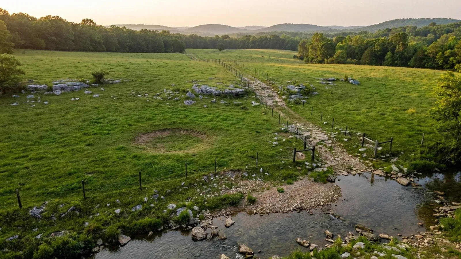
Rolling Ozark upland pasture with limestone ledges, a chert gravel track and a clear spring-fed creek.
Washington County Statewide code, local enforcement optional

Barndominium Builders in Fayetteville, AR

Fayetteville is one of only two Arkansas cities over 100,000 people, and it writes the most detailed development code in the state: a Unified Development Code that fills in its own footing depths, caps a workshop at half the size of the house, maps every slope over 15 percent into a hillside overlay, and will not issue a certificate of occupancy on a new dwelling until an independent energy rater has scored it. It is also 106,623 people at roughly 1,947 to the square mile inside 54.8 square miles, which means the honest answer on land is that the acreage is not inside the limits. Since 2025 the city reaches no further than its own boundary, so a site a mile out is a Washington County question — and a genuinely affordable one is a Madison or Carroll County question.

Fayetteville at a glance

County
Washington County
Population
106,623
ZIP codes
72701, 72703, 72704
Site visits
Fayetteville and the Northwest Arkansas corridor around it sit inside our regular working range, so site walks, slope and soil questions and trips to the Development Services counter here are routine rather than a special arrangement.

Building conditions in Fayetteville

The State's code reaches every parcel in Arkansas, including rural and unincorporated land. What is not everywhere is the office that checks it: a city or county is authorised to set up a building department, not required to, and a great deal of rural Arkansas never has. So the first question on any parcel is not what the code says — that part travels — but whether anyone here issues a permit, inspects the work, or publishes the design criteria your drawings still have to satisfy. Where nobody does, the obligation does not go away. It just moves to the appraiser, the insurer, your lender and whoever buys the place from you.

Build conditions for Fayetteville , Washington County, Arkansas . BUILD CONDITIONS FAYETTEVILLE, ARWashington CountyONE STATEWIDE CODEADOPTED RESIDENTIAL CODEONE STATEWIDE CODEThis jurisdiction publishes no design wind speed. It is settled in writing with the authority overyour parcel before the frame is ordered.ZONING · R-A RESIDENTIAL-AGRICULTURAL, RSF-.5…2 acres in R-A; 71,438 square feet i…Chapter 161 of the Unified Development Code. The whole chapter wasrepealed and re-enacted by Ordinance No. 6945, adopted 16 December…WATER, WASTEWATER, FIRE AND POLICE IMPACT FEE…$5,670 water and wastewater, plus $1…The city's published fee tables set water and wastewater impact feesfor an average single-family dwelling at $2,672 water and $2,998…WHO ISSUES THE PERMITCity of Fayetteville Building Safety…Development Services Building, 125 West Mountain Street,Fayetteville; Building Safety 479-575-8238, Planning 479-575-8267,…
Build conditions for Fayetteville, drawn from the sourced facts on this page. Every figure above is cited in the quick-facts panel below, with its source and vintage.
Fayetteville writes its own footing depth into ordinance, and it is 24 inches
UDC 173.02(B)(2)(a) is the most useful thing any Arkansas jurisdiction publishes about foundations, and almost nobody knows it is there. The footing bottoms shall be a minimum of 24 inches below finish grade. The minimum width of a concrete footing for a one-storey building of 1,400 square feet or less is 18 inches; for two-storey buildings and buildings over 1,400 square feet it is 24 inches. Reinforcement is two #4 bars in an 18-inch footing and three #4 in a 24-inch footing, tied perpendicular at no more than 24 inches on centre, supported three inches off the bottom at no more than six feet. Footing thickness is a minimum of 12 inches of 3,000 psi concrete, a concentrated-load pad is 24 by 24 by 12 inches with a mat of four #4s, and slabs on grade must sit at least eight inches above the surrounding finish grade at 3,000 psi minimum. The alternative in every case is a design sealed by an Arkansas registered architect or engineer. The residential code's statewide floor is 12 inches; Fayetteville has doubled it by local ordinance.

https://library.municode.com/ar/fayetteville/codes/code_of_ordinances?nodeId=CD_ORD_TITXVUNDECO_CH173BURE

In Fayetteville the shop may not be more than half the size of the house
UDC 164.02(A)(5): any accessory structure shall be 50 percent or less of the size of the principal structure, and anything larger 'shall be allowed only as a conditional use', granted under Chapter 163 and only on a finding that the structure is designed to be compatible with the principal structure and with those on surrounding properties. Accessory structures that exceed 50 percent must also meet the full setback requirements of the district rather than the reduced accessory setbacks. No Fayetteville zoning district permits a workshop larger than the dwelling by right. For this building type that is the single most consequential line in the code, because the usual barndominium proportion — a modest living end and a large shop — inverts the ratio the ordinance assumes. The conditional use application is a published fee and a public hearing, not a counter transaction.

https://library.municode.com/ar/fayetteville/codes/code_of_ordinances?nodeId=CD_ORD_TITXVUNDECO_CH164SUZORESPDERE_164.02ACSTUS

You cannot build the shop first and live in it while you finish the house
UDC 164.02(A)(1): no accessory structure shall be erected on any property prior to the construction of the principal structure unless the accessory structure has been approved by the Planning Commission as a conditional use — and 'an approved accessory structure erected prior to the principal structure shall not be inhabited.' That closes the most common way people phase a metal-building home: put up the pole barn, finish an apartment inside it, live there while the rest is built. Inside Fayetteville the sequence has to run the other way, or through the Planning Commission first. Accessory structures 10 feet or less in height get reduced setbacks of 3 feet at the side and 5 feet at the rear; anything taller takes the full district setbacks, which in R-A means 20 feet side and 35 feet rear.

https://library.municode.com/ar/fayetteville/codes/code_of_ordinances?nodeId=CD_ORD_TITXVUNDECO_CH164SUZORESPDERE_164.02ACSTUS

Fayetteville prices a residential building permit at $4.59 per $1,000 of valuation
The city's published Development Services fee table sets the Residential Building Permit at $4.59 per $1,000 of valuation with a $55 minimum, using the higher of the declared valuation and the current Building Data Valuation; a commercial permit is $6.32 and a miscellaneous permit $10.94 on the same basis. Electrical is $2.03 per $1,000, gas $2.03, mechanical $3.31 and plumbing $3.04, each with a $55 minimum. A plan review fee of 50 percent of the permit fee is collected before review begins, and a Craft Education Program charge of fifty cents per $1,000 of valuation rides on top. Residential plan review resubmittal after the second submittal is $100, a residential plan revision after the permit issues is $250, a residential footing-and-foundation-only permit is $83 and a residential temporary certificate of occupancy is $175 for 30 days. Reinspection is $125, payable before the next inspection. Starting work before the permit issues triples the fee with a $250 minimum penalty, and UDC 159.01(B)(11)(e)(iv) adds that paying the triple fee does not excuse compliance.

https://www.fayetteville-ar.gov/301/Fees

Also worth knowing before you build in Fayetteville

Fayetteville maps every slope over 15 percent into an overlay that outranks the zoning under it
The UDC definitions chapter defines the Hillside/Hilltop Overlay District as 'Lands located within the city that generally have slopes in excess of 15%', shown on the city's official zoning map, and states that 'the development regulations in the Hillside/Hilltop Overlay District supercede the underlying zoning district'. Height inside it is measured differently from everywhere else in the city — from the lowest point of the structure at the historic grade, before any development, to the highest point, and from historic grade even where the building sits on a graded pad. The overlay pulls in a grading review for any parcel inside its boundary, and where a parcel is split by the boundary only the portion inside it is caught. Arkansas publishes no statewide slope trigger of any kind; this 15 percent line is Fayetteville's own, and Fayetteville is one of very few Arkansas cities with a mapped hillside district at all.

https://library.municode.com/ar/fayetteville/codes/code_of_ordinances?nodeId=CD_ORD_TITXVUNDECO_CH151DE_151.01DE

In the hillside overlay a dwelling's foundation plans must be sealed, and the shop's need not be
UDC 173.02(B)(2)(b) carves out a separate foundation rule for the overlay: 'A builder of a single-family residence, duplex or other residential, commercial or institutional structure not within a preliminary plat or large scale development shall have the foundation plans designed, approved and sealed by a professional engineer or architect. Accessory structures that do not serve as dwelling units are exempt from this foundation requirement.' On a barndominium that distinction lands squarely on the line between the two halves of the building: the living end is a dwelling and needs the seal, a detached shop that is not a dwelling unit does not. It is also the clearest statement in Arkansas that a jurisdiction expects an engineer on sloping ground rather than a prescriptive table.

https://library.municode.com/ar/fayetteville/codes/code_of_ordinances?nodeId=CD_ORD_TITXVUNDECO_CH173BURE

Cut and fill on a Fayetteville hillside has published numbers: 33 percent, 50 percent, 100 feet and 10 feet
UDC 169.06(C) sets a finish grade on cut or fill slopes no steeper than 33 percent, three horizontal to one vertical, unless the City Engineer approves otherwise — and inside the Hillside/Hilltop Overlay District no steeper than 50 percent, two horizontal to one vertical. The maximum length of any cut or fill slope without a terrace is 100 feet measured along the ground, and the terrace must be at least 6 feet wide. Any retaining wall over 4 feet in height must be designed by an Arkansas registered professional engineer and field inspected by that same design engineer, who must certify the wall was built to the design; the City Engineer may require engineering on walls under 4 feet. All proposed rock cuts, and any cut or fill of 10 feet or more, require a geotechnical investigation and a formal report from a registered professional engineer. On Ozark ground that regularly means a pad, a wall and a report before a slab is poured.

https://library.municode.com/ar/fayetteville/codes/code_of_ordinances?nodeId=CD_ORD_TITXVUNDECO_CH169PHALLA

No certificate of occupancy in Fayetteville without an independent HERS rating, and a label on the front door
UDC 173.07(B)(1) amends the energy code with a requirement almost no other Arkansas city imposes: 'The City of Fayetteville requires that all new residential construction have a Home Energy Rating System (HERS) Index rating completed by an independent RESNET certified home energy rater, or equivalent, prior to the issuance of a Certificate of Occupancy.' Where a development repeats the same floor plan, at least 20 percent of the units must be rated. Subsection (2) then requires a label supplied by the city to be posted in a very visible location near the front entrance showing the estimated monthly utility cost derived from that rating, and to stay there until the structure is sold or for at least ninety days, whichever is less. Additions, alterations and renovations must meet the energy code but are not rated or labelled. For a metal-skinned building in Climate Zone 4 that makes the thermal-bridging detail at the girts and purlins a certificate-of-occupancy issue, not a comfort preference.

https://library.municode.com/ar/fayetteville/codes/code_of_ordinances?nodeId=CD_ORD_TITXVUNDECO_CH173BURE

Fayetteville runs a same-day permit desk, and a barndominium is disqualified from it on four counts
The Building Safety Division routes qualifying projects submitted before 2 p.m. for same-day review, and publishes both the qualifying list — fences over 7 feet, sheds and storage buildings, window and door replacement, porch and patio covers, pools, decks, detached garages and carports, solar panels, and single-family dwellings and accessory dwelling units — and the disqualifying factors that push a project back into regular review. Those are the Hillside/Hilltop Overlay District, floodplain, anything over 1,200 square feet proposed, a proposed driveway, Planned Zoning District zoning, and attached garages. A barndominium on acreage typically trips four of the six at once. The page also asks that the 911 address already be assigned and live in the city's GIS before an application goes in.

https://www.fayetteville-ar.gov/4492/Same-Day-Permit-Process

1,200 square feet of impervious area is the number that pulls in the grading and tree reviews
Two separate chapters use the same threshold. UDC 169.03(A) requires grading review for construction of greater than 1,200 square feet of impervious area on a single site, and for anything inside the Hillside/Hilltop Overlay District boundary regardless of size. UDC 167.04(A)(11) applies tree preservation to all permit applications for developments of greater than 1,200 square feet of impervious area, with an abbreviated tree preservation plan filed with the building permit and an express bar on land disturbance, grading or tree removal until that plan is approved and the tree protection measures are inspected on site. Inside the hillside overlay the 1,200 square foot exemption disappears entirely and all of the tree provisions apply. Table 1 sets the minimum canopy to be preserved at 25 percent in R-A, RSF-.5, RSF-1 and RSF-4, and 20 percent in RSF-2. A barndominium footprint plus its driveway clears 1,200 square feet without trying.

https://library.municode.com/ar/fayetteville/codes/code_of_ordinances?nodeId=CD_ORD_TITXVUNDECO_CH167TRPRPR_167.04TRPRPRDUDE

Fayetteville's planning jurisdiction is now one sentence long, and it was rewritten in January 2026
UDC 150.04 Jurisdiction now reads, in full: 'The city's planning jurisdiction is the area within the corporate boundaries. The city's planning jurisdiction does not extend to properties held by federal, state, or county entities.' The citation under it ends with Ordinance No. 6965, section 1, dated 20 January 2026. Act 314 of 2025 repealed A.C.A. 14-56-413 outright and abolished municipal extraterritorial planning jurisdiction in Arkansas; under the repealed tiers a city of Fayetteville's size held a planning ring reaching miles into the county. Neighbouring Springdale amended its own subdivision regulations to match within days, in August 2025; Fayetteville took until the following January to rewrite the jurisdiction section of its code. The city's own Planning Division web page still describes the division as managing development 'within the City of Fayetteville and the planning area surrounding the corporate city limits' and reviewing applications 'inside the Fayetteville city limits and planning area' — the ordinance has caught up and the website has not, which is worth knowing before relying on any handout about land outside the limits.

https://library.municode.com/ar/fayetteville/codes/code_of_ordinances?nodeId=CD_ORD_TITXVUNDECO_CH150GEPR_150.04JU

Fayetteville repealed and replaced its entire zoning chapter in December 2025
The editor's note at the head of UDC Chapter 161 records that Ordinance No. 6945, adopted 16 December 2025, repealed the former sections 161.01 through 161.33 and 161.35 through 161.38 and enacted a new chapter in their place, ending a chain of amendments running back to the 1965 code. Every district in the city — R-A through the downtown form-based districts — carries that same December 2025 citation. The pace has not slowed since: Ordinance No. 7020, adopted 4 August 2026, cut the minimum lot width for residential dwellings from 18 feet to 12 feet in five districts, and Ordinances 7010 and 7028 rewrote the data centre rules twice in the same year. The code is codified through Ordinance No. 6986 of 17 March 2026 at Supplement 41, and the fee table on the city's own website already runs ahead of the codified chapter because Ordinance No. 6998 amended Chapter 159 in May 2026.

https://library.municode.com/ar/fayetteville/codes/code_of_ordinances?nodeId=CD_ORD_TITXVUNDECO_CH161ZORE

The soil series named for this valley floor was established in Washington County in 1970
The NRCS Official Series Description for RAZORT gives its type location as 'Washington County, Arkansas; SE1/4NE1/4SE1/4 sec. 33, T. 17 N., R. 31 W. Type location is on north side of Hamestring Creek', and records the series as established in Washington County in 1970. Razort is a fine-loamy Mollic Hapludalf: very deep, well drained, moderate permeability, formed in silty alluvium on level or nearly level flood plains and low terraces at 0 to 3 percent slopes, with a gravelly 2C horizon around 54 inches carrying about 55 percent gravel. The description ends the drainage paragraph with the sentence that matters: 'These soils may be flooded for brief periods.' That is the bottomland along the West Fork and the White River south and east of the city, and it behaves nothing like the ridge above it — where the Captina and Nixa series carry a fragipan at 16 to 38 and 14 to 27 inches that perches water instead of draining it.

https://soilseries.sc.egov.usda.gov/OSD_Docs/R/Razort.html

Washington County holds 165 of Arkansas's 1,242 mapped sinkholes, and zones every parcel it has
The USGS data release Sinkholes and Springs of the Ozark Physiographic Province digitised 1,242 sinkholes across 19 Arkansas counties from more than 200 topographic quadrangles published between 1942 and 2014; Washington County accounts for 165 of them, and Benton County next door for 332. Fayetteville sits on the Springfield Plateau, whose Boone Formation limestone the Arkansas Geological Survey says contains the majority of karst features in the Ozark Plateaus and more than half the caves in Arkansas. The Survey's warning about the failure mode is the one to build around: a cover-collapse sinkhole 'usually develops in a short period of time with no prior indication of its pending existence'. Outside the city limits, Washington County's own Planning page states that the designated zoning for the entirety of the county's parcels is Agricultural/Single-Family Residential at one unit per acre, and that the county does not enforce building codes for agricultural buildings, single-family homes or residential accessory structures — no permits, no inspections, no certificates of occupancy unless one is specifically requested. Zoning everywhere, inspection nowhere.

https://www.sciencebase.gov/catalog/item/5728fd08e4b0b13d3918aa35

Every stream in Fayetteville carries a 50-foot protection zone, and steep banks widen it
UDC 168.12 establishes streamside protection zones on all surface waters on the adopted Protected Streams Map and on any surface water where FEMA has established a floodway. Zone 1, the waterside zone, extends at least 25 feet landward from the top of bank in each direction. Zone 2, the management zone, begins at the outer edge of Zone 1 and runs another 25 feet, so 'the combined width of Zones 1 and 2 shall be no less than 50 feet from the top of bank on all sides of the surface water', widened further where the floodway extends past it. And the same 15 percent slope figure that defines the hillside overlay reappears here: slope is calculated at the upstream and downstream property lines, and at 100-foot increments where a property has more than 100 feet of stream frontage, and 'when slope calculations are equal to or greater than 15%, the width of the waterside zone shall be extended by an additional 20 feet at that point.' Land annexed after Ordinance No. 5390 of 1 March 2011 picks the zones up automatically on annexation.

https://library.municode.com/ar/fayetteville/codes/code_of_ordinances?nodeId=CD_ORD_TITXVUNDECO_CH168FLDAPRCO_168.12STPRZO

This is the most expensive ground in Arkansas, and the answer to it is one county east
USDA NASS puts Benton County's agricultural land at $9,796 per acre, the highest county figure in Arkansas, with Washington County at $7,460 — first and second in the state. Washington County has 2,099 farm operations across 50.1 percent of its land with a median farm of 60 acres; Benton has 1,796 with a median of 50, the finest-grained ownership in Arkansas. Fayetteville itself is 106,623 people on 54.8 square miles at about 1,947 to the square mile, so the platted city is not where acreage is. Madison County is the third county of this same metropolitan area and the whole of its ring: 834 square miles at 22.1 people per square mile, growing 11.4 percent, with a median farm of 127 acres and 44.2 percent of its land in farms. Carroll County, contiguous with Benton and in no metropolitan area at all, runs 61.4 percent in farms with a median farm of 120 acres at 46.5 people per square mile. Those two counties are where a Fayetteville buyer who wants land actually ends up.

https://www.nass.usda.gov/Publications/AgCensus/2022/index.php

An excavator grading a compacted building pad on a cleared lot, with survey stakes and a drainage swale visible.
Below the slab

The expensive surprises are in the ground, not the building

What moves an Arkansas budget is usually below grade, and the state hands you a different problem depending on where you stand. In the Delta the issue is shrink-swell clay that moves with the season, and it is the reason a wide, light building with a big slab and a big door opening is the shape most at risk. Along the Fall Line there is a second, separate clay belt with nothing to do with the Delta at all. Up in the Ozarks the question inverts: what matters is not what the slab sits in but what is under it, because that limestone is full of solution cavities and the collapses arrive with no prior indication at the surface. And on Crowley's Ridge, where Jonesboro and Paragould sit, it is fine wind-blown loess that stands up in a vertical cut and then erodes out from under whatever you put on it. The same ground decides your wastewater system, which is the gate that most often moves a rural build's schedule — and it is soils that decide it, not the size of the house. So the site work, the foundation and the wastewater get resolved together rather than one at a time. We price the dirt before we price the building.

What a build looks like

Three stages every Fayetteville project passes through, from a raw parcel to a finished home. Site work first, because that is where the budget is decided.

Aerial view of an undeveloped rural lot with cleared grass, an oak and hickory treeline with shortleaf pines, and a pale gravel access track.
Stage one

The parcel

Zoning, setbacks, flood zone and utility access get checked before anything is drawn.

An excavator grading a compacted building pad on a cleared lot, with survey stakes and a drainage swale visible.
Stage two

Pad and permit

Clearing, grading and a compacted pad, while the submittal works through whichever office issues the permit where you are building.

A finished barndominium at dusk with warm interior lighting glowing through its large windows.
Stage three

Frame to finish

Shell erected and dried in, then systems, insulation and interior finish through to CO.

Those are the rules where you are building in Fayetteville. Tell us what you want to build and we will draw it to them.

Where we build around Fayetteville

Washington County and the rural land around it. The buildable acreage for a project this size usually sits outside the city limits, which is frequently what changes who issues your permit.

The Fayetteville service area, including the rural acreage outside the built-up edge, which is where the parcels big enough for a build like this usually sit. The map marks the territory we build in. It is not a branch location, and there is no office at this pin.

Nearby areas we build in

Others we cover nearby. One may be a county, another a city inside it — and since March 2025 the soft edge between them is gone, because the cities' extraterritorial jurisdiction was abolished outright and that land reverted to the counties. So the office that issues the permit, the fees it charges, the zoning and whether anyone publishes design criteria at all can differ from one card to the next, and the boundary that decides it may have moved recently.

Building in Fayetteville: common questions

9 questions we get asked most often about building in Fayetteville. If yours is not on the list, ask it directly.

Do I need a building permit to build a barndominium in Fayetteville?
Inside the city limits, yes, and Fayetteville runs one of the most structured processes in Arkansas. The Building Safety Division of the Development Services Department at 125 West Mountain Street issues building, electrical, gas, mechanical and plumbing permits, and Unified Development Code 173.01(F)(1) provides that buildings and parts of buildings shall not be occupied before a certificate of occupancy is executed and issued by the Building Official. Applications and payments run through the city's Civic Access portal. Every permit expires by limitation if construction is not commenced within six months of issue, or if it is abandoned for six months at any point after it starts, and a permit extension fee or a new permit is then required for the unfinished portion. A barndominium used as a dwelling is a detached one-family dwelling under the residential volume of the Arkansas Fire Prevention Code, and its shop is an accessory structure to that dwelling, so the metal skin does not move it into a different code — it moves it into the same process as any other house, plus the accessory-structure rules in Chapter 164. Grading and erosion control apply on top: the city states that grading and erosion control standards apply to all single-family construction including additions, and publishes residential grading plan and site plan requirements for that purpose. Outside the city limits none of this exists. Washington County issues no building permits and runs no inspections for single-family homes or residential accessory structures, and has not since long before Act 314 of 2025 removed the city's reach into the county.
What does a building permit actually cost in Fayetteville?
Fayetteville is one of the few Arkansas jurisdictions that publishes this in full, and it prices on construction valuation rather than floor area. The city's Development Services fee table sets the Residential Building Permit at $4.59 per $1,000 of valuation with a $55 minimum, using the higher of the declared valuation and the current Building Data Valuation; commercial is $6.32 and miscellaneous $10.94 on the same basis. The trade permits are separate and each carries its own $55 minimum: electrical $2.03 per $1,000, gas $2.03, mechanical $3.31, plumbing $3.04. A plan review fee equal to 50 percent of the permit fee is collected before review begins, and a Craft Education Program charge of fifty cents per $1,000 of valuation is added. Beyond that the published list is unusually specific: residential plan review resubmittal after the second submittal $100, residential plan revision after permit issuance $250, pre-application review of plans $200, footing and foundation only $83 residential, temporary certificate of occupancy $175 for thirty days, moving permit $200, permit extension $83, reinspection $125 payable before the next inspection, and an emergency or after-hours inspection at $300 plus $100 per hour after two hours. Each inspection required outside the city limits adds $20. Work started before the permit issues is charged at triple the fee with a $250 minimum penalty, and the ordinance states that paying the triple fee does not relieve anyone from full compliance. Separately, a new single-family dwelling carries water and wastewater impact fees of $2,672 and $2,998, $5,670 combined, plus $150 fire protection and $162 police and public safety.
Can my workshop be bigger than the house?
Not by right, and this is the most important thing to know before drawing a Fayetteville barndominium. Unified Development Code 164.02(A)(5) states that any accessory structure shall be 50 percent or less of the size of the principal structure. Anything larger is allowed only as a conditional use, granted under Chapter 163 and only on a finding that the requested structure is designed to be compatible with the principal structure on the property and with those on surrounding properties. There is no Fayetteville zoning district that permits a shop larger than the dwelling by right — not R-A, not the large-lot RSF districts, not the downtown districts. An accessory structure that exceeds 50 percent also loses the reduced accessory setbacks and must meet the full setback requirements of its district, which in R-A means 35 feet at the front, 20 feet at each side and 35 feet at the rear. Two other lines in the same section matter as much. Under 164.02(A)(1) no accessory structure may be erected before the principal structure unless the Planning Commission approves it as a conditional use, and an approved accessory structure built first shall not be inhabited — so the common plan of putting up the pole barn, finishing living quarters inside it and building the house later does not work inside the city. And under 164.02(A)(2), where an accessory structure is built as an integral part of the principal structure it must be made structurally part of it, share a common wall, and comply in all respects with the building code requirements applicable to the principal structure. In practice the workable Fayetteville designs are the ones where the living space is genuinely the larger half, or where the conditional use hearing is planned for from the start.
Does Fayetteville publish wind speed, snow load and seismic design numbers?
No, and the honest answer is more useful than a borrowed number. Arkansas prints the residential code's climatic and geographic criteria table blank and leaves the local jurisdiction to fill it in; most Arkansas jurisdictions never do, and Fayetteville is one of them. Its Current Codes page lists the editions it enforces — the 2021 Arkansas Fire Prevention Code (2021 IBC and IRC with amendments), 2021 Property Maintenance Code, 2021 International Swimming Pool and Spa Code, 2021 Arkansas State Mechanical Code, 2018 Arkansas State Plumbing, 2018 Arkansas State Fuel and Gas Code, 2020 National Electrical Code, 2017 ANSI A117.1 and the 2014 Arkansas Energy Code (2009 IECC) — and closes with 'Codes Proposed for Adoption N/A'. There is no design wind speed, no ground snow load, no seismic design category, no weathering or termite class on it. What Fayetteville does instead is push the question onto the drawing: 173.02(B)(1)(a) requires submitted plans to note construction type, occupancy classification, occupant load, design live loads, design dead loads, occupancy and tenant separations, design snow load and design wind load. So the values are the designer's, read off the adopted code's own maps and ASCE 7 and reviewed by the Building Official. The city of Rogers, twenty minutes north, publishes a full block including 15 psf ground snow, a 105 mph wind figure and an 18-inch frostline, but those are Rogers's figures adopted for Rogers and putting them on a Fayetteville drawing would attach a number to the wrong jurisdiction. Two things are settled here. The 2014 Arkansas Energy Code puts Washington among only twelve Arkansas counties in Climate Zone 4. And Fayetteville does publish foundation numbers of its own — 24 inches to the bottom of the footing, 18 or 24 inches wide by storey and floor area, 12 inches thick, 3,000 psi, with the rebar schedule spelled out.
My site is on a slope. What changes?
Fayetteville is the rare Arkansas city that answers this in writing. The Unified Development Code defines the Hillside/Hilltop Overlay District as lands within the city that generally have slopes in excess of 15 percent, shows it on the official zoning map, and provides that its development regulations supersede the underlying zoning district. Building height inside the overlay is measured from the lowest point of the structure at the historic grade, before any development, to the highest point — and from historic grade even where the building sits on a graded pad, which removes the usual trick of cutting a bench to shrink the measured height. Section 173.02(B)(2)(b) requires the foundation plans for a single-family residence, duplex or other residential, commercial or institutional structure in the overlay to be designed, approved and sealed by a professional engineer or architect, while expressly exempting accessory structures that do not serve as dwelling units. Chapter 169 supplies the earthwork limits: cut or fill slopes at a finish grade no steeper than 33 percent citywide and no steeper than 50 percent inside the overlay, a maximum 100 feet of slope length without a terrace at least six feet wide, retaining walls over four feet designed by an Arkansas registered professional engineer and field inspected and certified by that same engineer, and a geotechnical investigation with a formal report for all rock cuts and any cut or fill of ten feet or more. Being inside the overlay also triggers grading review regardless of project size, removes the 1,200 square foot tree-preservation exemption, and disqualifies a project from the same-day permit desk. Arkansas publishes no statewide slope trigger, so none of this transfers to any other city — but the underlying physics does, and on Ozark ground the topographic wind speed-up factor in the residential code is a separate issue worth checking on any ridge-top site.
Fayetteville had an extraterritorial jurisdiction. What happened to it?
It is gone, and Fayetteville's own documents took about five months to catch up. Act 314 of 2025 repealed A.C.A. 14-56-413 in its entirety and abolished municipal extraterritorial planning jurisdiction in Arkansas. Under the repealed tiers a city of Fayetteville's size administered and enforced its planning ordinances miles beyond its corporate limits. The act also repealed 14-17-208(i), which had given a city subdivision jurisdiction in adjoining unincorporated areas, and 17-28-305(b)(3), which had let a city extend electrical permit and inspection jurisdiction into the same ring by city-county agreement. Fayetteville's response is on the face of its code: section 150.04 now reads that the city's planning jurisdiction is the area within the corporate boundaries and does not extend to properties held by federal, state or county entities, and the citation under it is Ordinance No. 6965, section 1, dated 20 January 2026. Springdale next door had amended its subdivision regulations to the same effect in August 2025, within days of the change; Fayetteville waited for the following January. One thing has still not been updated: the city's Planning Division page describes the division as managing growth 'within the City of Fayetteville and the planning area surrounding the corporate city limits' and reviewing applications 'inside the Fayetteville city limits and planning area'. That is language from the old regime sitting on a current page, and it is a good reason to read the ordinance rather than the handout. Practically, the change matters because the old ring is exactly where the buildable acreage around Fayetteville sits. Land there now answers to Washington County and to nobody else — its zoning, its lot-split and subdivision rules, its floodplain permit, its 911 addressing and its Health Department septic permit, with no building inspection at any point.
Can I actually buy acreage in or near Fayetteville?
Inside the limits, realistically no. Fayetteville is 106,623 people on 54.8 square miles of land, about 1,947 to the square mile, and most of what is inside the boundary is platted subdivision, university, or the form-based downtown and corridor districts. The code does keep an acreage ladder on the books — R-A Residential-Agricultural at a two-acre minimum lot, 200 feet of width and one-half unit per acre, then RSF-.5 at 71,438 square feet and RSF-1 at 35,720 square feet, all with 35-foot front and rear setbacks and 20 feet at each side — and R-A is the only district in the city with no maximum height limit, which is worth knowing if the shop bay is tall. But the amount of R-A land actually available is small, and this is the most expensive rural land market in Arkansas: USDA NASS puts Washington County's agricultural land at $7,460 an acre and Benton County next door at $9,796, the first and second highest county figures in the state. The compensation is that ownership is unusually finely divided — Washington County has 2,099 farm operations with a median of 60 acres, Benton 1,796 with a median of 50 — so a small tract can be found; it is the price that bites. The researched answer for a Fayetteville buyer who wants real land is east and north. Madison County is the third county of this same metropolitan area and effectively its entire exurban ring: 834 square miles at 22.1 people per square mile, growing 11.4 percent, 44.2 percent of its land in farms with a median farm of 127 acres. Beyond it, Carroll County sits in no metropolitan area at all, runs 61.4 percent in farms with a median farm of 120 acres at 46.5 people per square mile, and is where Northwest Arkansas money has been moving next. Both have their own pages on this site.
What is the ground like around Fayetteville, and what does it do to a foundation?
Three conditions, and which one you are on changes the whole build. The first is the karst. Fayetteville sits on the Springfield Plateau, underlain by the Boone Formation limestone, which the Arkansas Geological Survey says contains the majority of karst features in the Ozark Plateaus region and more than fifty percent of the caves in Arkansas. USGS digitised 1,242 sinkholes across nineteen Arkansas counties from old topographic quadrangles, and Washington County holds 165 of them. The failure mode is the one to design against: clay-rich overburden bridges a subsurface cavity for years, then a cover-collapse sinkhole, in the Survey's words, 'usually develops in a short period of time with no prior indication of its pending existence', often after prolonged wet and dry swings. The second is the fragipan on the uplands. The Captina series is a Typic Fragiudult with a very firm, roughly seventy percent brittle pan at 16 to 38 inches; on the cherty ridgetops the Nixa series is very slowly permeable with the pan at 14 to 27 inches and 35 to 85 percent chert by volume. A fragipan perches water above itself, so surface drainage, downspout runouts and slab edge detailing matter more here than the clay content alone suggests, and a percolation test can fail on a lot that looks bone dry in August. The third is the valley floor. The Razort series was established in Washington County in 1970 with its type location on the north side of Hamestring Creek: very deep, well drained, moderate permeability, silty alluvium on 0 to 3 percent slopes over a gravelly horizon around 54 inches — and the description ends 'These soils may be flooded for brief periods.' That is the West Fork and White River bottomland, easy to build on and the first ground to go under. Fayetteville's own answer to all three is prescriptive: 24 inches to the bottom of the footing, an engineer's seal on any dwelling foundation in the hillside overlay, and a geotechnical report for any cut or fill of ten feet or more.
Fayetteville requires an energy rating before occupancy. What does that mean for a metal building?
It means the envelope has to be designed to a number rather than to habit. Unified Development Code 173.07(B)(1) amends the adopted energy code to require that all new residential construction have a Home Energy Rating System Index rating completed by an independent RESNET certified home energy rater, or equivalent, before the certificate of occupancy is issued; where a development repeats a floor plan, at least 20 percent of the units must be rated. Subsection (2) then requires a label supplied by the city to be posted in a very visible location near the front entrance showing the estimated monthly utility cost derived from that rating, and to remain there until the structure is sold or for at least ninety days, whichever is less. Additions, alterations and renovations must meet the energy code but need no rating or label, and repairs need only match the standard of what was damaged. Washington County is one of only twelve Arkansas counties the 2014 Arkansas Energy Code places in Climate Zone 4 rather than Zone 3, so the prescriptive envelope targets are already a step above most of the state — ceiling R-30, wood-frame wall R-13, floor R-19, fenestration U-factor 0.50 and glazed fenestration SHGC 0.30. On a post-frame or steel building the practical consequences are specific: the steel girts and purlins are a continuous thermal bridge unless the assembly interrupts them, the large door openings and any shop-to-living-space wall have to be treated as part of the thermal boundary, and the air sealing at the base rail, the eave and the door heads is where a rating is won or lost. None of that is unusual construction; it just has to be decided at drawing stage rather than at insulation stage, because in Fayetteville an independent rater checks it before anyone can move in. The other trade requirements do not stop at the city limit either — electricians, plumbers and HVACR mechanics are licensed by the State of Arkansas everywhere, and the agricultural carve-outs in those statutes are drafted to stop at a dwelling.

Building in Fayetteville?

Start with the plan. Tell us what you want to build and we will draw it, then confirm which office issues the permit for your parcel, what it will let you put there, and what wind load it has to meet. That conversation costs nothing.