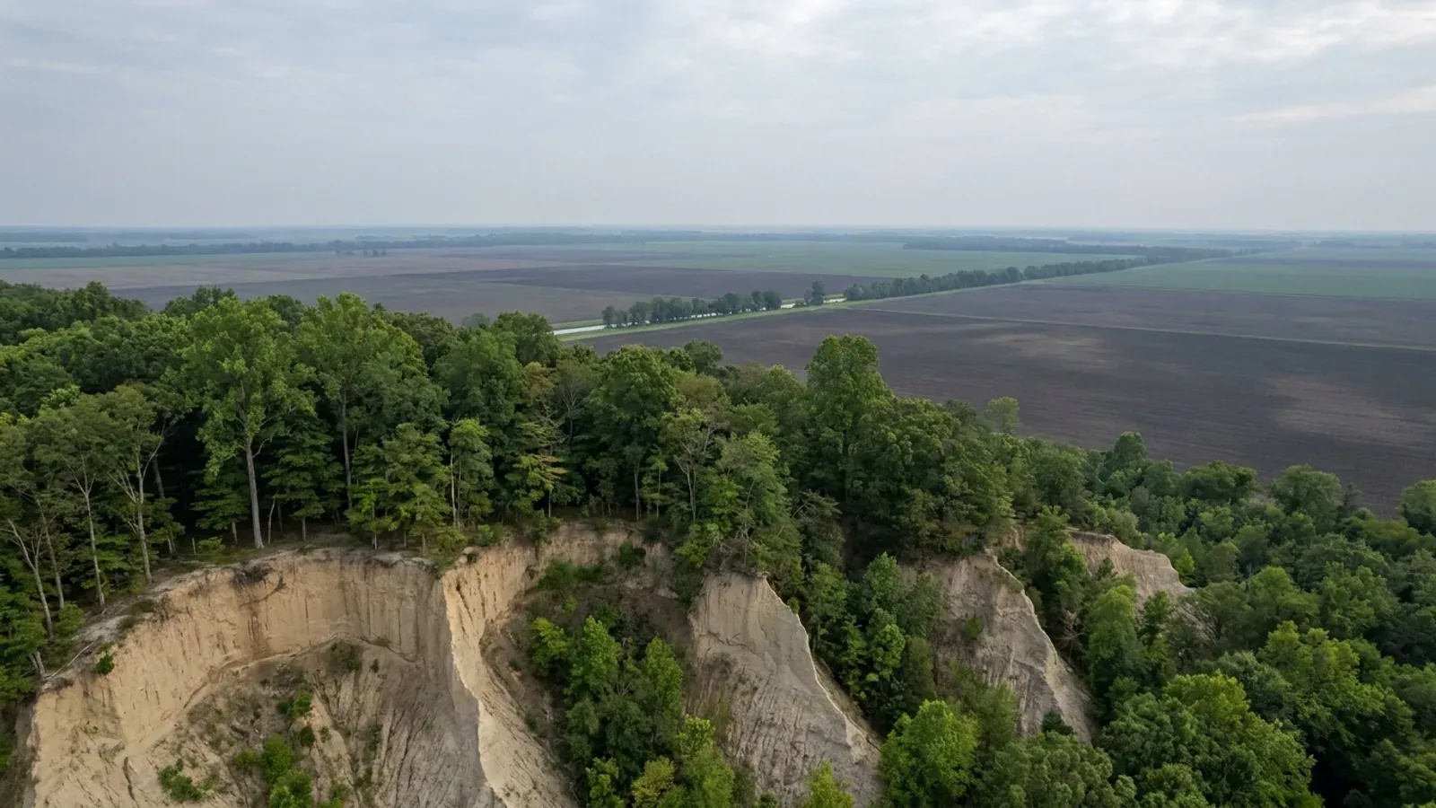
Barndominium Builders in Paragould, AR
Paragould is a first-class city of about 31,000 on the northern end of Crowley's Ridge, twenty miles from Jonesboro and running its own light, water, sewer, cable and fibre utility. It is one of the very few Arkansas jurisdictions that prints its whole building permit fee in the ordinance, publishes a footing specification on a single sheet, and writes its own amendments into the state residential code. Step outside the corporate limits and all of that stops: Greene County has no planning board, no zoning ordinance and no building department.
Paragould at a glance
- County
- Greene County
- Population
- 31,135
- ZIP codes
- 72450, 72451
- Site visits
- Paragould and the Greene County ground around it are inside the northeast Arkansas territory we keep on a regular rotation, so walking a ridge tract off Highway 49 or sitting down at the Inspector's counter on West Court Street is an ordinary booking rather than a special trip.
Building conditions in Paragould
The State's code reaches every parcel in Arkansas, including rural and unincorporated land. What is not everywhere is the office that checks it: a city or county is authorised to set up a building department, not required to, and a great deal of rural Arkansas never has. So the first question on any parcel is not what the code says — that part travels — but whether anyone here issues a permit, inspects the work, or publishes the design criteria your drawings still have to satisfy. Where nobody does, the obligation does not go away. It just moves to the appraiser, the insurer, your lender and whoever buys the place from you.
https://www.cityofparagould.com/DocumentCenter/View/1063/Footing-Requirements-PDF
Also worth knowing before you build in Paragould
- You cannot permit the shop first — the house has to be built and in use
- Paragould's definition of an accessory building at Sec. 46-81 carries an ordering rule most zoning codes do not: 'No building permit for an accessory building or accessory structure shall be issued under any circumstances unless the main structure or building has been constructed and is in use.' That closes off the sequence many barndominium buyers plan — put the shop up first, work out of it, and add the living space later. The same definition also supplies the way around the accessory rules altogether: 'Where a substantial part of the wall of the accessory structure is a part of the wall of the main building or where an accessory structure is attached to the main building in a substantial manner, as by a roof, such accessory structure shall be counted as a part of the main structure.' One structure under one roof is not an accessory building at all. And the current code sets no square-foot ceiling on a detached accessory building in the residential districts — only setbacks, which in R-E are 35 ft front, 20 ft side, 25 ft street side and 10 ft rear — while a footnote to Sec. 46-103 tells the building inspector to check accessory buildings for compliance and routes a refusal to the board of adjustment, then the city council, within two weeks.
- The rewritten zoning code the city posts would cap a detached shop at 1,200 square feet
- Paragould's Planning and Development page carries a complete rewrite of the zoning code, dated 3.26.26 as amended, alongside rezoning, conditional-use and variance application forms updated 3-2026. Section 4.3.1 of that document would change the accessory-structure answer entirely: a primary structure must be present on the lot, accessory structures 'shall not be used as a habitable dwelling unit', they are 'limited to 30 percent of the footprint of the primary structure, but shall not exceed 1,200 square feet, whichever is less' — with lots over one acre limited instead to 10 percent of the lot — height is capped at 25 feet and may not exceed the primary structure, and 'there shall only be one accessory structure per primary structure.' The AG district would keep its one-acre minimum at one dwelling per acre with a 35-foot height cap, while the Residential Estate minimum would rise from 11,000 square feet to 30,000. The document is not law yet: its own Section 1.10.2 still reads 'This ordinance is enacted by legislation adopted [DATE] by the Paragould City Council', and the Inspector's page lists it as the city's draft zoning code. Anyone planning a large detached shop in Paragould should ask where that rewrite stands before drawing it.
- One Paragould neighbourhood bans metal roofing on houses outright
- Sec. 46-109 establishes the Northend overlay district over the core historic neighbourhood identified in the Discover Paragould 2042 comprehensive plan, applying design standards on top of whatever the base zoning is. Five of them land on a barndominium: primary entrances must face and be directly accessible from the sidewalk with no interruption by driveways or parking; a newly constructed single-family dwelling must have a covered front porch extending at least 40 percent of the width of the dwelling excluding garages and at least six feet deep; where an alley runs behind the lot no new off-street driveway is permitted and the garage must be reached from the alley; the first floor must be raised at least 18 inches above the finished elevation of the front sidewalk; and, flatly, 'Metal roofing is prohibited on residential structures.' The rule catches redevelopment too — the overlay defines a redeveloped structure as one where contracted improvements exceed 50 percent of the county assessor's current appraised value. The boundaries are on the city zoning map, and the city maintains separate Northend, Midtown and Labor overlay property pages.
- Every new building in Paragould has to run a fibre conduit before the meter goes on
- Sec. 10-86 adds thirteen local requirements on top of the 2020 National Electrical Code, and the thirteenth is the one nobody expects: 'All building construction shall include a 3/4 inch conduit run from outside the building into a central location inside for the express purpose of the installation of fiber optic cable.' It has to sit near the electric meter outside, terminate inside within three feet of a 120-volt receptacle in a standard wall outlet box, and terminate outside in a fibre housing box supplied by the utility; a multi-unit building needs one per unit. The rest of the section is equally specific. The meter location is set by the utility and the centre of the meter must be between 48 and 66 inches above finished ground grade. An overhead service mast must be a minimum two-inch rigid steel conduit extending at least 24 inches through the roof to give 18 inches of drip-loop clearance, strapped every 24 inches starting six inches above the socket. Fourteen-gauge wire is prohibited except on a 15-amp dedicated circuit for smoke detectors. Secondary conductors from the transformer to the main panel must be copper in conduit for anything over 200 amps, and the owner provides and installs them.
- Two materials, and only two, may run water under a Paragould slab
- Sec. 10-197 adopts the 2018 Arkansas State Plumbing Code and then adds three local rules, and the third decides how a slab-on-grade barndominium gets plumbed: 'The only approved materials for water supply lines under concrete slabs is either sleeved copper water supply lines or one piece PEX water supply lines.' The other two ban cellular-core or foam-core PVC for all drain, waste and vent work, and require vents to be tested through the roof with water or air to the lowest vent. The mechanical article is just as pointed: Sec. 10-146 adopts the 2021 International Mechanical Code and adds a single amendment — 'Bubble wrap insulation for HVACR ducts is prohibited' — with violations punishable as a misdemeanour at up to $250 a day, each day a separate offence. These are exactly the decisions a builder makes before the concrete is poured and the ductwork is ordered, and Paragould has already made them.
- The utility here is elected, it approves your plans before the city will, and its plumbing rules follow the pipe past the city limit
- Paragould Municipal Utilities runs the electricity, water, sewer, cable and fibre, and Sec. 42-25 and 42-26 provide that its five commissioners 'have been elected by popular vote' — the department was renamed from the Paragould Light, Water and Cable Commission by Ordinance No. 2023-34 on 23 October 2023. Sec. 10-53 makes it a gate on construction: complete plans for property development showing sewer, water, electricity and cable with all easements clearly marked must go to the commission, and 'No permit will be issued until approval is obtained for said plans.' Sec. 42-3 adds that a lot split needs a survey reviewed by a PMU designee and 15-foot-wide easements drawn on it before it can be approved. Two more consequences reach past the corporate limit. Sec. 10-197 makes the city's adopted plumbing code govern 'all plumbing installed, altered or repaired within or without the city, wherever water and/or sewage service originating from the municipal water and/or sewage system is furnished.' And Sec. 42-119 provides that a customer on PMU sewer who takes water from a rural water district pays the city sewer rate multiplied by 1.20. PMU publishes its rates — a $15.00 monthly residential electric facility charge at $0.07468 per kWh for the first 750 kWh, a $13.83 water facility charge and a $17.47 sewer facility charge — but not its connection fees, which it asks customers to get from its service centre.
- A conditional use permit costs nothing here, and so does a variance
- Sec. 46-481 sets out the zoning fees in four lines, and three of them are zero: the certificate of occupancy and compliance is no charge, a conditional use permit is no charge, and appeals and variances are no charge. Only an application for rezoning carries a fee, at $50.00. The section is honest about what it does not cover — legal advertisements, certified mail, legal representation, drafting, surveying, engineering and planning costs all fall on the applicant, and Sec. 46-482 makes a variance applicant pay for the published notice, with Sec. 46-483 adding a $25.00 filing fee to the city clerk. There is one penalty in the same section, and it is worth reading before anyone moves furniture in: a final inspection and certificate of occupancy must be obtained before occupancy of any residence, the duty sits with whoever owned the property when the building permit was taken out, and the fine is $25.00 with the building inspector empowered to issue the citation. In a market where a rezoning or conditional use hearing elsewhere runs into the hundreds, a free variance hearing is a real difference.
- Act 314 abolished municipal planning jurisdiction in 2025, and Paragould's code still defines a five-mile ring
- Act 314 of 2025, approved 18 March 2025, repealed A.C.A. 14-56-413 in its entirety along with 14-17-208(i), 14-38-101(b)(1)(B), 14-40-208, 14-56-417(c), 14-56-422(5)(B) and 17-28-305(b)(3), ending municipal extraterritorial planning jurisdiction across Arkansas and the electrical permit reach that went with it. Paragould's own instruments have not followed. The definitions section of the zoning code still provides that 'the Planning Jurisdiction of the City of Paragould is that area indicated on an officially adopted map that includes the corporate limits of the city and those areas beyond the corporate limits up to a distance of five miles', adding that 'Zoning jurisdiction is limited to the corporate boundaries' and that subdivision regulations 'may be enforced outside the corporate limits through cooperation with officials of the Greene County Government.' The rewritten zoning code the city posts, dated March 2026, carries that same definition forward word for word. And the city's Subdivision Regulations, dated 22 February 1993, still set standards for subdivisions 'outside the corporate limits but within the Extraterritorial Jurisdiction' under an authority citation to Section 19-2825 of the Arkansas Statutes, a numbering the state replaced in 1987. Read the act, not the leftover text.
- Unincorporated Greene County has no planning board, no zoning and no building permit — and its code says so in one word
- Under A.C.A. 14-17-203(a) an Arkansas county judge 'may create' a county planning board with the quorum court's approval, and only then may the court adopt zoning, which 14-17-209(c) says 'shall be observed through denial of the issuance of building permits and use permits.' Greene County has not taken the first step. Its codified Code of Ordinances, produced by the Association of Arkansas Counties Risk Management Fund and hosted in PDF with online content updated 21 May 2024, gives Chapter 13 to Urban / Rural Development; Article I is headed BUILDING and its whole text is 'Reserved', and Article II, PLANNING / ZONING, reprints A.C.A. 14-17-209 and 14-17-210 and then reads 'Reserved' as well. The county's published department list runs Assessor, C.A.S.A., Circuit Clerk, Collector, County Clerk, Courthouse Security, Coroner, District Clerk, Extension Office, Health Department, Library, County Judge, Human Resources, Juvenile Division, Revenue Office, Public Defender, Prosecuting Attorney, Road Department, Sheriff, Treasurer and Veteran's Services — with no planning, zoning or building office anywhere in it. The one thing a rural build does have to arrange with the county is a 911 address, which comes from the Addressing Department at the 911 Center on 870-239-7562, and the county asks callers to 'have relevant property or permit information available.'
- 31,007 acres of Greene County is mapped at 15 to 35 percent slope, and the loess sits on gravel
- A USDA-NRCS Soil Data Access query over Greene County soil survey area AR055 — 370,829 acres across 49 map units — returns 'Brandon-Saffell complex, 15 to 35 percent slopes' at 31,007 acres, the fourth-largest map unit in the county, with a further 4,484 acres of the same complex at 8 to 15 percent, 2,627 acres at 3 to 8, and 1,250 acres of Memphis silt loam at 15 to 35 percent. Add the Loring silt loam mapped at 8 to 15 percent and about 55,800 acres of the county, one acre in seven, is on a slope of 8 percent or steeper. That is Crowley's Ridge, and here it is not simply loess. NRCS describes the Brandon series as formed in 'a silty mantle, presumably loess, that is 20 to 40 inches thick over very gravelly or gravelly marine and riverine deposited materials', with rock fragments running 30 to 80 percent below the solum; Saffell is loamy-skeletal, well drained, with rock fragments to 60 percent by volume. The county also carries 508 acres mapped simply as 'Pits, gravel'. A pad cut on the Greene County ridge is likely to be sitting on gravel two to three feet down, which is a different bearing and a different drainage problem from the flat ground either side of it.
- The single biggest soil in the county is a sodium-rich flat, and a fifth of it is shrink-swell clay
- The same SSURGO query returns 'Foley-Bonn complex, 0 to 1 percent slopes' as the largest map unit in Greene County at 32,816 acres, with another 4,759 acres of it mapped as frequently flooded. Both series are Natraqualfs — soils with a sodium-rich subsurface horizon — and both are poorly drained; adding Hillemann, Lafe and the separately mapped Foley units puts roughly 53,000 acres, about one seventh of the county, in sodic ground. NRCS describes the Lafe series as 'somewhat poorly drained; slow runoff; very slow permeability', with 'a seasonally high water table that is within 1 to 2 feet of the soil surface in late winter and spring most years' and sodium saturation of 15 percent or more starting as little as three inches down. Beside that sit the smectitic clays: Jackport at about 25,178 acres, Forestdale at 22,030 and Kobel at 20,579, roughly 18 percent of the county in soils that shrink and swell. The statewide SSURGO run puts Greene at 6.8 percent Vertisols, 19.1 percent with a linear extensibility of 6 or more in the upper metre, and 24.6 percent with a fragipan — the last of those the highest of the northern Crowley's Ridge counties.
- Greene County lost a fifth of its farmland in five years, and the median farm is 77 acres
- The 2022 Census of Agriculture county profile records 496 farms in Greene County working 224,286 acres — 60.7 percent of the county — down 21 percent since 2017, with the average farm at 452 acres and the median, from the same census, at 77. The size distribution is what matters for a land search: 44 farms of 1 to 9 acres, 136 of 10 to 49, 164 of 50 to 179, 67 of 180 to 499, 35 of 500 to 999 and 50 of 1,000 or more. So 180 operations — 36 percent — are under fifty acres and 69 percent are under 180, which is a materially finer grain than the Delta counties further south, where medians run from 325 to 1,170 acres. The flat ground is committed: 136,015 acres are irrigated, 61 percent of land in farms, and the top crops are soybeans at 67,158 acres, rice at 55,699 and corn at 29,124, with crops making up 93 percent of the county's $167 million in sales. Only 11,746 acres of the land in farms is woodland. Greene County as a whole is 28 percent forest and the county's population grew 3.7 percent between 2020 and 2025, so the wooded, subdividable ground is on the ridge, not on the row-crop flats.
- FEMA says Paragould has a history of frequent damaging floods, and it is the only community here with more than an approximate map
- The Flood Insurance Study for Greene County and Incorporated Areas, FIS number 05055CV000C, revised 15 September 2022, lists seven communities. Six of them — Greene County unincorporated, Lafe, Marmaduke, Oak Grove Heights, Sedgwick and Delaplaine, the last with no Special Flood Hazard Areas identified at all — carry Zone A only, the approximate designation with no base flood elevation. Paragould alone carries Zones A, AE, AO and X, meaning parts of the city have detailed elevations and parts are mapped for shallow sheet flooding. The study's own account of the problem is one sentence about Eight Mile Creek: 'The City of Paragould has a history of frequent damaging floods. In the past, floods have cost property owners millions of dollars in flood damages.' It tabulates events on 18 June 1945, 18 February 1956, 14 August 1957, 17 September 1962, 30 January 1969, 19 April 1973 and 17 December 2001. It also flags that FEMA has identified the Eight Mile Drainage District #5 Levee, on FIRM panels 05055C0375F and 05055C0500F, as not demonstrated to meet the 44 CFR 65.10 requirements for one-percent-annual-chance protection. The initial countywide FIS became effective 16 June 2009; the city adopted its own Flood Damage Prevention Code, dated 12 October 2009, by Ordinance No. 2013-02.
https://www.cityofparagould.com/DocumentCenter/View/2576/Paragould-Zoning-Code---32626
https://www.arkleg.state.ar.us/Home/FTPDocument?path=%2FACTS%2F2025R%2FPublic%2FACT314.pdf
https://library.municode.com/ar/greene_county/codes/code_of_ordinances
https://www.cityofparagould.com/DocumentCenter/View/1545/Greene-County---Flood-Insurance-Study-FIS

The expensive surprises are in the ground, not the building
What moves an Arkansas budget is usually below grade, and the state hands you a different problem depending on where you stand. In the Delta the issue is shrink-swell clay that moves with the season, and it is the reason a wide, light building with a big slab and a big door opening is the shape most at risk. Along the Fall Line there is a second, separate clay belt with nothing to do with the Delta at all. Up in the Ozarks the question inverts: what matters is not what the slab sits in but what is under it, because that limestone is full of solution cavities and the collapses arrive with no prior indication at the surface. And on Crowley's Ridge, where Jonesboro and Paragould sit, it is fine wind-blown loess that stands up in a vertical cut and then erodes out from under whatever you put on it. The same ground decides your wastewater system, which is the gate that most often moves a rural build's schedule — and it is soils that decide it, not the size of the house. So the site work, the foundation and the wastewater get resolved together rather than one at a time. We price the dirt before we price the building.
What we build in Paragould
All nine services are available in Paragould. What a build costs depends far more on the parcel than on square footage, so we price against your land rather than publishing a rate card.
Custom Barndominium Plans
Barndominium floor plans, elevations and engineered documents drawn to your parcel — and to the design numbers your Arkansas jurisdiction publishes.
Barndominium Kits
Engineered barndominium shell packages for Arkansas land, drawn to a named jurisdiction's criteria rather than to a national vendor's generic spec.
Turnkey Barndominium Builds
Land through handover under one contract, and a straight answer on what actually gates a barndominium build on rural Arkansas land.
What a build looks like
Three stages every Paragould project passes through, from a raw parcel to a finished home. Site work first, because that is where the budget is decided.

The parcel
Zoning, setbacks, flood zone and utility access get checked before anything is drawn.
Pad and permit
Clearing, grading and a compacted pad, while the submittal works through whichever office issues the permit where you are building.

Frame to finish
Shell erected and dried in, then systems, insulation and interior finish through to CO.
Those are the rules where you are building in Paragould. Tell us what you want to build and we will draw it to them.
Where we build around Paragould
Greene County and the rural land around it. The buildable acreage for a project this size usually sits outside the city limits, which is frequently what changes who issues your permit.
Keep reading
The questions that usually come next once you know what Paragould allows.
Barndominium Cost Guide
Sourced per-square-foot ranges by tier and by size, with a calculator built on the same figures.
Read itThe Arkansas Building Code
The code applies statewide, including unincorporated land — but a jurisdiction is only authorized to establish a building department, so on rural residential land there is often no counter at all.
Read itBuying Land in Arkansas
Where acreage is actually purchasable in homesite sizes, and what percolation, slope and the onsite wastewater rule do to a parcel before anything is designed.
Read itNearby areas we build in
Others we cover nearby. One may be a county, another a city inside it — and since March 2025 the soft edge between them is gone, because the cities' extraterritorial jurisdiction was abolished outright and that land reverted to the counties. So the office that issues the permit, the fees it charges, the zoning and whether anyone publishes design criteria at all can differ from one card to the next, and the boundary that decides it may have moved recently.
Building in Paragould: common questions
9 questions we get asked most often about building in Paragould. If yours is not on the list, ask it directly.
Who issues the building permit in Paragould, and what does it actually cost?
Can my shop be bigger than my house in Paragould?
Does the New Madrid Seismic Zone change how a barndominium gets built in Paragould?
What happens if my land is outside the Paragould city limits?
Can I actually buy acreage in or near Paragould?
What is different about building on Crowley's Ridge here versus on the flat ground?
Which codes does Paragould enforce, and what has it changed locally?
Is flooding a real issue in Paragould, and how do I check a parcel?
Paragould is rewriting its zoning code. What would change for a barndominium?
Building in Paragould?
Start with the plan. Tell us what you want to build and we will draw it, then confirm which office issues the permit for your parcel, what it will let you put there, and what wind load it has to meet. That conversation costs nothing.