Barndominium Builders in Jonesboro, AR
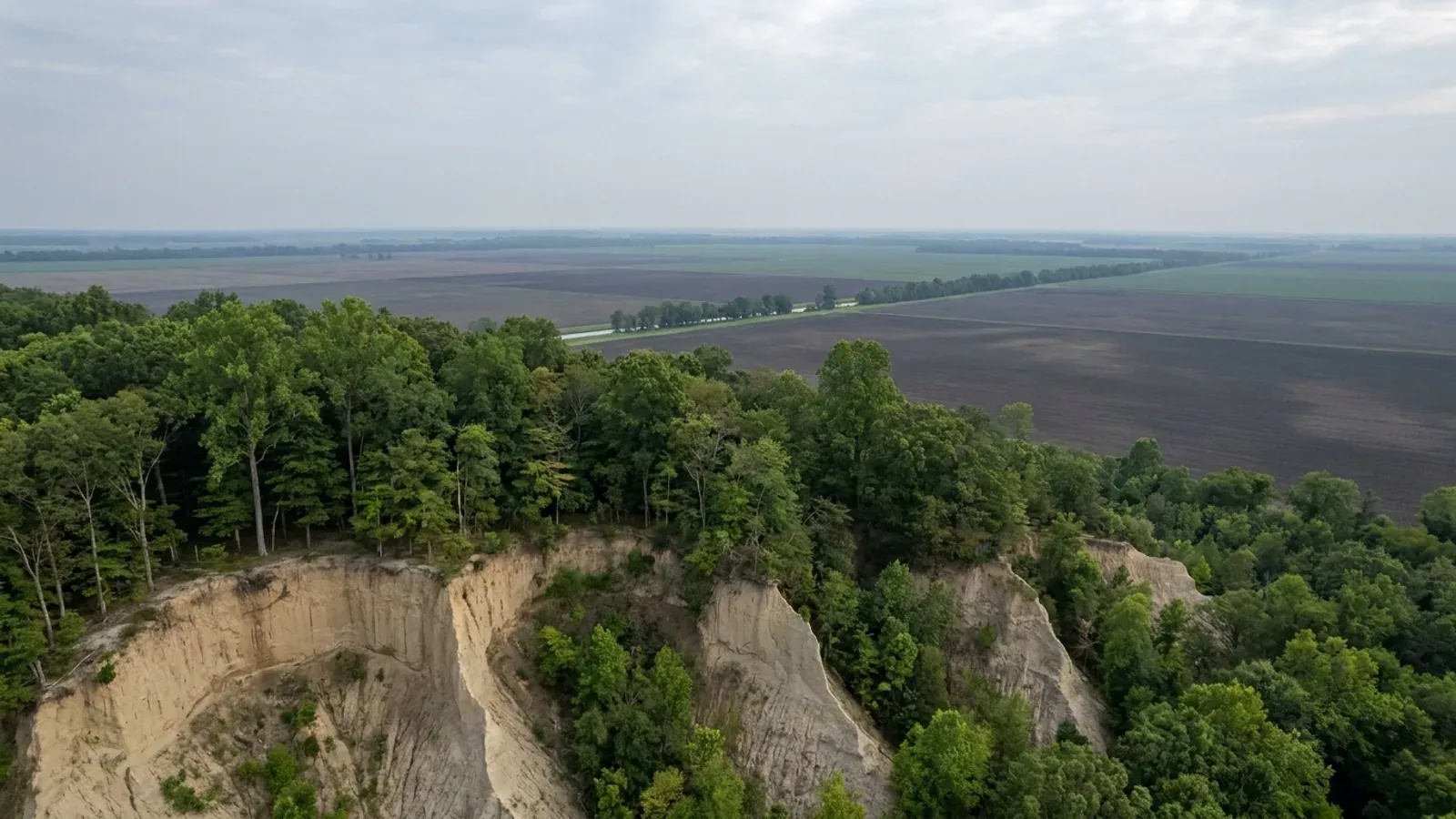
Jonesboro is the fifth-largest city in Arkansas and the only one of them sitting on Crowley's Ridge, a narrow band of wind-blown loess standing above a dead-flat Delta that begins a few miles east of town. That single geographic fact splits every foundation question in Craighead County in two, and it sits on top of the strongest ground-motion gradient in the state — the New Madrid Seismic Zone. Inside the city limits there is a building official, a published fee sheet and a five-acre agricultural zoning district; outside them there is no county zoning, no county building permit and nobody to deny one.
Jonesboro at a glance
- County
- Craighead County
- Population
- 83,296
- ZIP codes
- 72401, 72402, 72403, 72404, 72467
- Site visits
- Jonesboro and the Craighead County countryside around it sit inside the northeast Arkansas territory we work on a regular schedule, so a walk over a ridge parcel or a trip to the Inspections counter on Church Street is routine rather than a special arrangement.
Building conditions in Jonesboro
The State's code reaches every parcel in Arkansas, including rural and unincorporated land. What is not everywhere is the office that checks it: a city or county is authorised to set up a building department, not required to, and a great deal of rural Arkansas never has. So the first question on any parcel is not what the code says — that part travels — but whether anyone here issues a permit, inspects the work, or publishes the design criteria your drawings still have to satisfy. Where nobody does, the obligation does not go away. It just moves to the appraiser, the insurer, your lender and whoever buys the place from you.
https://geology.arkansas.gov/geohazards/earthquakes-in-arkansas.html
Also worth knowing before you build in Jonesboro
- A storm shelter is a $50 permit here — and the code will not let you skip it
- The Arkansas Residential Code's list of work exempt from permit at R105.2 begins with the words 'Other than storm shelters' before it exempts one-story detached accessory structures up to 200 square feet. A storm shelter is carved out of that exemption at any size. Jonesboro is one of very few Arkansas jurisdictions that has priced the resulting permit and published the number: the Inspections fee sheet carries a flat $50.00 line for 'Storm Shelter'. It sits beside a $60.00 residential sprinkler permit and a $50.00 swimming pool electrical bond. For a barndominium in a county on the New Madrid gradient and in the tornado corridor, that is a fifty-dollar line item on a shelter people actually build here, and it is not optional paperwork.
- Jonesboro's zoning contains a five-acre agricultural district inside the city limits
- The Minimum Dimension Requirements table at JMC 117-138(d) sets the AG Agricultural district at a five-acre minimum lot with 240 feet of lot width, 30-foot front and rear setbacks and 10-foot side setbacks. RS-1, the largest single-family district, asks 43,560 square feet — exactly one acre — on 120 feet of width with 40-foot front, 30-foot rear and 25-foot side yards. Single-family detached dwellings are permitted by right in AG, and JMC 117-226(1) allows an accessory dwelling unit there by right where it houses immediate family members or employees who work onsite. The ordinance describes AG's purpose as preserving existing agricultural resources and guiding the conversion of rural lands to suburban use, protecting areas with prime soils. Very few Arkansas cities on this site have any large-lot district at all; Jonesboro has one an order of magnitude larger than the next city's.
- 6,480 acres of Craighead County is mapped at 12 to 40 percent slope — in a county whose other half is dead flat
- The same SSURGO query returns a map unit named 'Memphis silt loam, 12 to 40 percent slopes' covering 6,480 acres of Craighead County, plus 390 acres of 'Memphis soils, 8 to 40 percent slopes, gullied' and 8,580 acres of Brandon-Saffell association in moderately sloping and moderately steep phases. Every one of those is Crowley's Ridge. The Memphis series is described by NRCS as formed in loess more than 48 inches thick, well drained, with slopes ranging from 0 to 50 percent. East of the ridge, the Encyclopedia of Arkansas's geography entry describes the Mississippi Alluvial Plain as 'extremely flat, with local elevation differences of only a few feet.' The whole 713-square-mile county is covered by just 43 soil map units, which is how uniform the Delta half is — and the ridge is where all the variance lives.
- Unincorporated Craighead County has no planning board, no zoning and no building permit
- Under A.C.A. 14-17-203(a) an Arkansas county judge 'may create' a county planning board with the quorum court's approval, and only after that may the court adopt zoning, which 14-17-209(c) says 'shall be observed through denial of the issuance of building permits and use permits.' Craighead County has not taken the first step. Its published department list runs County Judge, County Clerk, Circuit Clerk, Treasurer, Collector, Assessor, Building Maintenance, Election Commission, Computer Services, Sheriff, District Court, Juvenile Court, Jail, Office of Emergency Management, Veterans Service, Public Defender, Road Department and Lake City Courthouse — with no planning department, no zoning office and no building department anywhere in it. The county's own online ordinance and resolution archive runs to several hundred documents covering 2019 through 2026 and contains no zoning ordinance, no planning-board ordinance and no building-code adoption. No board, no permit, nobody to deny one.
- The one construction permit unincorporated Craighead County does issue is a floodplain permit
- Craighead County adopted the NFIP floodplain management program in 2004 and, in its own words, 'fully enforces Floodplain guidelines for building within the floodplain.' The Floodplain Manager sits in the Craighead County Annex at 511 Union, Room 5, Jonesboro, on 870-933-4575, and the county's permit packet is explicit about what the permit is and is not: it is required only for development in a FEMA-mapped Special Flood Hazard Area, it covers construction, clearing, grading, fill, dredging, drilling and watercourse alteration, all new buildings in a Special Flood Hazard Area require an Elevation Certificate, and 'before the house can actually be occupied, or the developed land used, a Compliance Certificate must be issued by the local FPA' after inspection. The quorum court re-adopted the underlying program by Ordinance 2024-15. On rural Craighead ground that is the whole county permit story.
- Jonesboro's electrical article adds eleven local exceptions the National Electrical Code does not contain
- JMC 105-54 lists local exceptions that govern over the adopted electrical code. Several land directly on a barndominium with a working shop. No permit will be issued for an electric service exceeding 200 amps, nor for any three-phase service, until the local utility has given written approval. A master switch or breaker must be installed on all electric services up to 400 amps, at the entrance of the electric meter, and that entrance 'shall not be concealed'; over 400 amps the NEC governs. The minimum size of aluminum wire that may be used is No. 2 stranded. Overhead service masts must be rigid conduit, intermediate metallic conduit or PVC, and thin-wall conduit may not be used for service entrances. In residential structures there may be no more than ten duplex receptacles or lights on a 15-amp circuit and no more than thirteen on a 20-amp circuit. And commercial buildings must be wired in conduit — but 'any Type 6 wood frame noncommercial accessory buildings to a residential use' are exempt from the metal conduit requirement.
- Erosion control goes in before the permit prints, and the driveway before the certificate of occupancy
- The City of Jonesboro's Planning and Development Guide sets out the residential single-family permit flow as a flowchart with four conditions attached to it. The application goes in through the city's online portal with one complete set of plans, a signed stormwater pollution prevention plan and a plot plan showing house location and setbacks. City Water and Light, Planning, Engineering and the Building Department all review it. Then: all applicable fees must be paid before a permit will be issued; erosion control must be in place before a permit will be issued; the driveway needs to be installed and inspected by the Engineering Department before a certificate of occupancy will be issued; and basement rooms with doors over 36 inches going to the outside and left unfinished must be fire rated. Construction inspections called in by 4:00 p.m. occur the following day, except footings, rough-in plumbing, gas and residential reconnects, which are done as soon as possible. Separately, JMC 112-8 makes clearing, grading or excavating one acre or more its own grading permit, reviewed by the city engineer within fifteen business days — and on a five-acre AG lot with a house, a shop and a drive, an acre of disturbance is easy to reach.
- Splitting five acres for agriculture is not a subdivision in Jonesboro — and outside the limits the plat goes to the County Judge
- The definition of 'subdivision' at JMC 113-1 ends with a carve-out: 'any division of land for agricultural purposes into lots or parcels of five acres or more shall not be deemed a subdivision unless street dedication or the installation of utilities are involved.' Outside the city, Craighead County's own instrument is Subdivision Ordinance 2019-13, adopted 24 June 2019, under which all new subdivision developments and the re-platting of existing parcels require the County Judge's approval before filing at the Circuit Clerk's office. Plats are dropped at the County Judge's office at 511 Union Street, Suite 119, Jonesboro; the county asks for ten to twenty days for a response, longer if the plat is referred to the Road Committee, which meets with the quorum court committees on the second Monday of the month. That is the only county gate a rural land split passes through.
- Act 314 of 2025 ended Jonesboro's planning ring — and the city's own ordinances still describe it
- Act 314 of 2025, approved 18 March 2025, repealed A.C.A. 14-56-413 in its entirety, abolishing municipal extraterritorial planning jurisdiction across Arkansas, along with 14-17-208(i), 14-38-101(b)(1)(B), 14-40-208, 14-56-417(c), 14-56-422(5)(B) and 17-28-305(b)(3), the provision that had let a city extend electrical permit and inspection jurisdiction into the same ring. Jonesboro is one of the eight Arkansas cities whose ring covered the land where the buildable acreage actually is. The Metropolitan Area Planning Commission's own page now describes its duties as the orderly physical development 'of the city.' But the codified ordinances have not caught up: JMC 113-3 still provides that no plat or subdivision of land 'within the city nor within the territorial jurisdiction of the city planning commission' shall be recorded until approved, and JMC 112-7 still speaks of land 'within the city planning jurisdiction.' Read the statute, not the leftover phrase.
- The Delta half of the county has two soil problems, and neither one is the one people expect
- The SSURGO query over AR031 returns three natric series among Craighead County's major components — Foley at roughly 32,139 acres, Hillemann at roughly 24,834 and Lafe at roughly 2,440 — about 59,400 acres, thirteen percent of the county, in soils carrying a sodium-rich subsurface horizon. The NRCS Official Series Description for Foley, a fine-silty, mixed, active, thermic Albic Glossic Natraqualf, describes 'very deep, poorly drained, very slowly permeable soils that formed in silty material high in sodium', on slopes of 0 to 3 percent, with 'a seasonally high water table within 18 inches of the soil surface from December through April.' The county's expansive clay, by contrast, is comparatively modest: Sharkey at about 16,218 acres and Jackport at about 15,849, giving a countywide Vertisol share of 7.0 percent against Crittenden's 33.7, Mississippi's 30.7 and Poinsett's 24.1. So the Jonesboro-area foundation risk is not primarily shrink-swell. It is a fragipan and a slope on the ridge, and slow drainage with a seasonal water table a foot and a half down in the lowlands.
- Two courthouses, one construction counter
- Craighead County is one of ten Arkansas counties with two county seats, and it runs two judicial districts from two buildings: the Craighead County Courthouse at 511 S. Main Street in Jonesboro and the Lake City Courthouse at 107 Cobean in Lake City, with the Courthouse Annex at 511 Union Street and the Election Annex at 315 W. Jefferson Avenue also in Jonesboro. The county's published directory of elected officials shows exactly two Eastern District posts — an Eastern District Deputy Sheriff and an Eastern District Deputy Clerk, both on 870-237 numbers. Every other office in the directory, County Judge, Assessor, Collector, Circuit Clerk, County Clerk, Treasurer, Sheriff, District Judges, Coroner and Surveyor, is listed once, on Jonesboro numbers. For anyone building, that means the two functions that matter — the County Judge's plat approval and the Floodplain Manager's permit — are both in Jonesboro regardless of which end of the county the land is on.
- Eighty percent of the farmland in Craighead County is irrigated, and only 4,872 acres of it is woodland
- The 2022 Census of Agriculture county profile records 393 farms in Craighead County working 283,467 acres — 62.6 percent of the county's land — at an average of 721 acres and a median of 100. Of that land in farms, 269,905 acres is cropland, 5,659 pastureland and just 4,872 acres woodland, and the profile's own headline figure is 228,004 acres irrigated, '80% of land in farms'. Ninety-nine percent of the county's $241 million in agricultural sales is crops. The ownership pattern is a barbell: 26 farms under 10 acres and 120 between 10 and 49 acres, so 38 percent of operations are under fifty acres, set against 95 farms — 24 percent — over 1,000 acres. That matters for a land search two ways. Small tracts genuinely exist here, unlike Mississippi County where the median farm is 1,170 acres. But a wooded homesite in Craighead County means Crowley's Ridge, because the flat ground is irrigated row crop and it is not for sale in ten-acre pieces.
https://www.jonesboro.org/DocumentCenter/View/8915/Development-Guide-PDF
https://craigheadcountyar.gov/government/departments/road-department
https://www.arkleg.state.ar.us/Home/FTPDocument?path=%2FACTS%2F2025R%2FPublic%2FACT314.pdf

The expensive surprises are in the ground, not the building
What moves an Arkansas budget is usually below grade, and the state hands you a different problem depending on where you stand. In the Delta the issue is shrink-swell clay that moves with the season, and it is the reason a wide, light building with a big slab and a big door opening is the shape most at risk. Along the Fall Line there is a second, separate clay belt with nothing to do with the Delta at all. Up in the Ozarks the question inverts: what matters is not what the slab sits in but what is under it, because that limestone is full of solution cavities and the collapses arrive with no prior indication at the surface. And on Crowley's Ridge, where Jonesboro and Paragould sit, it is fine wind-blown loess that stands up in a vertical cut and then erodes out from under whatever you put on it. The same ground decides your wastewater system, which is the gate that most often moves a rural build's schedule — and it is soils that decide it, not the size of the house. So the site work, the foundation and the wastewater get resolved together rather than one at a time. We price the dirt before we price the building.
What we build in Jonesboro
All nine services are available in Jonesboro. What a build costs depends far more on the parcel than on square footage, so we price against your land rather than publishing a rate card.
Custom Barndominium Plans
Barndominium floor plans, elevations and engineered documents drawn to your parcel — and to the design numbers your Arkansas jurisdiction publishes.
Barndominium Kits
Engineered barndominium shell packages for Arkansas land, drawn to a named jurisdiction's criteria rather than to a national vendor's generic spec.
Turnkey Barndominium Builds
Land through handover under one contract, and a straight answer on what actually gates a barndominium build on rural Arkansas land.
What a build looks like
Three stages every Jonesboro project passes through, from a raw parcel to a finished home. Site work first, because that is where the budget is decided.

The parcel
Zoning, setbacks, flood zone and utility access get checked before anything is drawn.
Pad and permit
Clearing, grading and a compacted pad, while the submittal works through whichever office issues the permit where you are building.

Frame to finish
Shell erected and dried in, then systems, insulation and interior finish through to CO.
Those are the rules where you are building in Jonesboro. Tell us what you want to build and we will draw it to them.
Where we build around Jonesboro
Craighead County and the rural land around it. The buildable acreage for a project this size usually sits outside the city limits, which is frequently what changes who issues your permit.
Keep reading
The questions that usually come next once you know what Jonesboro allows.
Barndominium Cost Guide
Sourced per-square-foot ranges by tier and by size, with a calculator built on the same figures.
Read itThe Arkansas Building Code
The code applies statewide, including unincorporated land — but a jurisdiction is only authorized to establish a building department, so on rural residential land there is often no counter at all.
Read itBuying Land in Arkansas
Where acreage is actually purchasable in homesite sizes, and what percolation, slope and the onsite wastewater rule do to a parcel before anything is designed.
Read itNearby areas we build in
Others we cover nearby. One may be a county, another a city inside it — and since March 2025 the soft edge between them is gone, because the cities' extraterritorial jurisdiction was abolished outright and that land reverted to the counties. So the office that issues the permit, the fees it charges, the zoning and whether anyone publishes design criteria at all can differ from one card to the next, and the boundary that decides it may have moved recently.
Building in Jonesboro: common questions
9 questions we get asked most often about building in Jonesboro. If yours is not on the list, ask it directly.
Can I actually buy land and build a barndominium in Jonesboro?
Who issues the permit in Jonesboro, and what does it cost?
Does the New Madrid Seismic Zone actually change how my barndominium gets built?
What is different about building on Crowley's Ridge versus three miles east of it?
Can my shop be bigger than my house?
What happens if my land is outside the Jonesboro city limits?
Which codes does Jonesboro enforce, and are its electrical rules really different?
Is flooding a real issue here, and how do I check a parcel?
Craighead County has two courthouses. Does that change anything for a build?
Building in Jonesboro?
Start with the plan. Tell us what you want to build and we will draw it, then confirm which office issues the permit for your parcel, what it will let you put there, and what wind load it has to meet. That conversation costs nothing.