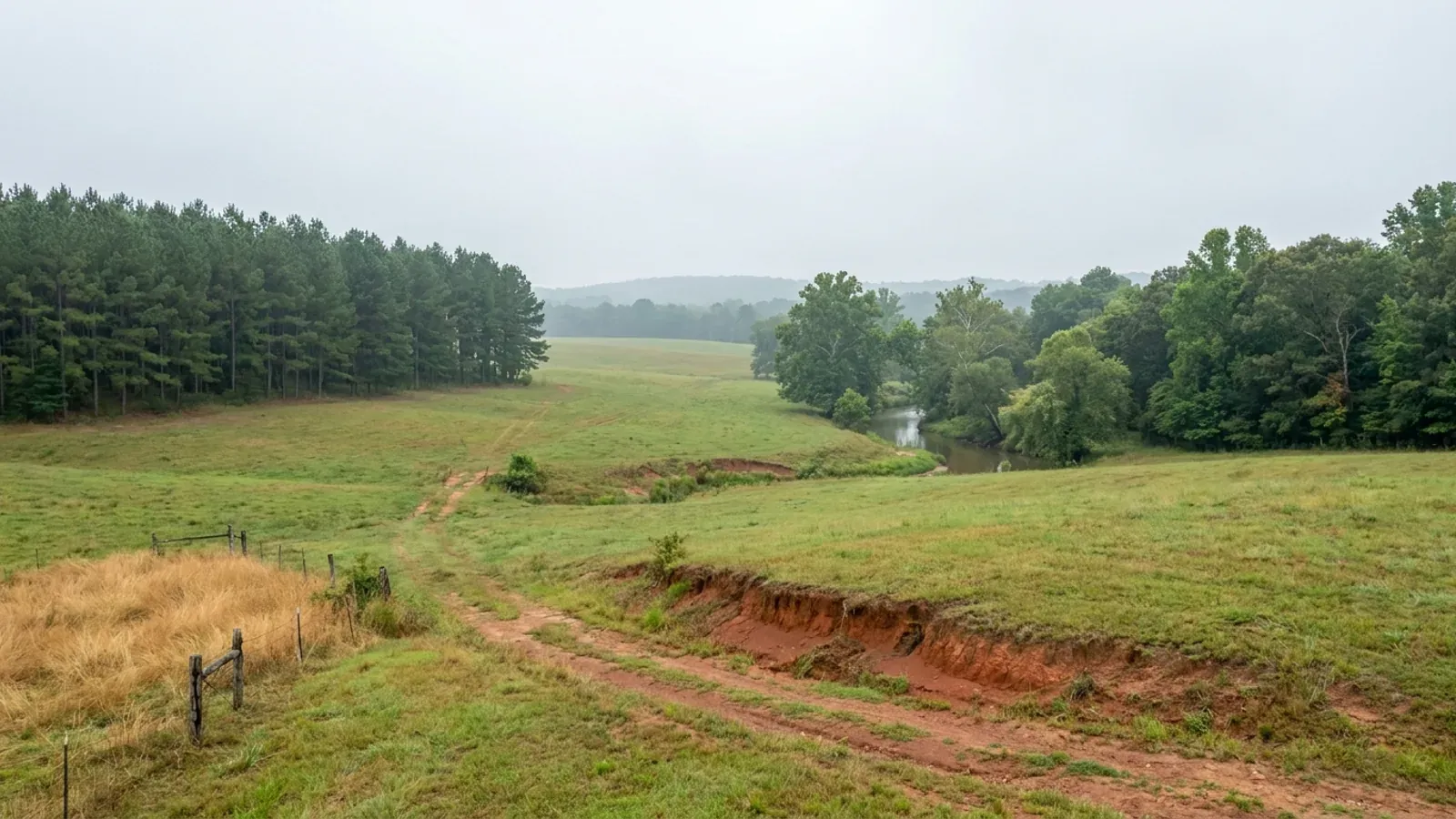
Rolling central Arkansas pasture with loblolly pine, red-brown clay in a cut bank and a wooded creek bottom.
Pulaski County Statewide code, local enforcement optional

Barndominium Builders in Little Rock, AR

Little Rock is the largest city in Arkansas at 206,427 people, very nearly double the next, and it is one of the harder places in the state to actually put a barndominium. Pulaski County has just 14.8 percent of its land in farms and the smallest median farm in Arkansas at 35 acres, and the city's own zoning ordinance never asks for more than 15,000 square feet in a single-family district. So this page does two jobs: it sets out exactly what Little Rock's Building Codes Division charges, publishes and enforces — including a permit fee and a shop-size rule almost no Arkansas jurisdiction puts in writing — and it routes you to Perry, Grant, Lonoke and Saline counties, where the land you are picturing genuinely exists.

Little Rock at a glance

County
Pulaski County
Population
206,427
ZIP codes
72201, 72202, 72204, 72205, 72206, 72207, 72209, 72210, 72211, 72212, 72223, 72227
Site visits
Little Rock anchors the Central Arkansas belt we work every week, and so do the four ring counties this page points you toward — Perry, Grant, Saline and Lonoke.

Building conditions in Little Rock

The State's code reaches every parcel in Arkansas, including rural and unincorporated land. What is not everywhere is the office that checks it: a city or county is authorised to set up a building department, not required to, and a great deal of rural Arkansas never has. So the first question on any parcel is not what the code says — that part travels — but whether anyone here issues a permit, inspects the work, or publishes the design criteria your drawings still have to satisfy. Where nobody does, the obligation does not go away. It just moves to the appraiser, the insurer, your lender and whoever buys the place from you.

Build conditions for Little Rock , Pulaski County, Arkansas : design wind speed 115 mph Cat II. BUILD CONDITIONS LITTLE ROCK, ARPulaski CountyONE STATEWIDE CODEDESIGN WIND SPEED115 mph Cat IILittle Rock's sheet is headed JANUARY 1, 2014 EFFECTIVE DATE and cites the 2012 IBC: Cat I 105mph, Cat III-IV 120. Its current code list publishes none. Settle the figure with the plan…ZONING · R-2 SINGLE-FAMILY IS THE PREDOMINANT…R-1: 15,000 sq ft, 80 ft wide, 120 f…Heights are 35 ft in R-1, R-2 and R-4A, and 45 ft in AF and OS. Lotcoverage by the main building and all accessory buildings together…NO DEVELOPMENT IMPACT FEE; A DATA PROCESSING…$25.00Ordinance No. 22,204 establishes a $25.00 data processing fee onresidential and commercial permits alike, in addition to the permit…WHO ISSUES THE PERMITCity of Little Rock Planning and Dev…Building Codes Division, 723 West Markham Street; applications arefiled in person, and the city also runs an interactive…
Build conditions for Little Rock, drawn from the sourced facts on this page. Every figure above is cited in the quick-facts panel below, with its source and vintage.
Little Rock publishes its building permit fee as a formula, and almost no Arkansas jurisdiction publishes one at all
Ordinance No. 22,204, passed 6 December 2022, replaced section 8-31(c) of the Little Rock Revised Code of Ordinances with a valuation-banded schedule. A permit is required for any work exceeding $5,000.00 including material and labour, or requiring an inspection, with a stated exclusion for a one-storey detached accessory structure used as a tool or storage shed where the floor area does not exceed 200 square feet. The bands: $5,000 and less, no fee unless an inspection is required, then $25.00 per inspection; $5,000.01 to $50,000, $50.00 for the first band plus $4.00 per additional thousand or fraction; $50,000.01 to $100,000, $250.00 for the first $50,000 plus $3.50 per additional thousand; $100,000.01 to $500,000, $420.00 for the first $100,000 plus $3.00 per additional thousand; above that, $1,620.00 for the first $500,000 plus $2.50 per additional thousand. Minimum building permit fee $50.00. Residential certificate of occupancy on a new single-family residence, duplex or townhouse, $30.00. On the ordinance's own arithmetic a $300,000 build carries a $1,020.00 building permit fee.

https://www.littlerock.gov/media/19234/ord-22204-fees.pdf

The only Little Rock sheet with design numbers on it was written to a code edition the state replaced in 2023
The City of Little Rock Codes & Design Criteria sheet is headed JANUARY 1, 2014 EFFECTIVE DATE. It lists the 2012 Arkansas Fire Prevention Code Volumes I, II and III, the 2011 Arkansas Energy Code, the 2011 National Electrical Code, the 2006 Arkansas State Plumbing Code and the 2010 Arkansas Mechanical Code, and it notes that 'Appendices A-Q are NOT adopted by the state of Arkansas' — the 2012 appendix lettering, which the 2021 code replaced with AA through AW. It is the sheet carrying the city's wind speeds by risk category, its 10 psf snow load cited to Section 1608 and Figure 1608.2, its 20 psf roof live load, its 12-inch frost line, and its minimum footing of 18 inches wide by 12 inches deep with 9 inches of concrete and a 3½-inch minimum slab. The city's current published list, Enforced Construction Codes dated 7 January 2023, names the 2021 Arkansas Fire Prevention Code Volumes 1 to 3 and the 2014 Arkansas Energy Code — and carries no design figures whatever. So Little Rock's numbers and Little Rock's code edition are on two different sheets, nine years apart.

https://www.littlerock.gov/!userfiles/editor/docs/planning/building%20codes/1%2023%2014%20Building%20Codes%20Design%20Criteria.pdf

Little Rock formally repealed its three-mile planning ring on 2 September 2025
Act 314 of 2025 repealed A.C.A. 14-56-413 outright and abolished municipal extraterritorial jurisdiction across Arkansas. Little Rock responded with an ordinance repealing the city's planning jurisdiction in unincorporated Pulaski County — reviewed and unanimously approved by the Little Rock Planning Commission on 14 August 2025, passed by the Board of Directors on 2 September 2025, and carried in the code's amendment history for Sec. 23-2 as Ordinance No. 22,651. Its recitals record that for municipalities of 150,000 population and greater the extraterritorial jurisdiction was three miles, and that the authority had included regulation of land subdivision, plat approval, building inspection and other land use and infrastructure matters within that radius. Section 1 provides that the city 'shall no longer assert, exercise, or enforce extraterritorial jurisdiction or control in any unincorporated areas of Pulaski County.' Section 6 preserves the city's ability to keep comprehensive plans and future land use maps covering land outside the limits for advisory purposes only, with no force of law, and a further section provides that all city planning documents, zoning classifications and development regulations apply immediately upon annexation.

https://www.littlerock.gov/city-administration/board-of-directors/meeting-agenda/AGENDA%20-%20WEB%20-%209-02-2025/O%20-%20ETJ%20Repeal.pdf

Your shop must contain less floor area than your house, and sit sixty feet back from the front line
Little Rock does not cap detached accessory buildings with a square-foot number. It uses a ratio and a geometry instead. Sec. 36-156(a)(2)c provides that accessory buildings or structures in the R-1 through R-4A districts shall not be located closer than sixty feet to the front property line or fifteen feet from a street side line, may not occupy more than thirty percent of the required rear yard area, and 'shall in all instances be subordinate to the principal structure on the lot and contain less gross floor area.' On a double-front lot they must meet the front yard setback on both streets. Sec. 36-156(a)(2)b then requires all single- and two-family residences to be separated from accessory structures by not less than six feet, and (2)f requires at least a three-foot setback from any side or rear property line, with no setback required where the rear yard abuts a dedicated alley. Layer the district lot-coverage cap on top — 30 percent of the lot for the main building and all accessory buildings combined in R-1 — and on a 15,000 square foot R-1 lot the house and shop together may not exceed 4,500 square feet of footprint.

https://library.municode.com/ar/little_rock/codes/code_of_ordinances?nodeId=COOR_CH36ZO_ARTIIINOEX_S36-156HEAREX

Also worth knowing before you build in Little Rock

Little Rock's agricultural zoning district asks for less land than its large-lot single-family district
Sec. 36-338 establishes the AF agriculture and forestry district, intended 'to provide a smooth transition between purely rural areas and newly urbanized areas.' It permits single-family residences together with the usual accessory uses, and agriculture and forestry operations including the raising of livestock and poultry. Its height limit is forty-five feet — ten feet more than R-1, R-2, R-3 and R-4A allow. Single-family setbacks are twenty-five feet front, eight feet side and twenty-five feet rear. The main building and all accessory structures together may not occupy more than twenty-five percent of the tract. And the minimum lot area is seven thousand square feet, with seventy feet of width and one hundred feet of depth — less than half the fifteen thousand square feet R-1 demands. Little Rock's agricultural district is not an acreage district; it is an annexation-transition district, and the ordinance says so in its own purpose clause.

https://library.municode.com/ar/little_rock/codes/code_of_ordinances?nodeId=COOR_CH36ZO_ARTVDIRE_DIV6SPDI_S36-338AFAGFODI

Fifteen thousand square feet is the largest lot the zoning ordinance asks for anywhere in Little Rock
Sec. 36-253 establishes R-1 for 'development of single-family residences on lots not less than fifteen thousand (15,000) square feet in area', with a minimum width of eighty feet and depth of one hundred twenty feet, a thirty-five foot front yard, ten-foot side yards, a twenty-five foot rear yard and a thirty-five foot height limit — and the section itself notes that R-1 'is the least utilized of the several single family zones.' Sec. 36-253(e) caps lot coverage: 'The main building and all accessory buildings on a lot shall not occupy more than thirty (30) percent of the total area of the lot.' R-2, the district that covers a major portion of the developed city, asks for six thousand square feet on fifty feet of width; R-4A asks five thousand. Roughly a third of an acre is the ceiling of Little Rock's residential zoning ambition, and 15,000 square feet is 0.34 acre.

https://library.municode.com/ar/little_rock/codes/code_of_ordinances?nodeId=COOR_CH36ZO_ARTVDIRE_DIV2REDI_S36-252ACBUCEDI

The one Little Rock district written around acreage is the one that expects you not to build much
Sec. 36-340 establishes the OS open space district, intended to encompass 'lands where natural topography creates practical difficulty for urban development' — where 'slope, drainage and erosion hinder the adequate placement of utility systems' — and to serve as a buffer between incompatible uses. Its first permitted use is 'One (1) single-family dwelling on each lot or building site having an area of not less than five (5) acres', alongside farming, gardening, orchards, livestock, pasture, poultry and forestry land operations. Accessory uses expressly include barns, silos and tank houses. Height is forty-five feet, front and rear yards fifty feet, side yards thirty feet. And Sec. 36-340(h) caps it: 'The main building and all accessory buildings in the OS district shall not occupy more than ten (10) percent of the total area of the tract.' Five acres at ten percent is 21,780 square feet of footprint — but the district exists because the ground is steep, wet or a buffer, not because it is good building land.

https://library.municode.com/ar/little_rock/codes/code_of_ordinances?nodeId=COOR_CH36ZO_ARTVDIRE_DIV6SPDI_S36-338AFAGFODI

A shipping container is not an accessory building in Little Rock, and the city will give you six months to move it
Sec. 36-252(b) defines an accessory building as 'a constructed edifice designed to stand alone, more or less permanently', and provides that 'Only those buildings specifically designed and constructed for the purpose of serving as an accessory building shall meet the definition of an accessory building.' It then names what does not qualify in a residentially-zoned district: 'cargo containers, truck boxes and trailers, train cars and cabooses, mobile homes, manufactured homes and recreational vehicles or trailers.' Such items are expressly not treated as nonconforming structures under Article III, so the usual grandfathering does not reach them, and any such item in use before the ordinance took effect 'shall be removed within six (6) months from notification by the city of the property owner.' Anyone planning container storage or a converted trailer alongside a Little Rock build should read that sentence first.

https://library.municode.com/ar/little_rock/codes/code_of_ordinances?nodeId=COOR_CH36ZO_ARTVDIRE_DIV2REDI_S36-252ACBUCEDI

Above five acres you need a second, separately priced permit before anyone moves dirt
Little Rock regulates land alteration under Chapter 29, Article VI. Sec. 29-186(d) requires a grading permit for a top-of-hill or hillside cut or fill greater than ten vertical feet, for any construction where the total volume of cut or fill reaches one thousand cubic yards, and for clearing or cutting trees — with the AF agriculture and forestry and M mining districts expressly excepted, alongside small residential lots. Sec. 29-186(a) adds that the responsible party 'shall not allow the removal of more than seven (7) trees within any given twelve-month period without first obtaining a grading permit', and Sec. 29-186(c) that 'All land alteration on properties within the designated floodplain requires a grading permit without exception.' Sec. 29-187(a)(1) exempts properties of two acres or less zoned R1, R2, R3, R4 or R7A, and residentially zoned property of five acres or less fronting on a residential street, folding their grading and erosion control into the building permit. Above that line the permit is separate, and Sec. 29-193 prices it: less than half an acre $100.00; half to one acre $200.00; greater than one acre $200.00 for the first acre plus $100.00 for each additional acre — doubled if issued after a notice of violation.

https://library.municode.com/ar/little_rock/codes/code_of_ordinances?nodeId=COOR_CH29STMADR_ARTVILAALRE_DIV2GRPEGRDRPL_S29-187EXVA

Thirty vertical feet is the most earth Little Rock will let you move in one go, and ten feet is the most in one face
Sec. 29-190 sets the cut-and-fill rules, and they are unusually specific for an Arkansas city. A maximum of thirty vertical feet of fill or excavation is permitted — 'such as three (3), ten-foot vertical terraces or two (2), fifteen-foot vertical terraces' — after which an additional development area at least 150 feet wide at no more than eight percent slope is required before another thirty feet may be used. Individual cuts or fills are limited to ten feet in height, or fifteen feet if architectural stone protects the vertical face. Terraces must be at least one foot wide for every foot of vertical height up to ten feet, densely planted, and broken up every 200 feet if straight. Slopes flatter than 3:1 need no terraces and carry no height limit. Sec. 29-190(3) provides that 'The city official may require certified geotechnical analysis for sliding and global stability safety', and (11) sizes the sediment basin at 3,600 cubic feet per acre where average slope is steeper than five percent against 1,800 where it is five percent or flatter. Sec. 29-190(15) keeps a 25-foot undisturbed strip along each side of any stream carrying more than 150 cubic feet per second in a ten-year storm.

https://library.municode.com/ar/little_rock/codes/code_of_ordinances?nodeId=COOR_CH29STMADR_ARTVILAALRE_DIV2GRPEGRDRPL_S29-187EXVA

Along Highway 10 the minimum tract is two acres and every building stands one hundred feet back
Sec. 36-344 puts the Highway 10 scenic corridor overlay across all land with Highway 10 frontage lying within three hundred feet of each side of the right-of-way, from the western boundary of the Rodney Parham Road intersection out to the western boundary of the planning boundary — the west Little Rock corridor where what acreage the city has mostly sits. Inside it, Sec. 36-346 requires a minimum development tract of not less than two acres, with existing lots of record of two acres or less exempt; a one hundred-foot building setback from the property line abutting Highway 10 for 'All principal and accessory buildings or structures'; a forty-foot rear yard; and a thirty-foot side yard, with a landscaped buffer averaging twenty-five feet along rear and side. Sec. 36-345 carves out the exception that matters most here: the overlay regulations 'apply to all development, redevelopment or expansion of existing development with the exception of single-family and duplex development under zoning districts R-1, R-2, R-3, and R-4, or PUD submissions as required.' AF-zoned frontage is not in that exception list.

https://library.municode.com/ar/little_rock/codes/code_of_ordinances?nodeId=COOR_CH36ZO_ARTVDIRE_DIV7DEOVDIIG10SCCO_S36-346SIDEDEST

Pulaski County's six most extensive soils are three different foundation problems
A USDA-NRCS Soil Data Access query over the Pulaski County survey area (AR119), summing mapunit acres weighted by major-component percentage, returns Carnasaw first at about 71,100 acres, then urban land, Leadvale at about 48,400, Mountainburg at about 38,700, Linker at about 35,500 and Perry at about 30,200, with rock outcrop mapped over another 9,600 acres. Those are not variations on one theme. Carnasaw is a fine, mixed, semiactive, thermic Typic Hapludult on 'nearly level to very steep sideslopes of the Ouachita Mountains and the Arkansas Valley and Ridges', with solum thickness and depth to shale bedrock of 40 to 60 inches. Mountainburg is a loamy-skeletal Lithic Hapludult with depth to bedrock of 12 to 20 inches. Leadvale is a fragipan soil. Perry is a very-fine smectitic Chromic Epiaquert whose 10-to-40-inch control section runs 60 to 85 percent clay, dominated by montmorillonite, in the Arkansas River backswamps. Clay over shale, rock at knee height, a perching pan and a shrink-swell Vertisol — in one county.

https://soilseries.sc.egov.usda.gov/OSD_Docs/M/MOUNTAINBURG.html

Pulaski is one of the few Arkansas counties carrying shallow bedrock, shrink-swell clay and fragipan all at once
SSURGO summaries for the Pulaski County survey area put shallow bedrock — a lithic, paralithic or densic restriction within 152 centimetres — under 31.8 percent of the county, Vertisols under 5.9 percent with 23.3 percent of the area carrying a linear extensibility of 6 or more in the upper metre, and a fragipan under 12.7 percent. That combination is close to unique in Arkansas. The Delta counties record 0.0 percent shallow bedrock. The Ouachita and Ozark counties record almost no Vertisol. Neighbouring Saline is 52.1 percent shallow bedrock with no Vertisols at all, and neighbouring Faulkner is 52.7 percent shallow bedrock and 31.5 percent fragipan. Pulaski straddles the boundary, so which of the three problems you get is a question about which side of the county you buy on rather than a question about the county. The Perry series alone covers about 31,600 acres of Pulaski.

https://websoilsurvey.sc.egov.usda.gov/App/HomePage.htm

The expansive-clay belt near Little Rock is a bedrock formation, not river mud, and the two get confused constantly
The Arkansas Geological Survey's expansive soils page names one formation: 'In Arkansas, the clays of the Porters Creek Clay of the Midway Group are highly expansive. The Porters Creek Clay outcrops in a narrow but continuous belt along the Fall Line from just south of Hope to near Arkadelphia and intermittently from Malvern to near Batesville.' Malvern to Batesville is the Central Arkansas leg of the Fall Line, the contact where the older highlands meet the Coastal Plain. The Survey describes the formation as 'dark bluish-gray to black calcareous clay', an aquitard yielding very little water to wells, with outcrop thickness locally ranging from 0 to 130 feet, and mineralogy including calcium-magnesium smectite. That is a different mechanism from the Vertisol clay of the Arkansas River backswamps and the Delta, which is river alluvium; the Survey's page does not mention the alluvial plain, Sharkey clay or Vertisols at all. Its case studies section reads that there are no expansive soil case studies reported at this time. Two separate shrink-swell stories run through Central Arkansas, and a soils report is the only way to know which one is under a given pad.

https://geology.arkansas.gov/geohazards/expansive-soils.html

The county froze building in Little Rock's old ETJ ring three weeks before the city repealed it
Pulaski County adopted a temporary moratorium on certain development activities on 13 August 2025, effective at 11:40 a.m. that day, restricted to properties inside the former extraterritorial jurisdictions of Little Rock and North Little Rock and running six months unless extended or terminated by the Quorum Court. Projects consistent with the previously adopted Little Rock and North Little Rock plans could proceed after consulting the Planning and Development Department, and pre-existing projects were exempt. The county's stated reason was the new state law effective 5 August 2025 that transferred zoning authority in those areas from the cities to the county. Separately, the Pulaski County Quorum Court adopted the Pulaski County Land Use Study and Plan on 27 May 2025 — a policy document with no legal enforcement, which leaves it to the Quorum Court to enact any zoning. A countywide zoning code has been under public debate since, and drew organised opposition from Pinnacle Mountain area residents in December 2025. Anyone buying in that former three-mile band should check where the county has got to before closing.

https://www.pulaskicounty.net/news/posts/pulaski-county-issues-temporary-moratorium

Little Rock publishes what it costs to ask for an exception, too
Ordinance No. 21,676, passed 11 December 2018, sets the city's planning application filing fees. A Board of Adjustment application costs $75.00 for administrative appeals and interpretations, $100.00 for single-family and two-family variance applications, $250.00 for multifamily and nonresidential variance applications, and $60.00 for sign variances. Conditional use permits are priced by site size: $175.00 for residential sites up to half an acre, $200.00 for residential sites over half an acre and less than three acres, and $275.00 for residential sites of three acres and larger. A special use permit is $175.00 for all sites. Under Chapter 29 a grading variance or appeal to the Planning Commission carries a flat $50.00 plus $5.00 per acre of total project area. Since the accessory-building rules in Sec. 36-156 are the ones a barndominium most often runs into, the $100.00 single-family variance line is the number worth knowing before redesigning around them.

https://littlerock.gov/wp-content/uploads/application-fee-ordinance.pdf

An excavator grading a compacted building pad on a cleared lot, with survey stakes and a drainage swale visible.
Below the slab

The expensive surprises are in the ground, not the building

What moves an Arkansas budget is usually below grade, and the state hands you a different problem depending on where you stand. In the Delta the issue is shrink-swell clay that moves with the season, and it is the reason a wide, light building with a big slab and a big door opening is the shape most at risk. Along the Fall Line there is a second, separate clay belt with nothing to do with the Delta at all. Up in the Ozarks the question inverts: what matters is not what the slab sits in but what is under it, because that limestone is full of solution cavities and the collapses arrive with no prior indication at the surface. And on Crowley's Ridge, where Jonesboro and Paragould sit, it is fine wind-blown loess that stands up in a vertical cut and then erodes out from under whatever you put on it. The same ground decides your wastewater system, which is the gate that most often moves a rural build's schedule — and it is soils that decide it, not the size of the house. So the site work, the foundation and the wastewater get resolved together rather than one at a time. We price the dirt before we price the building.

What a build looks like

Three stages every Little Rock project passes through, from a raw parcel to a finished home. Site work first, because that is where the budget is decided.

Aerial view of an undeveloped rural lot with cleared grass, an oak and hickory treeline with shortleaf pines, and a pale gravel access track.
Stage one

The parcel

Zoning, setbacks, flood zone and utility access get checked before anything is drawn.

An excavator grading a compacted building pad on a cleared lot, with survey stakes and a drainage swale visible.
Stage two

Pad and permit

Clearing, grading and a compacted pad, while the submittal works through whichever office issues the permit where you are building.

A finished barndominium at dusk with warm interior lighting glowing through its large windows.
Stage three

Frame to finish

Shell erected and dried in, then systems, insulation and interior finish through to CO.

Those are the rules where you are building in Little Rock. Tell us what you want to build and we will draw it to them.

Where we build around Little Rock

Pulaski County and the rural land around it. The buildable acreage for a project this size usually sits outside the city limits, which is frequently what changes who issues your permit.

The Little Rock service area, including the rural acreage outside the built-up edge, which is where the parcels big enough for a build like this usually sit. The map marks the territory we build in. It is not a branch location, and there is no office at this pin.

Nearby areas we build in

Others we cover nearby. One may be a county, another a city inside it — and since March 2025 the soft edge between them is gone, because the cities' extraterritorial jurisdiction was abolished outright and that land reverted to the counties. So the office that issues the permit, the fees it charges, the zoning and whether anyone publishes design criteria at all can differ from one card to the next, and the boundary that decides it may have moved recently.

Building in Little Rock: common questions

9 questions we get asked most often about building in Little Rock. If yours is not on the list, ask it directly.

Can I actually build a barndominium in Little Rock?
Yes, and the city will permit and inspect it — but be honest with yourself about the land. Little Rock is 206,427 people on 121 square miles at about 1,700 people per square mile, and its zoning ordinance never asks for more than 15,000 square feet in a single-family district. R-1, described in the code as the least utilised of the several single-family zones, wants 15,000 square feet. R-2, which covers a major portion of the developed city, wants 6,000. The AF agriculture and forestry district — the only agricultural district in the ordinance — wants 7,000 square feet, less than half of R-1. The only district written around acreage is OS open space, which permits one dwelling per five-acre building site and then caps all buildings at ten percent of the tract, and which exists precisely because the ground is steep, wet or serving as a buffer. Pulaski County as a whole has 14.8 percent of its land in farms and the smallest median farm in Arkansas at 35 acres, so the county is not hiding a reservoir of ten-acre tracts either. What Little Rock is genuinely good for is an infill build on a platted lot, a large addition, or a house with a shop inside the city's size and coverage rules. If what you want is a pole barn home on real acreage, you buy it in the ring — Perry, Grant, Lonoke or Saline County — and this page tells you which one fits which build.
Who issues the permit in Little Rock, and what does it actually cost?
The Building Codes Division of the City of Little Rock Planning and Development Department, at 723 West Markham Street. It runs six sections — building, electrical, mechanical, plumbing and gas inspections, plan review and permits — and applications are filed in person, with an interactive building-construction permit programme available online. Unlike almost every Arkansas jurisdiction, Little Rock publishes the fee. Ordinance No. 22,204, passed 6 December 2022, sets a valuation-banded schedule in section 8-31(c) of the Revised Code of Ordinances. A permit is required for any work exceeding $5,000.00 including material and labour, or requiring an inspection, with a carve-out for a one-storey detached tool or storage shed of 200 square feet or less. From $5,000.01 to $50,000 the fee is $50.00 for the first band plus $4.00 per additional thousand; from $50,000.01 to $100,000, $250.00 for the first $50,000 plus $3.50 per thousand; from $100,000.01 to $500,000, $420.00 for the first $100,000 plus $3.00 per thousand; above that, $1,620.00 for the first $500,000 plus $2.50 per thousand. The minimum building permit fee is $50.00. Add a $25.00 data processing fee on every permit and a $30.00 residential certificate of occupancy on a new single-family residence. Run a $300,000 valuation through it and the building permit fee is $1,020.00. Re-inspection is charged, and where work starts before the permit issues the ordinance triples the fee.
Can my shop be bigger than my house inside the city limits?
Not if it is detached. Little Rock does not use a square-foot cap the way some Arkansas cities do; it uses a ratio, a geometry and a coverage limit stacked together. Sec. 36-156(a)(2)c provides that accessory buildings in the R-1 through R-4A districts shall not sit closer than sixty feet to the front property line or fifteen feet from a street side line, may not occupy more than thirty percent of the required rear yard area, and shall in all instances be subordinate to the principal structure on the lot and contain less gross floor area. Sec. 36-156(a)(2)b then forces six feet of clear separation between the residence and any accessory structure, and (2)f requires a three-foot setback from side and rear property lines, waived only where the rear yard abuts a dedicated alley. On top of that sits the district lot-coverage cap: in R-1 the main building and all accessory buildings together may not occupy more than thirty percent of the lot, which on the district's own 15,000 square foot minimum is 4,500 square feet of total footprint. The route around the accessory-building rules is to stop having an accessory building: a shop built as part of the principal structure is measured as the principal structure. Note also that Sec. 36-156(a)(2)c is written for the R-1 through R-4A districts; the AF district instead carries a forty-five foot height limit and a twenty-five percent coverage cap, and OS a ten percent cap. The Board of Adjustment hears single-family variances, and the filing fee for one is $100.00.
What design numbers does Little Rock publish, and are they current?
Little Rock is one of only two Arkansas jurisdictions found publishing design criteria at all, and its numbers come with a date that has to travel with them. The City of Little Rock Codes & Design Criteria sheet is headed JANUARY 1, 2014 EFFECTIVE DATE. It gives wind loads by risk category — 105 mph for Risk Category I, 115 mph for Risk Category II, 120 mph for Risk Categories III and IV — cited to Chapter 16, Table 1604.5 of the 2012 International Building Code. It gives a 10 psf snow load under Section 1608 and Figure 1608.2, a 20 psf roof live load, a 12-inch frost line, minimum footings 18 inches wide by 12 inches deep with 9 inches of concrete bearing on undisturbed soil or 90 percent compacted fill, and a 3½-inch minimum slab. Its seismic entry reads 'IBC, Project Zone Classification 1; Site Class B; State of Arkansas Act 1100' — a statutory zone that governs public structures under A.C.A. 12-80-103, and a rock site class, where the residential code's own maps assume Site Class D as a default. The sheet's whole code list is the 2012 Arkansas Fire Prevention Code, the 2011 energy code and the 2011 NEC. Little Rock's current published list, Enforced Construction Codes dated 7 January 2023, names the 2021 Arkansas Fire Prevention Code Volumes 1 to 3, the 2020 NEC and the 2014 Arkansas Energy Code — and carries no design figures at all. So the city is on the 2021 code and its only numbered sheet is written to the 2012 one. Take the 105/115/120 to the plan reviewer and confirm what the division is using before you order steel.
Little Rock used to reach three miles outside the city. What happened to that?
It is gone, and Little Rock is the cleanest documented example in Arkansas of a city closing the loop on it. Act 314 of 2025 repealed A.C.A. 14-56-413 outright, abolishing municipal extraterritorial jurisdiction statewide, along with 14-17-208(i), 14-38-101(b)(1)(B), 14-40-208, 14-56-417(c), 14-56-422(5)(B) and 17-28-305(b)(3), the provision that had let a city extend electrical permit and inspection jurisdiction into the same ring. The Little Rock Planning Commission reviewed a repealing ordinance on 14 August 2025 and approved it unanimously; the Board of Directors passed it on 2 September 2025, and it appears in the code's amendment history for Sec. 23-2, Planning Jurisdiction, as Ordinance No. 22,651. The ordinance's recitals record that the ring was three miles for municipalities of 150,000 population and greater and had covered land subdivision, plat approval and building inspection. Section 1 states the city shall no longer assert, exercise or enforce extraterritorial jurisdiction or control in any unincorporated area of Pulaski County. The ordinance rewrites the city's planning jurisdiction as the corporate limits, deletes the old planning-jurisdiction maps, and strikes extraterritorial language from the subdivision, zoning and waste-facility chapters. It preserves advisory long-range planning outside the limits with no force of law, and it provides that all city regulations apply immediately on annexation. Land in that former ring now answers to Pulaski County — which froze certain development there by moratorium on 13 August 2025 and has been debating a countywide zoning code since.
Do I need a grading permit as well as a building permit?
On a small platted lot, no. On the kind of tract a barndominium buyer wants, very likely yes — and it is priced separately. Little Rock regulates land alteration under Chapter 29, Article VI, which the city adopted because development had been 'causing the displacement of large amounts of earth and tree cover', producing flooding, erosion, unstable slopes and hillside scars. Sec. 29-186(d) triggers a grading permit for a top-of-hill or hillside cut or fill greater than ten vertical feet, for any construction where total cut or fill reaches 1,000 cubic yards, and for clearing or cutting trees, with the AF agriculture and forestry and M mining districts excepted. Sec. 29-186(a) adds that more than seven trees may not be removed in any twelve-month period without one, and Sec. 29-186(c) that all land alteration in the designated floodplain requires one without exception. Sec. 29-187(a)(1) exempts properties of two acres or less zoned R1 through R4 or R7A, and residentially zoned property of five acres or less fronting a residential street, folding their grading and erosion control into the building permit instead. Above that, Sec. 29-193 prices it: $100.00 under half an acre, $200.00 from half to one acre, and $200.00 for the first acre plus $100.00 for each additional acre beyond that — doubled if a notice of violation has already issued. A grading and drainage plan must be sealed by a registered engineer, architect or landscape architect, except for sites under two acres, or residentially zoned sites under five acres where cuts and fills stay under ten feet, which the owner or contractor may prepare with city approval.
What is the ground like here, and what does it mean for a slab?
Little Rock sits where the Ouachita foothills meet the Arkansas River valley and the Coastal Plain, and the soils say so plainly. A USDA-NRCS Soil Data Access query over the Pulaski County survey area returns, by major-component acreage, Carnasaw first at roughly 71,100 acres, then urban land, Leadvale at about 48,400, Mountainburg at about 38,700, Linker at about 35,500 and Perry at about 30,200, with rock outcrop mapped over another 9,600. Those are four separate foundation conversations. Carnasaw is a fine, mixed, semiactive, thermic Typic Hapludult on the sideslopes of the Ouachita Mountains and the Arkansas Valley and Ridges, with shale bedrock at 40 to 60 inches. Mountainburg is a loamy-skeletal Lithic Hapludult with bedrock at 12 to 20 inches — rock inside the depth a footing cares about. Leadvale carries a fragipan that perches water above itself in late winter and spring. Perry is a very-fine smectitic Chromic Epiaquert whose control section runs 60 to 85 percent clay dominated by montmorillonite, in the Arkansas River backswamps. County-wide, SSURGO puts shallow bedrock under 31.8 percent of Pulaski, a fragipan under 12.7 percent, and 23.3 percent of the area at a linear extensibility of 6 or more in the upper metre. Separately, the Arkansas Geological Survey identifies the Porters Creek Clay of the Midway Group as Arkansas's expansive bedrock formation, outcropping along the Fall Line and running intermittently from Malvern to near Batesville — a different mechanism from the alluvial Vertisols and not to be confused with them. Which of these is under your pad is a site question, not a city question, and the soils report is where it gets answered.
Is there anywhere inside Little Rock with real acreage, and what governs it?
There is some, mostly on the west and far southwest sides, and it comes with its own layer of rules. Three things govern it. First, the underlying district: AF agriculture and forestry permits single-family residences with the usual accessory uses plus agriculture and forestry operations including livestock and poultry, allows forty-five feet of height where the ordinary residential districts allow thirty-five, and caps the main building and all accessory structures at twenty-five percent of the tract — but its minimum lot is only 7,000 square feet, so AF zoning tells you what you may do, not how much land you have. OS open space is the only district requiring five acres per dwelling, and it caps all buildings at ten percent of the tract. Second, the Highway 10 scenic corridor overlay, which covers all land with Highway 10 frontage within three hundred feet of each side of the right-of-way from the Rodney Parham intersection west. Inside it, Sec. 36-346 sets a minimum development tract of two acres, a hundred-foot setback from the Highway 10 property line for all principal and accessory buildings, a forty-foot rear yard and a thirty-foot side yard — with Sec. 36-345 excepting single-family and duplex development in R-1, R-2, R-3 and R-4. Third, the terrain: west Little Rock is where Mountainburg and rock outcrop are mapped, and where Chapter 29's thirty-foot cut-and-fill ceiling, ten-foot single-face limit and possible geotechnical sliding analysis start to bite. Where a site cannot be developed within the overlay standards, Sec. 36-348 routes it through the planned zoning district process instead.
If I look at one of the ring counties instead, what actually changes?
The counter changes, and so does the ground. Little Rock has a building official, a plan reviewer, an inspection sequence, a published permit fee and a zoning ordinance with a shop-size rule in it. Most of the ring has none of that. In Arkansas county zoning is a two-step opt-in: a county judge may create a planning board with the quorum court's approval under A.C.A. 14-17-203(a), and only then may the court adopt zoning, which 14-17-209(c) says is observed through denial of building permits. Pulaski County itself shows the halfway state — it has a planning board and a subdivision code, but its zoning ordinance, zoning map and building permit application all apply to the Lake Maumelle Watershed only. All six ring counties sit inside the Little Rock–North Little Rock–Conway metropolitan area, and they are not interchangeable. Perry County, west up Highway 10, is 18.7 people per square mile and 76 percent forest — the least dense county in any Arkansas metropolitan area, on Ouachita rock. Grant County, south, is 97 percent forest, the highest forest share of any county in the state, on sandy coastal-plain ground with a median farm of 92 acres. Lonoke County, east, has 82.9 percent of its land in farms, the highest share of any metropolitan county in Arkansas, on flat Mississippi Alluvial Plain with a high water table and a median farm of 122 acres. Saline County, south-west, is Ouachita foothill and the fastest-suburbanising of the four, with Carnasaw and Townley clay over weathered shale and 52.1 percent of the county carrying shallow bedrock. Same metro, four different foundations, and four different answers to who inspects.

Building in Little Rock?

Start with the plan. Tell us what you want to build and we will draw it, then confirm which office issues the permit for your parcel, what it will let you put there, and what wind load it has to meet. That conversation costs nothing.