Barndominium Builders in Crawford County, AR
Unincorporated Crawford County has no planning board, no zoning and no building permit — but it is not a county that regulates nothing, and that is the thing worth knowing before you buy here. Its published law reaches construction through two doors instead: a road ordinance that makes the County Judge's permit a condition of any new entrance onto a county road, and a state stormwater permit that obliges the county to review the site plan of every project disturbing an acre or more inside its urbanized area. The office that holds that stormwater permit is Emergency Management, because there is no building official to give it to.
Crawford County at a glance
- County
- Crawford County
- Population
- 62,657
- ZIP codes
- 72956, 72921, 72932, 72934, 72935, 72946, 72947, 72948, 72952, 72955
- Site visits
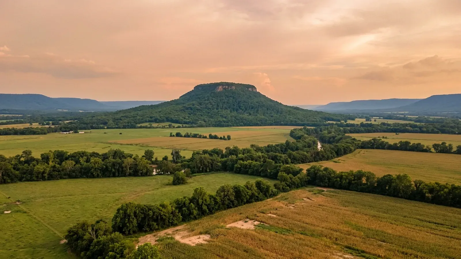
- Crawford County runs from the Arkansas River bottoms at Kibler and Dyer up twenty-two miles of terraces to the Boston Mountains crest above Mountainburg, and both ends of that climb fall inside our regular Arkansas River Valley coverage, so a site walk at either is ordinary scheduling.
Building conditions in Crawford County
The State's code reaches every parcel in Arkansas, including rural and unincorporated land. What is not everywhere is the office that checks it: a city or county is authorised to set up a building department, not required to, and a great deal of rural Arkansas never has. So the first question on any parcel is not what the code says — that part travels — but whether anyone here issues a permit, inspects the work, or publishes the design criteria your drawings still have to satisfy. Where nobody does, the obligation does not go away. It just moves to the appraiser, the insurer, your lender and whoever buys the place from you.
https://www.crawfordcountyar.gov/docs/CRAWFORD%20DRIVEWAY%20PERMIT.pdf
https://www.adeq.state.ar.us/downloads/WebDatabases/PermitsOnline/NPDES/Permits/ARR040036.pdf
https://www.adeq.state.ar.us/water/permits/npdes/stormwater/noi/ms4/p_arr040000_renewal.aspx
https://encyclopediaofarkansas.net/entries/crawford-county-761/
Also worth knowing before you build in Crawford County
- Fifteen county offices, and the permit counter is the road shop
- The county's own listing of officials has fifteen entries and none of them is a building department, a planning office or a code enforcement office. What it does have is a road department the County Judge describes in his own words: forty-two employees, about 300 miles of paved roads and streets and another 600 miles of gravel county roads, roughly 200,000 tons of gravel spread a year, paving crews working April to late November. The published forms are County Road Standards revised May 2019, a driveway permit, a heavy haul permit, a non-county-maintained road grading request, a road cut permit, a road bore permit, an application for private road development, a county road surface map and a road adoption agreement. The department's own instruction is the one to follow before buying: 'All new public roads, subdivision streets, and private road developments have fees and permits that will be required. Contact the County Judge's office before any plans are developed for these projects.'
- Splitting land here is a road question, not a plat question
- Crawford County has no subdivision ordinance and no planning board to administer one, so the document that governs carving a homesite out of a larger tract is the county's Application for Private Road Development. It asks the applicant to tick which kind of split it is — Division of Family Land, Division of 40 acre tracts, Division into three (3) parcels, Court-ordered Split, Cemetery Purposes, or Public Services — and then to give the current tax parcel numbers, the total acreage of the property, the total number of parcels proposed, the acreage of the proposed parcels, and 'U.S., State or County Road Name or Number giving access to property'. It asks whether the required surveys are attached and, if not, why not. It is signed under penalty of perjury by the owner or the owner's authorised agent. That list of categories is the closest thing this county has to a subdivision rule, and the question it actually turns on is how the new parcels reach a road.
- Wet boring is prohibited when your water line crosses a county road
- Getting a utility to a rural site here means crossing a county road, and the county's bore permit is specific about how. The bore must sit at least 24 inches below the ditch flowline and no less than 36 inches below the road surface, and not more than one foot inside the right-of-way line. 'BORING SHALL BE BY THE DRY BORE METHOD OR DIRECTIONAL BORE. WET BORING IS NOT PERMITTED' — defined as using water under high pressure to jet a hole ahead of the bit. Overbore should not exceed five percent of the pipe diameter, and crossings through box or pipe culverts are not permitted at all. Bore pits go outside the right-of-way where practical. The road cut permit runs on the same depths and adds that openings on shale roads are backfilled with Class 7 base gravel and levelled with the existing road, and that the permit holder stays responsible for the cut for one year after the first repair, with the work subject to acceptance or rejection by the County Highway Superintendent.
- Alma's published subdivision rules still claim a mile of the county the legislature took back
- Act 314 of 2025 repealed A.C.A. § 14-56-413 outright and abolished municipal extraterritorial jurisdiction in Arkansas, along with § 14-56-417(c), which had barred recording a plat inside a city's territorial ring without planning-commission approval. The City of Alma's published Subdivision and Land Development regulations have not caught up. Section 3, headed Jurisdiction, still makes them 'applicable to all land within the planning area of the City of Alma as indicated the "Planning Area Map" adopted by the Planning Commission'. Section 3 of the street article still provides that 'Subdivisions located outside the city limits but within the one-mile planning area of the City of Alma shall construct the streets and roads to conform to the current Crawford County Road requirements for construction and maintenance.' The setback article still sets a 25-foot front building setback for land in the planning area but not contiguous with the city. And the enforcement article still states that 'No plat of any tract of land within the planning area jurisdiction of the Planning Commission shall be accepted by the county recorder for filing of record unless the plat has been approved by the Planning Commission.' The regulations recite Act 186 of 1957 as their authority. Alma's own zoning regulations, reissued April 2026, carry no planning-area language at all.
- Van Buren's valuation floor starts at $140 a square foot — and only heated space counts
- The City of Van Buren Building Department Fee Schedule sets a minimum cost-of-construction valuation for new residential work: $140 per square foot from 0 to 1,800 square feet, $150 from 1,801 to 2,500, $175 from 2,501 to 3,500 and $200 at 3,501 and larger. The line that matters most for this building type is the note under the table: 'The square footage is calculated based on the conditioned space (heated and cooled) of the house.' An unheated shop bay under the same roof does not enter the valuation. Where a claim is made that those costs are not appropriate to the project, the owner or contractor must establish a lesser figure using the current Marshal and Swift evaluation report or the current International Code Council building evaluation data. On the fee itself, single-family and duplex work runs $20 from $50 to $500 of construction cost, $30 to $1,000, $40 to $1,500, $50 to $2,000, and at $2,001 and over, $2 for each $1,000 of valuation or fraction thereof with a $60 minimum. A $25 erosion control permit applies on all construction, reinspection is $50, a driveway permit is $100 unless a building permit for new construction already covers it, fencing $50, residential roofing or siding $100, a residential solar project $150. Plumbing runs $2.75 per fixture or opening with $20 per inspection and three inspections on a new house; electrical $2.50 per circuit; heat and air $2.75 per unit.
- Enders clay is under nearly a third of this county, and it moves
- SSURGO's Crawford County survey area, AR033, covers 387,207 acres in 32 map units at data version 10 September 2025, and one soil dominates it: Enders, at about 122,200 acres, roughly 31.6 percent of the county. Enders is a fine, mixed, active, thermic Typic Hapludult, and its argillic horizons run 45 to 50 percent clay from about 21 centimetres down to 130, with linear extensibility as high as 7.5 and saturated hydraulic conductivity of 0.21 to 0.73 micrometres per second — slow enough that water sits on it. Weathered shale, recorded as a paralithic restriction, averages 134 centimetres and comes as shallow as 104. Its mapped slopes run 3 to 50 percent. Nella is second at about 67,100 acres, 17.3 percent, and it is the opposite proposition: a deep, well drained, fine-loamy siliceous Typic Paleudult with no restriction recorded inside 152 centimetres. Between them those two soils cover nearly half the county, and the difference between them is the difference between a straightforward footing and a designed one.
- Rock within five feet under half the county, and slope on half of it too
- The same SSURGO survey area records a bedrock or fragipan restriction shallower than 152 centimetres under 49.3 percent of Crawford County — about 191,000 acres. The three carriers are specific and behave differently. Mountainburg, about 30,600 acres, is a Lithic Hapludult with hard sandstone averaging 43 centimetres down and as shallow as 41 — sixteen to seventeen inches, which is trench-and-hammer depth for a footing or a service line. Linker, about 20,100 acres, hits rock around 81 centimetres. Leadvale, about 30,300 acres, carries a fragipan from 64 centimetres to 130: not rock, but a dense pan that perches water above itself through the wet months, and the reason a fragipan sits under 9.0 percent of this county rather than the 37.5 percent recorded across the river in Sebastian. Slope is the other constraint and it is the bigger one: components with a representative slope of 12 percent or more cover about 201,900 acres, 52.1 percent of the survey area, and components at 30 percent or steeper cover about 164,400 acres, 42.5 percent. Enders and Nella are both mapped up to 50 percent slopes.
- In the bottoms the problem inverts: no rock at all, and clay that swells
- The southern strip of the county, along the Arkansas River, is a different survey entirely. Roxana, about 8,400 acres, is a coarse-silty Typic Udifluvent — young river alluvium, well drained, silty to below 180 centimetres. Dardanelle, about 7,900 acres, is a Typic Argiudoll on the terraces, some of the best farmland in western Arkansas, and Gallion adds about 4,700 more. Crevasse contributes about 3,600 acres of nearly pure sand. The two to watch are the wet ones. Wrightsville, about 8,400 acres, is a poorly drained Typic Glossaqualf with a 45 percent clay Btg horizon from 43 to 99 centimetres and conductivity of 0.21 micrometres per second — a claypan with water standing on it. Roellen, about 5,400 acres, is a fine, montmorillonitic, thermic Vertic Haplaquoll: poorly drained, 37 to 50 percent clay from the surface down past 180 centimetres, and linear extensibility of 7.5 in every horizon. That is the genuinely expansive soil in this county, and it is in exactly the flat, cheap, easy-to-build-on-looking ground a buyer is drawn to.
- The county and its towns are on two different flood maps
- FEMA's Community Status Book lists unincorporated Crawford County as NFIP community 050428, with a first flood hazard boundary map dated 17 June 1977, an initial flood insurance rate map and regular programme entry both dated 5 August 1991, and a current effective map dated 3 December 2010. Kibler, community 050337, shares that 3 December 2010 date, and so does the City of Van Buren, 050053. The rest of the county does not: Alma 050236, Chester 050050, Dyer 050408, Mountainburg 050051, Mulberry 050354 and Rudy 050052 all sit on a 16 March 2009 map, and Cedarville, 050505, carries the note 'ADOPTED CRAWFORD COUNTY FIRM (CID 050428) DATED 12/20/2000'. Van Buren is the only community in the county in the Community Rating System — entry 1 May 2009, current effective 1 May 2019, Class 9, listed at a 5 percent discount — and the city's floodplain administrator is David Martin, CFM, reached through Public Works at the Municipal Annex, 111 North 12th Street. Which map applies to a parcel here therefore depends on which side of a town line it falls, and the county's is the newer one.
- 2019 put a levee at Yoestown Bottoms in the federal record
- In the spring of 2019 the Arkansas River ran at a level no gauge record covered, and Crawford County was one of the seventeen counties eventually declared federal disaster areas — with Arkansas, Chicot, Conway, Desha, Faulkner, Franklin, Jefferson, Johnson, Lincoln, Logan, Perry, Pope, Pulaski, Searcy, Sebastian and Yell. The Encyclopedia of Arkansas records that as levees were topped in Perry, Logan and Yell counties, 'Levee damage was also reported in the Yoestown Bottoms area of Crawford County', and that the flood shut down river traffic and closed the ports at Tulsa and Muskogee in Oklahoma and at Van Buren and Little Rock, with the closure of the McClellan-Kerr Arkansas River Navigation System estimated at a daily loss of $23 million to the state's economy. It is not a historical question here: the County Judge's office reports current flood recovery work — clean-up in the north and west of the county, reopening the Chastain Bridge, replacing a washed-out culvert at Old 12 Cross Roads, and previously flooded areas on the 81 Loop — with all other road projects on hold and the county working with ADEM and FEMA.
- Fort Smith's drinking water is stored in this county, and nobody here zones the watershed
- Fort Smith's Water Resources department states that 328,320 acres of land, streams and tributaries across six counties make up its watersheds. The primary source is the Frog Bayou watershed — 74 square miles, fed by 43 to 65 inches of rain a year, 'Location: Boston Mountains, two miles north of Mountainburg, AR', with runoff stored in Lake Fort Smith at approximately 1,400 surface acres and treated at the Lake Fort Smith Water Treatment Plant. The secondary source is the Lee Creek watershed, 439 square miles across four counties in Arkansas and Oklahoma, stored in Lee Creek Reservoir at about 634 surface acres. Both of those reservoirs, and the mountain ground draining into them, sit in Crawford County. Pulaski County took the one step Arkansas allows a county to take here and created a planning board solely to zone the Lake Maumelle watershed under the areas-of-critical-environmental-concern provision at A.C.A. § 14-17-206. Crawford County has not, so the land above the lake that supplies a city of ninety thousand carries no county land use control at all.
- More cropland than pasture, 9,040 irrigated acres, and a 66-acre median farm
- The 2022 Census of Agriculture records 765 farms in Crawford County on 139,358 acres — about 36.6 percent of the county — averaging 182 acres, with a median of 66 by the statewide operations table. By size, 61 operations are 1 to 9 acres, 274 are 10 to 49, 257 are 50 to 179, 110 are 180 to 499, 32 are 500 to 999 and 31 are 1,000 acres or more; that puts 44 percent of the county's farms under 50 acres. What separates Crawford from its neighbour across the river is the land use split: 56,120 acres of cropland against 45,688 of pastureland and 30,424 of woodland, with 9,040 acres irrigated. Sebastian County's split runs the other way. Top crops are forage at 23,124 acres and soybeans at 16,517, with 4,043 acres of wheat, and the livestock inventory is 641,110 broilers and other meat-type chickens and 29,635 cattle and calves. Of $68.8 million in sales, 71 percent is livestock and poultry and 29 percent crops. The number of farms fell 4 percent since 2017 while land in farms rose 14 percent and average size rose 19 percent — consolidation at the top, which is exactly the market that puts small tracts up for sale.
https://www.crawfordcountyar.gov/officials/county_judge.cshtml
https://www.crawfordcountyar.gov/docs/APPLICATION%20FOR%20PRIVATE%20ROAD%20DEVELOPMENT.pdf
https://encyclopediaofarkansas.net/entries/flood-of-2019-14746/
https://www.fortsmithar.gov/government/departments/water-utilities/water/water-sources

The expensive surprises are in the ground, not the building
What moves an Arkansas budget is usually below grade, and the state hands you a different problem depending on where you stand. In the Delta the issue is shrink-swell clay that moves with the season, and it is the reason a wide, light building with a big slab and a big door opening is the shape most at risk. Along the Fall Line there is a second, separate clay belt with nothing to do with the Delta at all. Up in the Ozarks the question inverts: what matters is not what the slab sits in but what is under it, because that limestone is full of solution cavities and the collapses arrive with no prior indication at the surface. And on Crowley's Ridge, where Jonesboro and Paragould sit, it is fine wind-blown loess that stands up in a vertical cut and then erodes out from under whatever you put on it. The same ground decides your wastewater system, which is the gate that most often moves a rural build's schedule — and it is soils that decide it, not the size of the house. So the site work, the foundation and the wastewater get resolved together rather than one at a time. We price the dirt before we price the building.
What we build in Crawford County
All nine services are available in Crawford County. What a build costs depends far more on the parcel than on square footage, so we price against your land rather than publishing a rate card.
Custom Barndominium Plans
Barndominium floor plans, elevations and engineered documents drawn to your parcel — and to the design numbers your Arkansas jurisdiction publishes.
Barndominium Kits
Engineered barndominium shell packages for Arkansas land, drawn to a named jurisdiction's criteria rather than to a national vendor's generic spec.
Turnkey Barndominium Builds
Land through handover under one contract, and a straight answer on what actually gates a barndominium build on rural Arkansas land.
What a build looks like
Three stages every Crawford County project passes through, from a raw parcel to a finished home. Site work first, because that is where the budget is decided.

The parcel
Zoning, setbacks, flood zone and utility access get checked before anything is drawn.
Pad and permit
Clearing, grading and a compacted pad, while the submittal works through whichever office issues the permit where you are building.

Frame to finish
Shell erected and dried in, then systems, insulation and interior finish through to CO.
Those are the rules where you are building in Crawford County. Tell us what you want to build and we will draw it to them.
Where we build around Crawford County
Crawford County and the rural land around it. The buildable acreage for a project this size usually sits outside the city limits, which is frequently what changes who issues your permit.
Keep reading
The questions that usually come next once you know what Crawford County allows.
Barndominium Cost Guide
Sourced per-square-foot ranges by tier and by size, with a calculator built on the same figures.
Read itThe Arkansas Building Code
The code applies statewide, including unincorporated land — but a jurisdiction is only authorized to establish a building department, so on rural residential land there is often no counter at all.
Read itBuying Land in Arkansas
Where acreage is actually purchasable in homesite sizes, and what percolation, slope and the onsite wastewater rule do to a parcel before anything is designed.
Read itNearby areas we build in
Others we cover nearby. One may be a county, another a city inside it — and since March 2025 the soft edge between them is gone, because the cities' extraterritorial jurisdiction was abolished outright and that land reverted to the counties. So the office that issues the permit, the fees it charges, the zoning and whether anyone publishes design criteria at all can differ from one card to the next, and the boundary that decides it may have moved recently.
Building in Crawford County: common questions
9 questions we get asked most often about building in Crawford County. If yours is not on the list, ask it directly.
Do I need a building permit to build a barndominium in unincorporated Crawford County?
If there is no building permit, what does Crawford County actually require before I build?
What would the same house cost to permit inside Van Buren instead?
Van Buren and Alma used to regulate land outside their limits. What happened to that?
What design wind speed, snow load and frost depth does Crawford County publish?
What is the ground like here, and what does it do to a foundation?
How much should I worry about flooding on a Crawford County site?
Can I actually buy acreage in Crawford County, and where in the county should I look?
I am looking at land north of Mountainburg, near Lake Fort Smith. Is anything different up there?
Building in Crawford County?
Start with the plan. Tell us what you want to build and we will draw it, then confirm which office issues the permit for your parcel, what it will let you put there, and what wind load it has to meet. That conversation costs nothing.